My Corner Online
Devils Well
Devil's Well is located off of Highway KK between Aker's Ferry (which is at the intersection of KK and K) and Highway 19 (which leads south to Eminence. The drive on the gravel road, down Devil's Well Road, is not an easy one, especially for a vehicle. A four-wheel drive is recommended. However, vehicles can make it safely, but should be mentally prepared for the trip.
It is difficult to photography the well, so I hope the above video helps you see this amazing place a little bit better. The trail to the well is short and easy, but the trail to the 4.6 mile trail to the Cave Spring is longer and I have not done it.
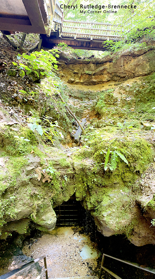
The stairs take you deep into the karst to view the well and in the summer you will experience a temperature change. Each time I have been there, the water has been flowing. The water flows from the karst well in an underground lake to cave spring. Cave Spring is directly on the Current River and can also be accessed by canoe. Cave Spring is halfway between Akers Ferry and Pulltite and is big enough to paddle a canoe inside. The water from Devils Well is one of the many sources of water that form the Current River.
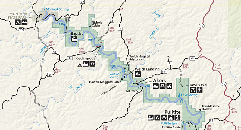
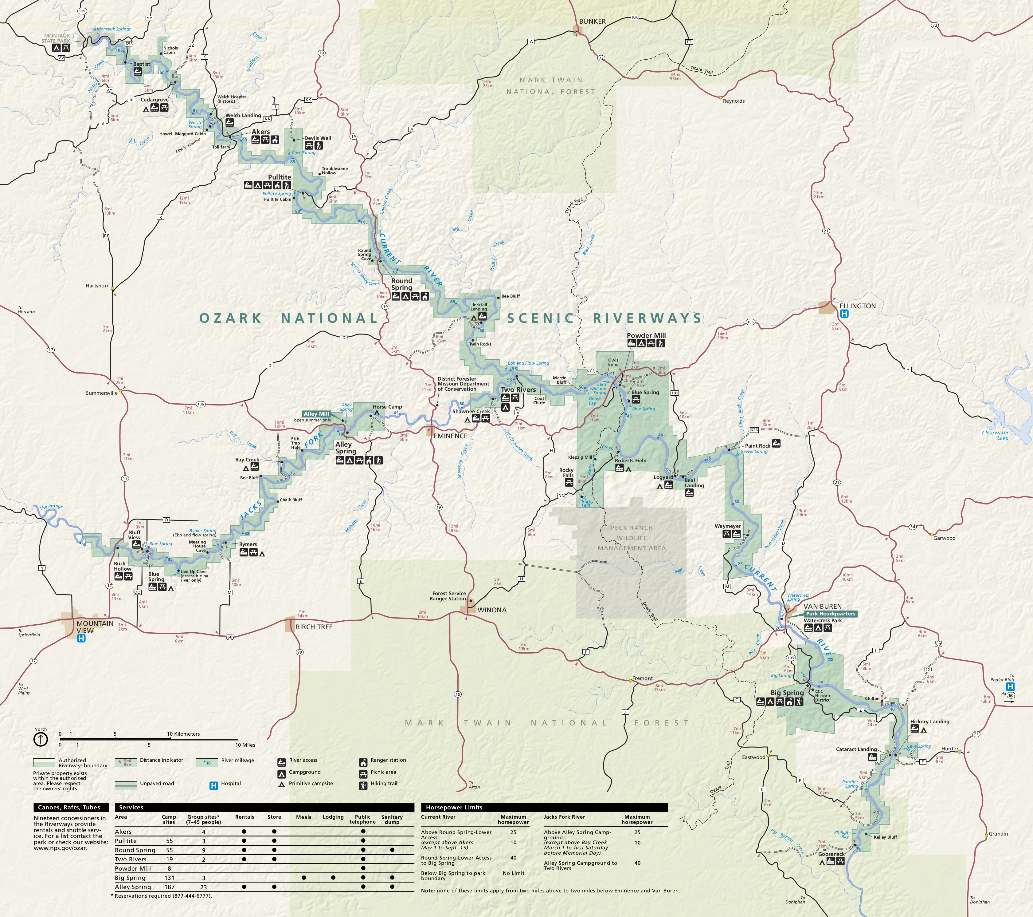
Visit the Ozark National Scenic Riverways Map and download it for you trip. The above image is a snippet of this map showing the Upper Current River places to visit. Not all of these places are in Dent County as some are in Shannon County, along with the Middle Current River areas. Cedar Grove is just over the county line in Dent County. Welch begins Shannon County.