You are in Cluster 1 Back to Brennecke Genealogy
1600's Onward | Citizenship Certificate
Brennecke Driving Tour | Military | Thanks | Family Notes
Chapter A - Heinrich "August" Julius Brennecke
Chapter B - Heinrich (Henry) Ludwig Brennecke
Chapter C - Georg August Friedrich Brennecke
Chapter D - Carl August Friedrich (Fred) Brennecke
Chapter E - Georg Friedrich Wilhelm (William) Brennecke
Chapter F - Hanna Justine Louisa (Louise) Brennecke
Chapter G - Johann Heinrich Christian Carl (Charles) Brennecke (our line)
Chapter H - Johanna Caroline Friedrike Brennecke
Chapter I - George (Schoose) H. Brennecke
Chapter J - Johann Franklin (Frank) Brennecke
Chapter K - Johann Jacob (Jake) Brennecke
Brennecke Driving Tour
This video of the driving tour as taken in 2006.
The video is an hour and 17 minutes long. (only part of the video works! Yikes!)
Brennecke Driving Tour (Part 1)
1. Start at Zion United Methodist Church, the church that August and Wilhelmine Brennecke attended along with their family. August and Wilhelmine are buried in the church cemetery, as is their sons Henry, William, Franklin, and daughter Caroline. Also, many of their grandchildren and spouses are buried in Zion United Methodist Cemetery.
2. Driving, turn left on Z at the bottom of the church hill. At the stop sign turn right. Turn right on County Road 231. Drive approximately 1.1 miles to 1195 County Road 231. The first Liberty School and also a churchwere located here on the left.
3. At 1.3 miles is a dirt lane to the right. Karl & Caroline Brennecke (Chapter H) Neumeyer purchased this farm in 1870 from Frederick and Louisa Deneke. It is believed the house at that time was log. The current structure was built around the log house. Karl sold this farm in 1892. Now the property belongs to the heirs of Roy and Melba Deneke (Chapter H). Melba was a granddaughter of Caroline Brennecke Neumeyer.
4. At 1.5 miles is a blue house on the right. This was part of the William Brennecke (Chapter E) farm and is now owned by Ronald and Shirlene Deneke (Chapter H). Ronald is a great-grandson of Caroline Brennecke Neumeyer (Chapter H).
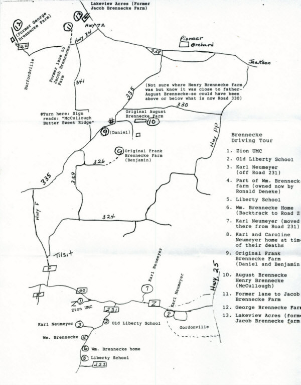
5. Continue on until you get to the second Liberty School on your left. On July 15, 1889, the directors of the Liberty School District (southwest of Gordonville) paid William Brennecke (Chapter E) $64 for an acre of land to build a new elementary school. This building was to replace the original 1852 Liberty "log" school building. The new Liberty School was operational from 1890 until 1944 (the last year there was a record of a teacher.) Later, it became a part of the Jackson School District. A great-granddaughter of August and Wilhelmine Brennecke, Doris Brennecke Davault (Chapter K), taught at the Liberty School one year, 1940-1941. Turn around at County Road 222 and start back toward Z.
6. On the right, just past the gate at 1921 County Road 231, is where the home of William Brennecke (Chapter E) was located. Missouri Brennecke Asling (Chapter E) and her husband Louis lived on the William Brennecke farm at one time also. She was a daughter of William Brennecke.
7. Backtrack and at Z turn right toward Gordonville. Drive approximately .6 mile to Ruby Lane. On the left as your drive by, you can observe the location of the farm that Karl and Caroline Neumeyer (Chapter H) moved to from the farm off County Road 231 in 1892.
8. Continue into Gordonville. At 943 Highway Z, a blue house on your right is the house in which Karl and Caroline Neumeyer (Chapter H) were living when they died in 1921. Driving, circle on S. Clark and South Bohnsack back to Z. Turn left on Z. Go back toward Zion UMC. Instead of turning left to go to the church, take State Highway OO to State Highway F. Turn right. Drive thru Tilsit. Continue on until County Road 335. Turn right again. The 1988 Brennecke Family book states that the Frank Brennecke (Chapter J) farm adjoined his father August Brennecke's farm, between Jackson and Tilsit.
9. At 4.9 miles from Z and OO (Zion UMC) is where Daniel Brennecke (Chapter J) lived. This land was a part of the Frank Brennecke (Chapter J) farm. Daniel was a son of Frank Brennecke. Another son, Benjamin Brennecke (Chapter J) lived near by until the 1960's. To get to the original Frank Brennecke (Chapter J) farm, turn off Road 335 onto Road 329. We are told it is not advisable to drive all the way down to the farm. Just drive to Dead End Road 326 and turn around and come back to Road 335 and turn right and continue driving a short distance to the next place.
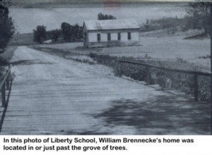
10. At 5.1 miles from Zion UMC is where a sign reads "McCullough Butter Sweet Ridge." A portion of this property is where August & Wilhelmine Brennecke lived. Refer to page 18 on the August and Wilhelmine Brennecke home and land. That page also tells about Henry Brennecke's land (Chapter B).
11. Drive onto Highway 72, turn left, drive to Highway 34 and turn left again and drive .6 of a mile to see where the original entrance to the farm of Jacob Brennecke (Chapter K) once was There is no longer a lane going to the farm, but there is a row of trees and you can see where the lane used to be. The old Cane Creek School (which is no longer there), was just across Highway 34 from the lane. (After going to another home, we will come back and drive to where the house once stood.)
12. Drive on west to State Highway UU, a few miles north of Burfordville. The George Brennecke (Chapter I) farm was on Stroder Branch (about 1 1/2 miles from Highway 34) on State Highway UU. A great grandson, Carl Criddle (Chapter I), owns the farm now. He lives on the right side of the road and his mother still lives on the "Criddle) home place across the road on the left. A few yards down the hill on the left is where the original George Brennecke (Chapter I) home stood. There is a metal building where the cellar was located. On down the hill is a driveway to the left (with hay bales near by). Drive in there. To the right on the hill is a row of trees where the three-story basement type barn was located. For more information on the barn, refer to the history in Chapter I.
13. Go back to Highway 34 and turn left. Observe again the original entrance to the Jacob Brennecke (Chapter K) farm about .6 mile before reaching Highway 72 West. Turn left on Highway 72 and go to the entrance of Lakeview Acres (a subdivision) and turn left. This entire subdivision is the former Jacob Brennecke (Chapter K) farm. It lies between Highways 72 and 34. Drive to the end of the subdivision and on the left is a beautiful brick home on the site of the original home of the Jacob Brennecke family.
This is the end of the driving tour. Go back to the entrance of Lakeview Acres subdivision and turn right to go to Jackson or Cape Girardeau.
DIRECTIONS TO AUGUST BRENNECKE FARM BY WAY OF JACKSON, MO
Drive 2.2 miles on Highway 72 West from the intersection of Highways 24, 61, 34, and 72; then turn left on County Road 335 and drive 1.75 miles. When you see the sign at the left that read "McCullough Butter Sweet Ridge" you know you are there. The sign also has a "walking horse" on it. The August Brennecke home was located about one-fourth mile down the gravel road on a long ridge. All that remains to mark the place is a sunken spot where the old stone-walled cistern was. There is also a small pond which Jacob "Jake" Brennecke (Chapter K) was a "Buffalo wallow."
LOCATIONS OF HOMESTEADS OF OTHER CHILDREN
OF AUGUST & WILHELMINE BRENNECKE
The homestead of August and Wilhelmine Brennecke and their children, Henry Brennecke (Chapter B), William Brennecke (Chapter E), Caroline Brennecke Neumeyer (Chapter H), George Brennecke (Chapter I), Frank Brennecke (Chapter J), and Jacob Brennecke (Chapter K) can all be seen on the driving tour.
You may also visit the homesteads of their other children. More information on August Brennecke (Chapter A) in Germany may be found in Chapter A or within the article entitled "Research in Germany (Page 84.) The location of the homestead of Fred Brennecke (Chapter D) was on Bellevue Street, Cape Girardeau, Missouri, at the present site of the post office. The location of the homestead of Louisa Brennecke Meyer (Chapter F) must have been near Hornsby, Illinois, as they are buried in Kinder Cemetery there. Maybe one of their descendants one day will help us determine the location of their homestead.
Charles Brennecke (Chapter G) owned a farm just north of Kelso, Scott County, Missouri. Travel south on Highway 55 from the Jackson/Cape Girardeau exit approximately 15 to 20 minutes to the Scott City exit. Follow the signs toward Kelso, which will put you on U.S. Highway 61. U. S. Highway 61 now splits the farm into two parts. Highway 61 was built in the 1920's or 30's. The Charles Brennecke homestead stood on what is now 668 N. Messmer. Messmer used to be the old Kingshighway/Highway 29. Turn left onto Messmer near the KC Hall. The property is located on the left side of the road at 668 N. Messmer. The Charles Brennecke barn was still standing in 1975, but the large two-story house burned in 1925. Not long after 1975, the barn was taken down. A modern house now sits directly behind where the old house used to sit. If you look carefully at the lawn in front of the house, you can see an indentation where the old house stood. There is also a small mound where the old well was filled in and closed up. You can get a good image of the size of the land by standing in front of this house and looking out to the other side of Highway 61, and then to the left where the gravesite stands, and then to the right where the KC Halls stands. It is known that all of this land, and maybe more, was part of the Brennecke Farm.
An alternate route to the homestead is to travel down U.S. Highway 61 a bit further until you see the city limit sign. Shortly before the city limit sign, turn left and travel one block to Messmer. Turn left onto Messmer and the house will be on the right side. Also, if you turn right onto Messmer and travel a short distance you will see a cemetery on the left side of the road in which the family of Heinrich Peetz, friends of Charles Brennecke, are buried.
To travel to the gravesites of Charles and Caroline Brennecke (Chapter G), go to the city limit sign on U.S. Highway 61. Directly past the sign you will see a new subdivision on the right side of the road. Turn right into the subdivision and then take the first left. The address of the house is 141 W. Honeysuckle, on the corner of Honeysuckle and Tulip. More information and photos can be seen under Chapter G.