Cave Spring Cave - Akers Ferry to Pulltite Current River Float
Here is our kayak trip which I took on Monday, June 24, 2024. I lost my kayak buddy when she moved from Missouri to the State of Washington, and having my son home for a few weeks, it was a great opportunity for some quality time. We had a great trip and the weather was in the 90’s which was perfect as well.

The highlight of the float trip is Cave Spring Cave. What a fun name! The spring water comes from an underground system with storage reserves at Devils Well and Wallace well. As the above map screenshot (from the index page) you can see the close proximatity of Devil's Well to Cave Spring Cave. The turnoff to Devil's Well is on the way to Akers Ferry. You can access Cave Spring Cave from Devils Well on a 4.6 mile loop trail. That is too far of a hike for me so I have never done it, although I have visited Devils Well. Not being able to see it from land, I was glad to get to see it from the river access.
Here is the Pulltite to Round Springs float trip. Pulltite Springs is amazing to see! It is just below the section we floated on Monday. Here is the website page and video of us crossing Akers Ferry which is now pulled on shore and no longer operational. When the owners of Akers Ferry died in 2022, it left a huge gap in tradition of the area. Jadwin is now operating the Akers Ferry Canoe Rental in 2024 and that is who we rented our kayaks from and we were pleased with their services.
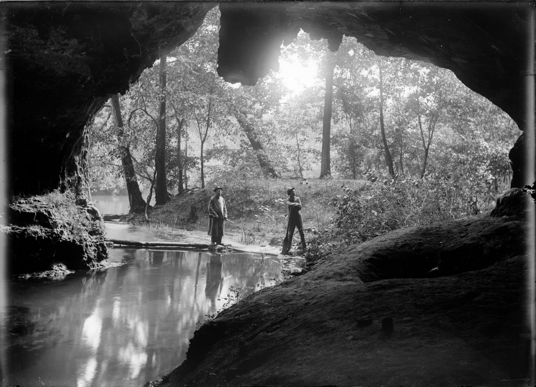
Here is a photo from the Missouri Digital Heritage collection of the cave in 1916 by photographer Charles Elliott Gill. That's just super cool! "George Darrow (right) and Arch Holman (left) stand at the edge of the water in a heavily wooded area. The scene is framed by the cave entrance. Gill called this 'Fish Cave Looking Out.' Now known as Cave Spring on the Current River." Courtesy of the Missouri State Archives, MS330 Charles Elliott Gill Photograph Collection

This photo was taken at the beginning of the float. I did not photograph or film any of the current areas of the river which we went through as I needed my hands on my oar and not my camera!


This spot was our first break and our lunch spot.


This is what it looks like where the cave is on the left. Approaching it, you cannot even tell it is there. It is at about 5.2 mile marker on the trip, which is about half way.


The cave really is a beautiful spot and a highlight of the trip.


The end of the float is just ahead in this photo. We were told it was a 10 mile float, but my app said we went 9.4 miles.