Turner Mill and Spring
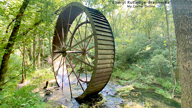
Not far down the trail, this huge mill wheel presents itself out in the middle of nowhere. It is quite an amazing sight! It's 25 feet tall!
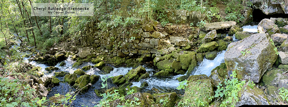
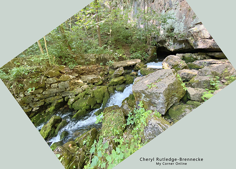
Around the picnic area, the trail continues. You will come to a water feature. Walk around and above it to continue on the trail to the amazing Turner Spring coming out of the bottom of a huge bluff. It pours down over a great distance. It is one of those "I could sit there forever" places. Then begin to imagine how the water would flow from this Spring down to the huge wheel and turn it to grind corn or wheat or whatever it was that the mill produced back in the 1850's.
The travel to Turner Mill and Springs is quite the adventure. You have to really want to go here to make the way down these roads, up and down hills, along turns and twists, and seemingly in the middle of nowhere in the forest until a random house pops up and you wonder why people would ever want to live so remotely.
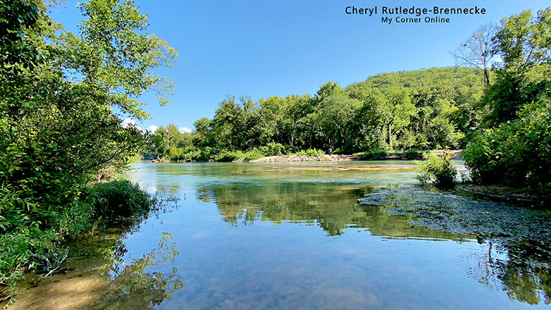
This location can be accessed by canoe on the Eleven Point River, or by both sides of the River, but to cross the river from the south access is not easily done because the river is wide. (You can see the south access across the river in the above photo.) Therefore, the only real access is far down gravel roads in Oregon County from the north access. The location is part of the Mark Twain National Forest.
Visiting Falling Springs and Turner Mill and Spring on the same trip make for a great day as they are near each other off of Highway 19, although Falling Springs is in Shannon County and Turner Mill and Spring is in Oregon County. Greer Springs is also on that stretch of Highway 19 on the other side of the road.
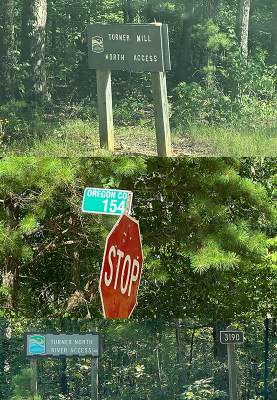
Falling Springs is 9.6 miles from Highway 60 and Turner Mill and Spring is 15 miles from Highway 60. Turner Mill and Spring can also be found 11 miles north of Alton on Highway 19. On Google maps, you will turn down FR3152 (that is, forest road), but the sign actually says Oregon County 154. That is confusing! No worries as the road is also clearly marked with a sign indicating "Turner Mill North Access." Travel about 6 miles on FR3152. Somewhere along the way you will pass over a creek bridge and if you look to your right there will be a man there in the middle of nowhere camping with his van. (giggle) Turn right onto 3190, which is also marked by a sign. Travel just short of 3 miles where you will dead end at the Eleven Point River Access. Just before the dead end you will see the parking area for Turner Mill with a picnic table and bathroom. The trailhead is directly next to the bathroom and the trail is not all that hard or lengthy, thank goodness, after that intimidating 9 mile gravel road drive.
Can I make it in a car? Yes, but just be prepared mentally for the drive. Consider how long it takes to drive 9 miles at a slower speed.
Or if you begin at Doniphan, take Highway 160 west, turn right on Highway J, and I am not even going to give you the rest of those directions because I did not travel that way and do not know what the roads are like. Just know that you can scope out those directions if you so choose. It looks like the roads are 164 to 168 to read 3190 and you travel through the Irish Wilderness.
If for some reason you want to drive to the South Access, just north of Alton on Highway 19, turn down Highway AA and then left on 127 to the river.