Washington State Park
The above video is from our visit in 2020.
This was during the beginning of the Covid-19 pandemic and we were trying our best to social distance, so I put up this short video.
.JPG)
This is a photo of my great-Grandpa, James William Rutledge, at the Washington State Park sign. I often look at it and wonder the location of this sign. My love of the great-outdoors is certainly deep in my roots! I do not know the year of this photo. I have a newspaper article referencing it, but I need to find it. I believe this is in the 1950's.
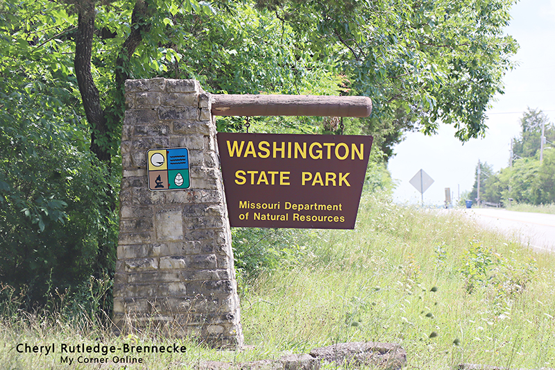
The sign at the entrance of the park looks nothing like the sign my great-grandpa sat in front. We visited on July 3, 2020.
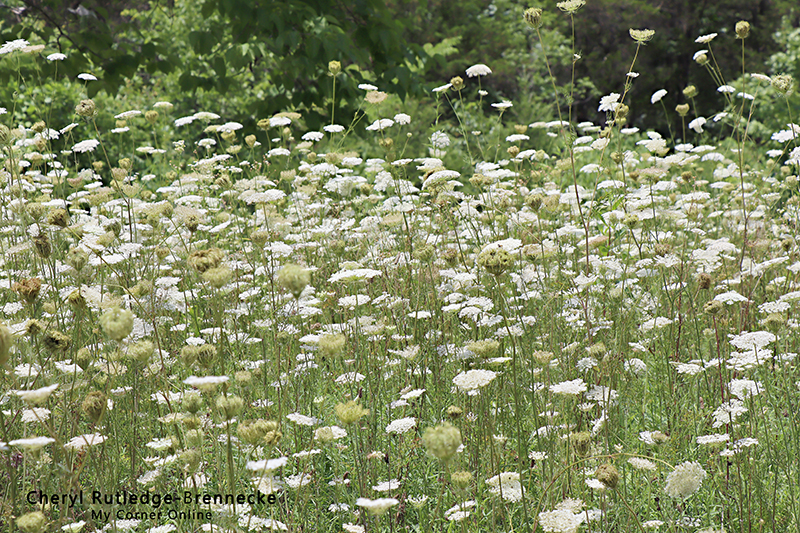
There were beautiful fields of Queen Anne's Lace flowers everywhere.
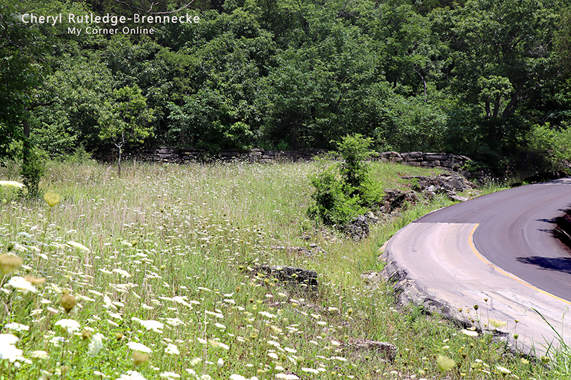
I just loved how the curve of the road was graced by the field of Queen Anne's Lace flowers.
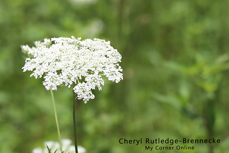
I love white and I think that is what attracts me so much to the Queen Anne's Lace.
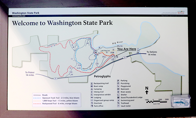
This is a map of the park that was on the wall in the Interpretive Exhibit Building. It was a small building with informational boards around the walls. The CCC (Civilian Conservation Corp) built much of this park. President Franklin D. Roosevelt formed the CCC during the Great Depression to put people back to work. Unmarried men between 18 and 25 came to work in the CCC Camps, where they lived and ate, and received $30 a month, being required to send $25 home to families. These men built roads, bridges, trails, entrance gates, bathhouses, cabins, and other building structures. I feel I can recognize their work whenever I enter a Missouri State Park! In 1934, there were 4,000 young men working at 16 Missouri State Parks.
CCC Company 1743 was the only African American company to work at the Missouri State Parks and they worked at Washington State Park beginning May 1934. CCC Company 1743 built 16 buildings, the 1000 steps trail, 22 road culverts, and many walls, paths, and curbs around the park.
Washington State Park was created to preserve ancient Indian petroglyphs, one of the most prominent being the thunderbird. The camp was named thereafter as "Camp Thunderbird." This is a photo of Camp Thunderbird on the wall of the Interpretive Exhibit Building. The stalls are so small!
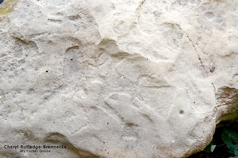
Outside the Interpretive Exhibit Center is a short walk to see some petroglyphs. We were able to identify some of them, but I found it difficult to photograph them as they are out under the weather and getting softer in texture.
We stopped by the trailhead for Rockywood Trails and observed the steps built by the CC, but since it was a 6 mile trail, decided to skip it this day.

This was the view before turning into the parking lot where the petroglyphs are located. I was quite a-taken by the view and the clouds. The petroglyphs are down a short walk and have a covering over them to protect them from the weather.
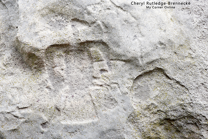
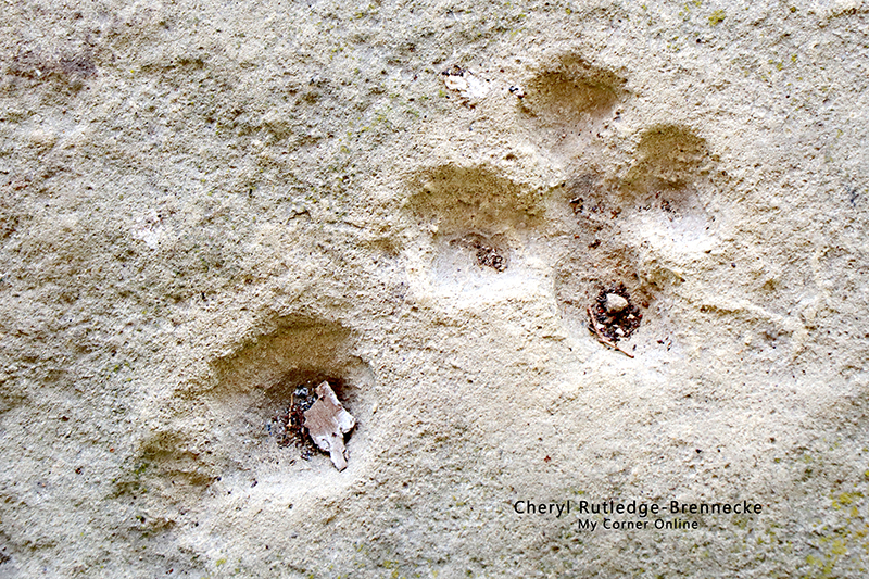
This is a photo of the ancient rock carvings by the Native Americans. It is believed that these people were of the Middle Mississippian culture that is the same found in Cahokia, Illinois. I have traced my ancestry back to these Mississippian Indians in Cahokia and Kaskaskia, so this is particularly interesting to me. The petroglyphs depicts humans, animals, arrows, cups, and other abstract symbols. The petroglyphs were sacred to the people who etched them. Archeologists believe that these etchings were made at large ceremonial places. Little is known about the purpose of the petroglyphs.
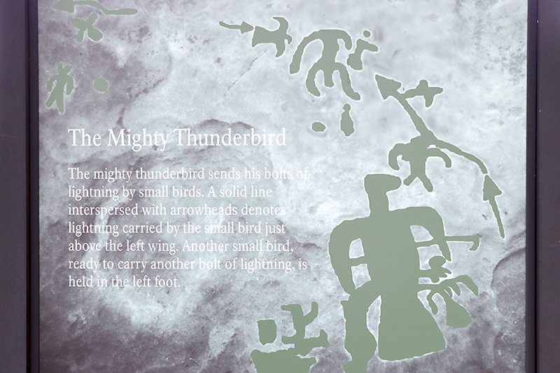
There are signs that hang from the covering (ceiling) over the petroglyphs showing how they are laid out on the ground below. They are so handy and make it fun to search for the carvings. Once you find one shape, you can spy the other ones by location association. This is the one that includes the thunderbird in the photo above.
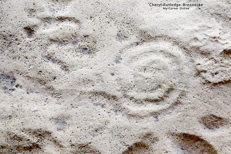
This is the spiral that can be seen in the below petroglyph mapping.
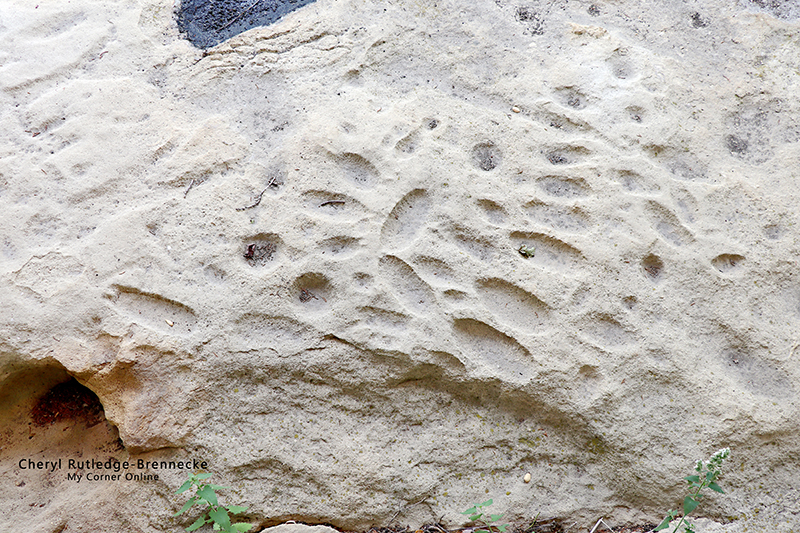
These are the fertility shapes as seen in the below petroglyph mapping.
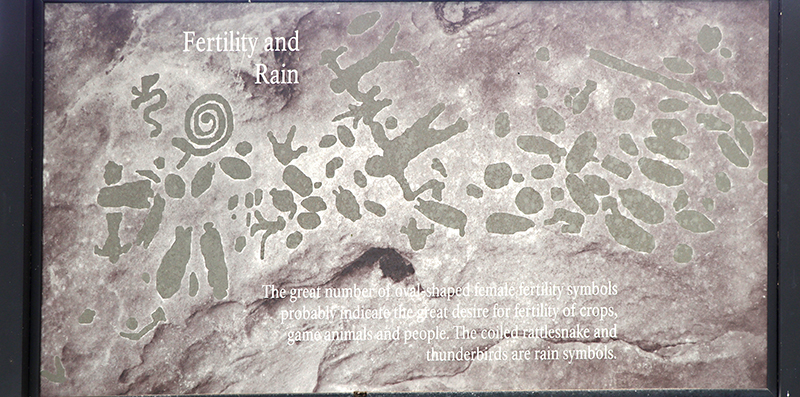
Here is the fertility and rain petroglyph map.
You can spy this large arrow in the petroglyph mapping below.
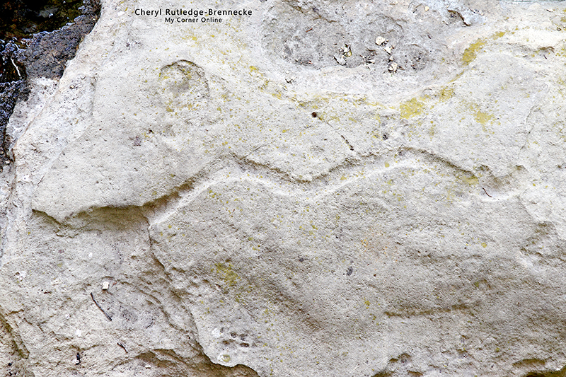
You can spy this animal in the petroglyph mapping below.
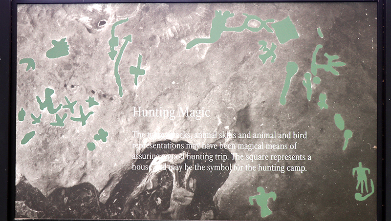
Here is the hunting magic petroglyph mapping.
Here is another thunderbird in the petroglyph mapping below.
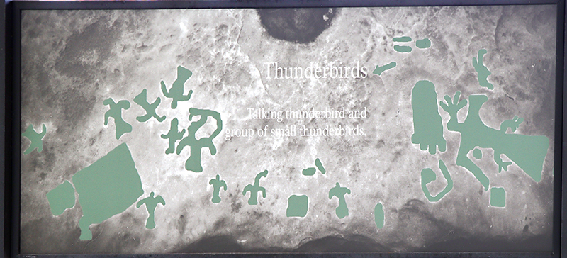
Here is the thunderbird petroglyph mapping.
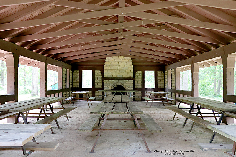
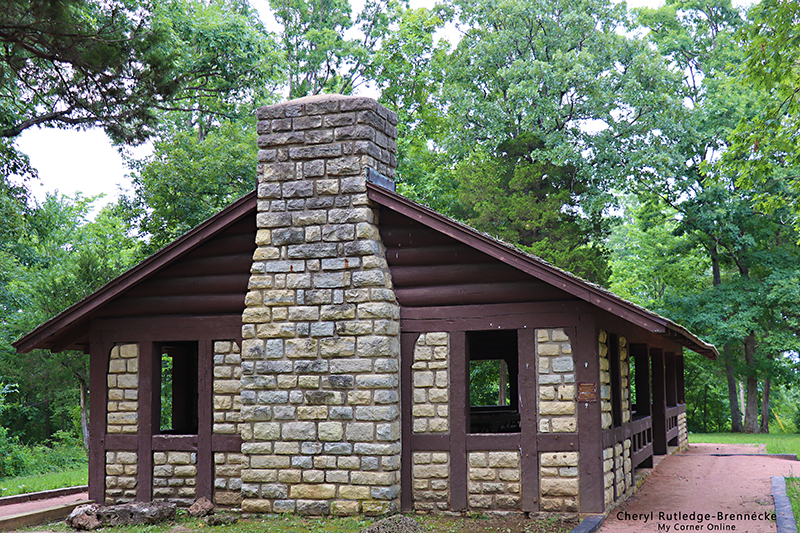
This is the inside of the park shelter made by the CCC. I love the stone fireplace as well as the stone on the floor.
Behind this shelter is a nice restroom and behind that is part of the Rockywood Trail. We heard there was a nice overlook down the trail and I suppose you could hike it for a bit and come back if you only wanted to do a small section.
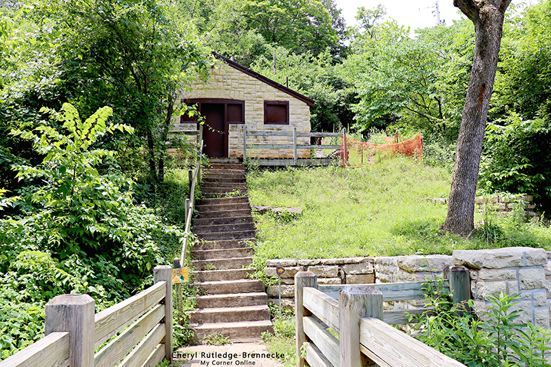
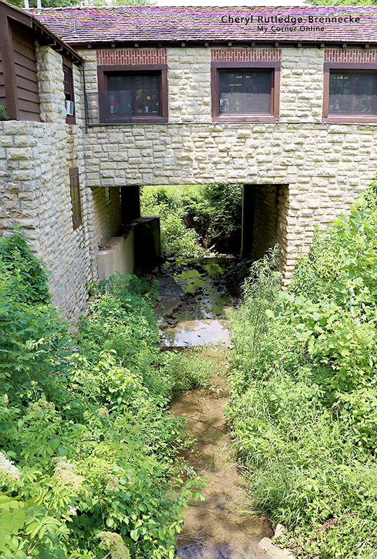
After exploring we went back to the main parking area where the Thunderbird Lodge and store is located. To the left of the lodge is this view where you can cross a creek and walk by a cabin. I love the old steps, but they were a bit wonky! It reminded of the steps in the Dirty Dancing movie where she danced up and down the steps. We did walk around the trails briefly behind the Lodge, but decided to return because it only gained access to the Big River upstream.
From the same standing point as the last photo, I turned to my right and took this photo of the Thunderbird Lodge where the store is located. The door for the store is around the other side of the building.
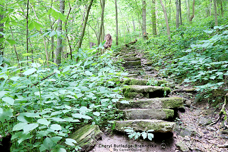
Across from the Thundbird Lodge and store is the trailhead for the 1000 Steps trail. We hiked this trail up to the top of the steep climb and then turned around to come back down. It was a very hot day! Everyone was down at the river and they were the smart people, but it sure was a great way to practice social distancing during the Covid-19 pandemic!
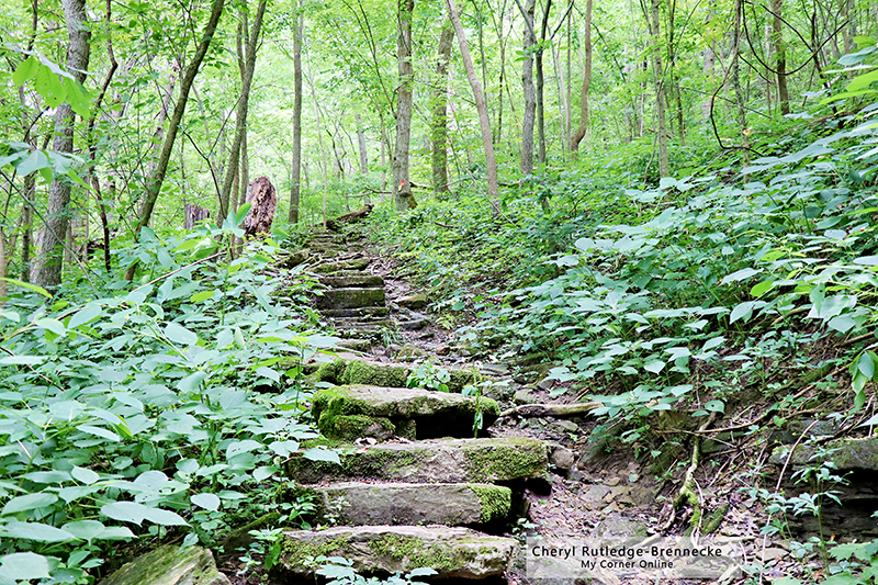
I found the trail calling me to take artistic photos, but none of them came out artistic as my mind imagined.
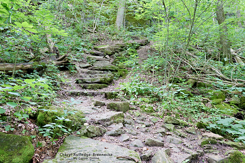
I think these steps on this 1000 Steps trail are more impressive in person than in a photo.At the top of the climb was another CCC built shelter.
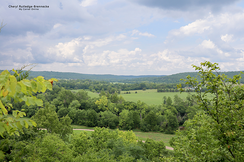
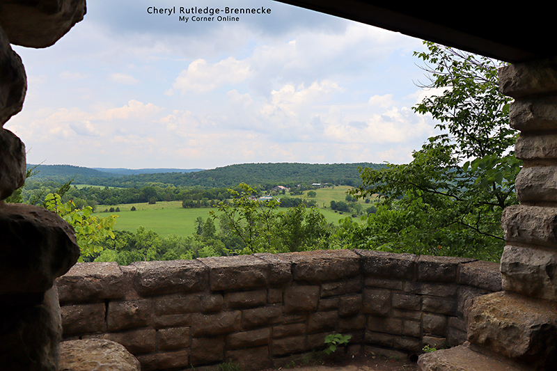
The view from this shelter was fantabulous!
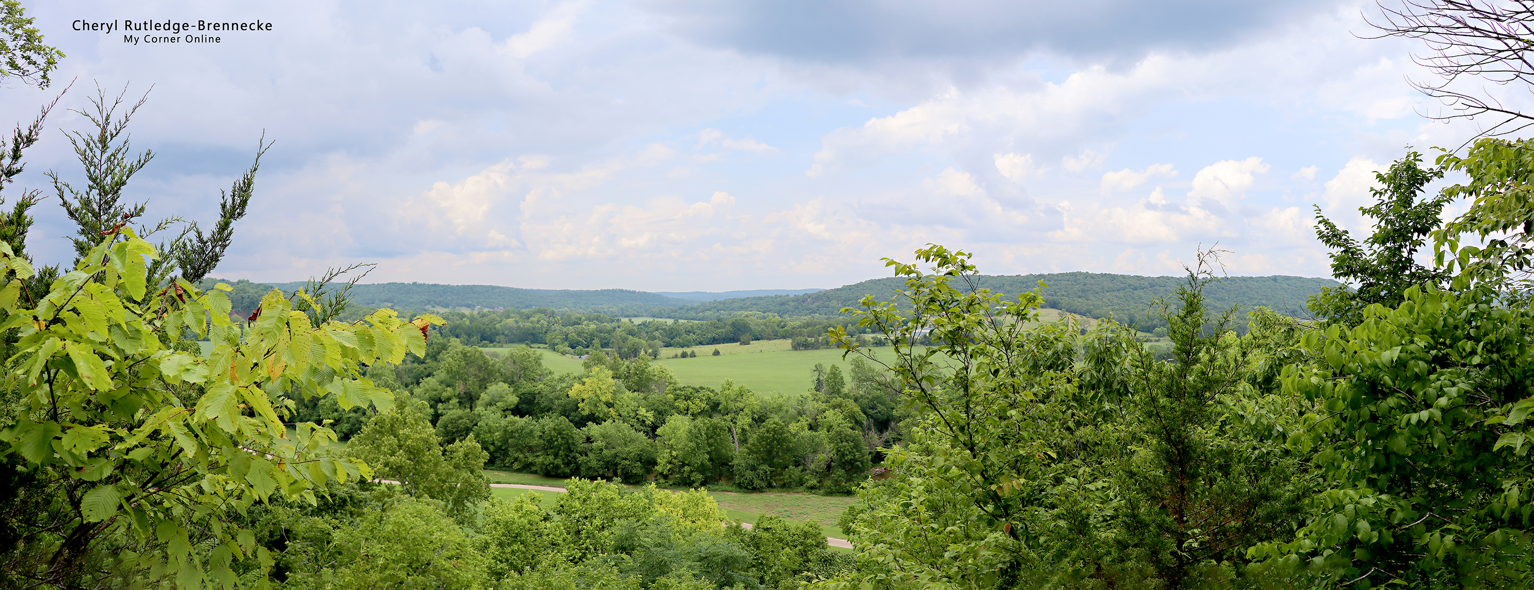
This is a panorama of the view as I put together several photos.
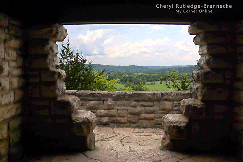
This is looking from inside the shelter. I loved the shape of the openings and the textures of the stones.
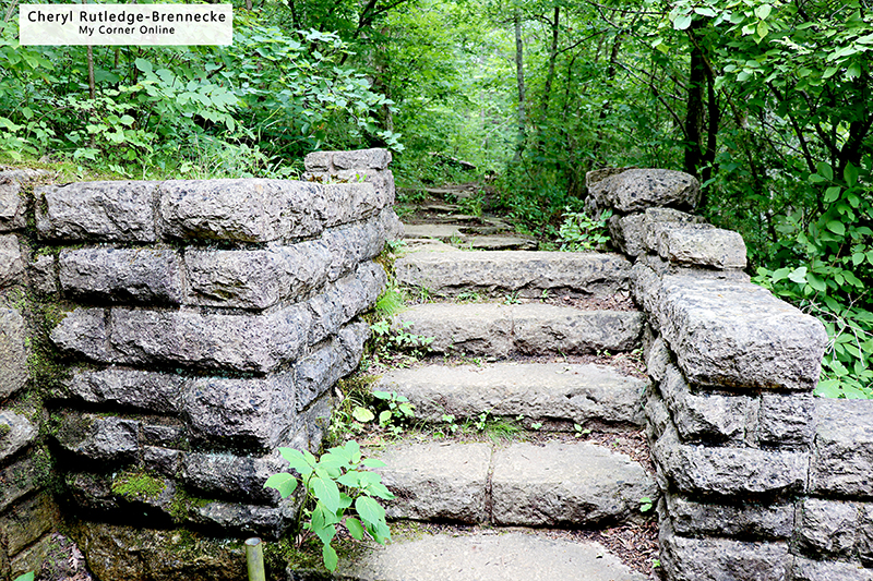
These are the steps leading down into the shelter and I found them to be an artistic composure as well.
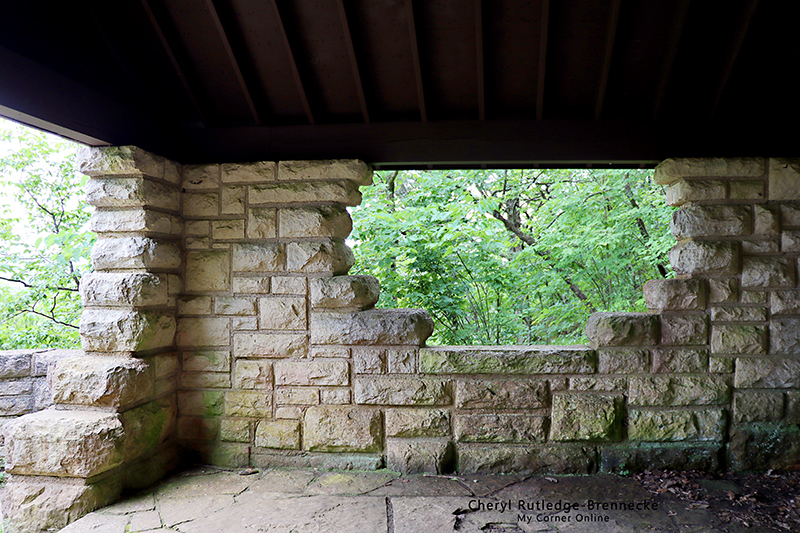
This is standing at the steps and looking into the shelter. I was just in a happy camera lens place!
Another photo from inside the shelter.
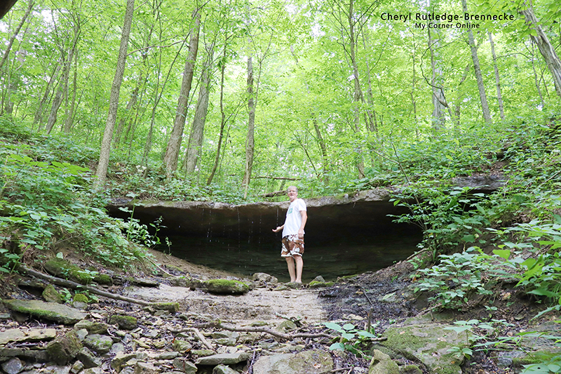
On our return downward the same way we had come up on the 1000 Steps trail, hubby took a short side trip up to this cave to explore. There was a small drip of water flowing on this hot summer day.
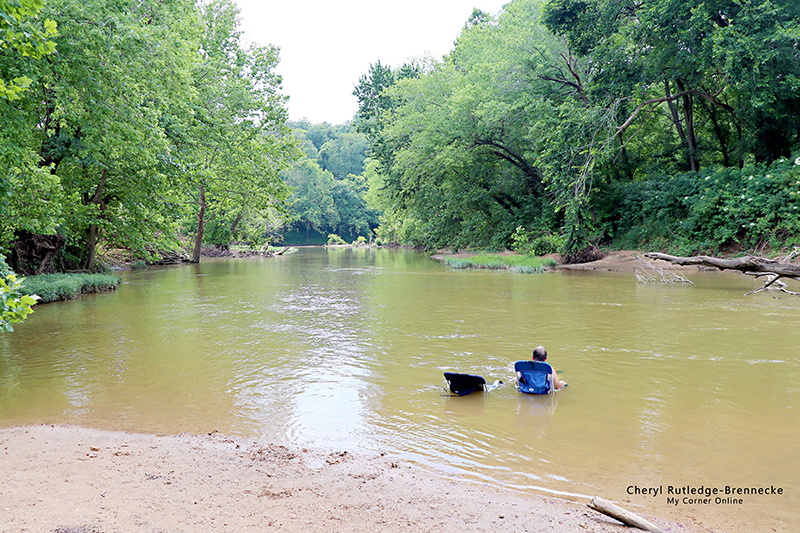
We went down to the water where everyone else was cooling off and tried to walk far to the end to find a secluded place, but the water was yucky and not pleasant for us and there was no escaping the loud and noisy people. I will never understand why people think that everyone else wants to listen to their loud music. Not only that, but there were several different people playing music. We actually could not wait to get out of the water, as much as we were looking forward to cooling down.
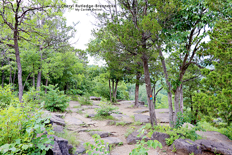
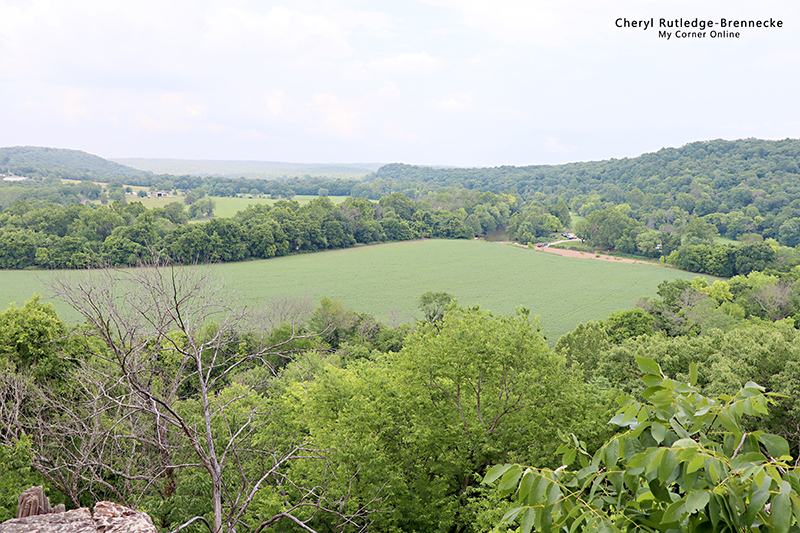
We traveled to the overlook area which was much quieter and enjoyable! The rocks and trees continually presented themselves in different composures that pleased my eye.
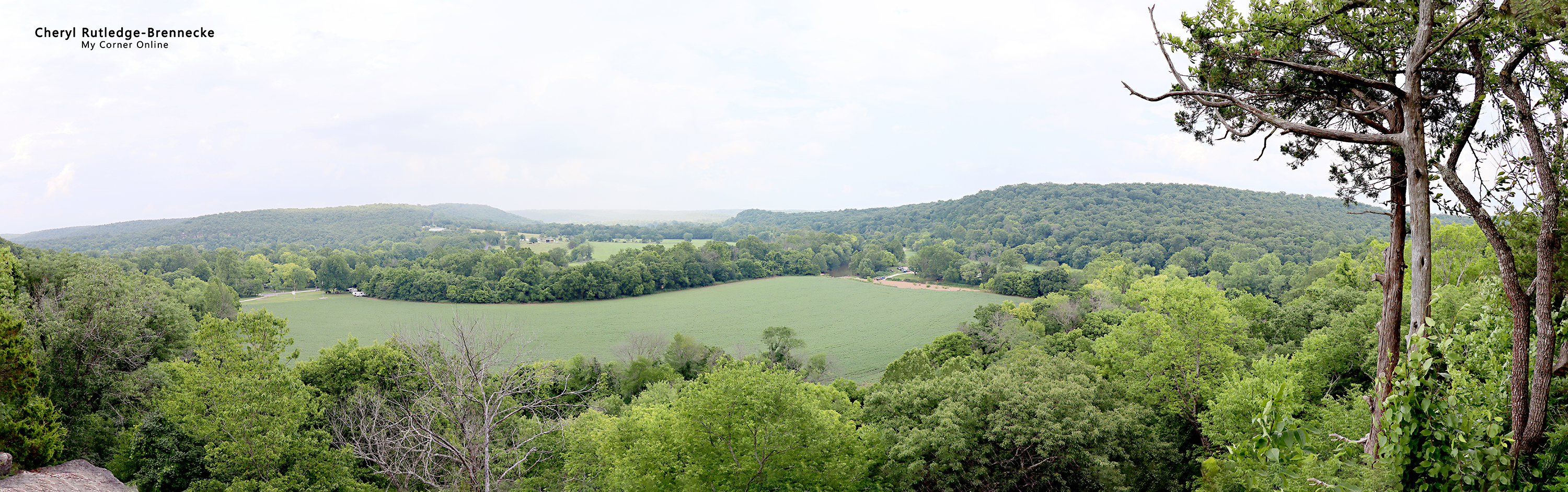
This is a panorama of several photos and it was an amazing view!
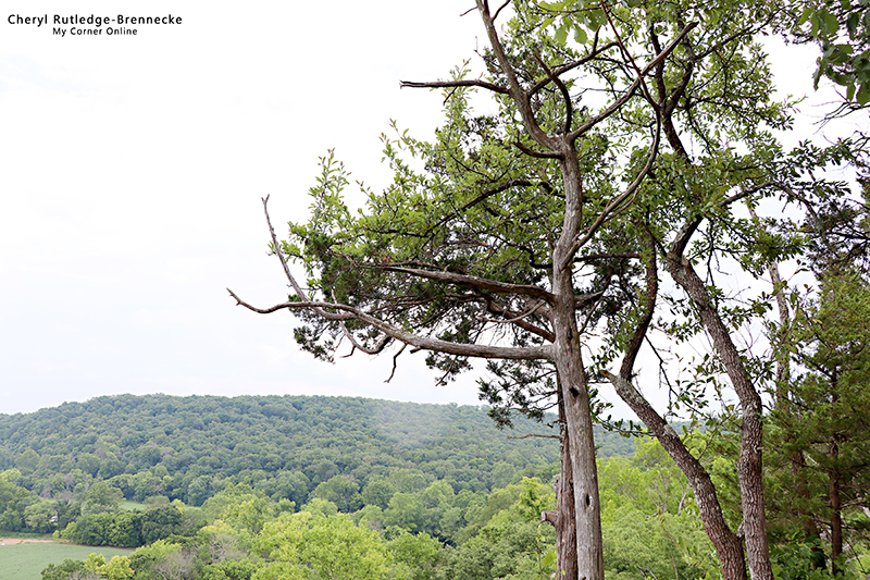
I just liked the trees in the foreground and the hills in the distance.
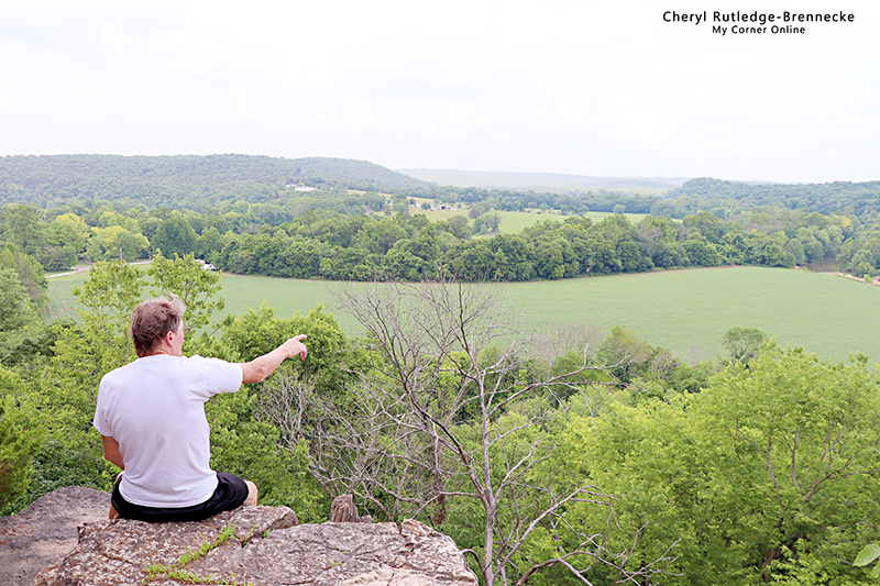
We sat here for a while and enjoyed the views.
In the distance in view you could see that part of the Big River where we had just sat in the water.
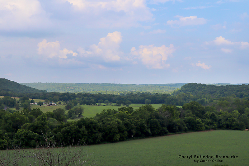
I took a low exposure photo to capture the beautiful sky that was not able to be captured on the regular exposure photos.
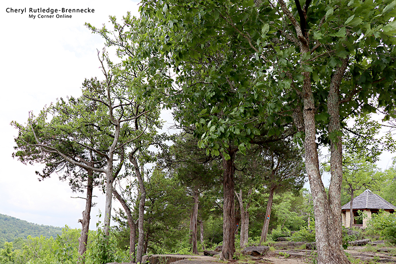
The trees with the building in the distance made for a beautiful shot! I loved the small shelter that was more like a gazebo at this overlook area. We sat in the shelter for a bit too.
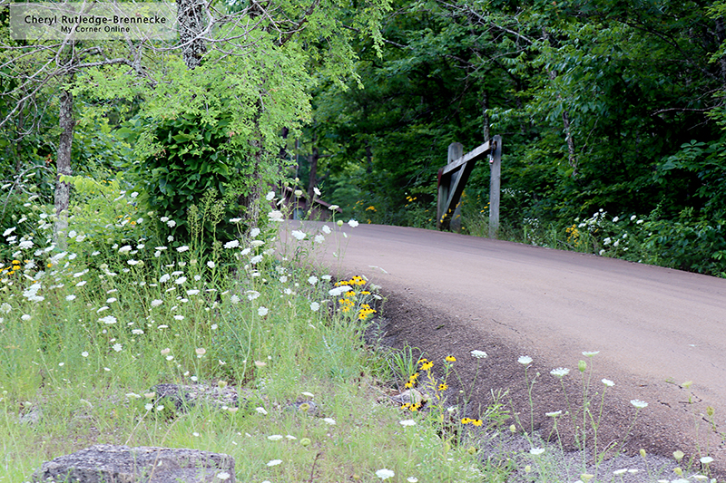
As we left, I just had to stop and take some more road photos with summer flowers along the roadside.