Sutton Bluff Recreational Area
On July 14, 2020, we had a most fabulous vacation centered around Sutton Bluff Recreational Area where we camped. Nearby at Centerville we visited the Black River underneath the highway underpasses (Centerville Access). We have have spent the entire day wallowing in the river there. Then we visited Reeds Spring Mill in Centerville. We visited the Lower Taum Sauk Lake as we drove around exploring. In far-out-and-away-ville we visited Cooks Spring. Finally we visited a remote camping area (Bluff View) not far away with a view. We also visited Lesterville Conservation Area and found it to be nothing exciting for us.
Sutton Bluff Recreational Area is in the Mark Twain National Forest alongside the West Fork of the Black River. It is maintained by the United States Forest Service (website here). The campsites are reserved through recreation.gov and you can see the available campsite map on their website.
Sutton Bluff was easy to find with GPS and is located between Centerville and Lesterville on Highway 21. Take County Road 907 northwest for 7 miles, then turn on County Road 849 and travel south for 3 miles to the campground.
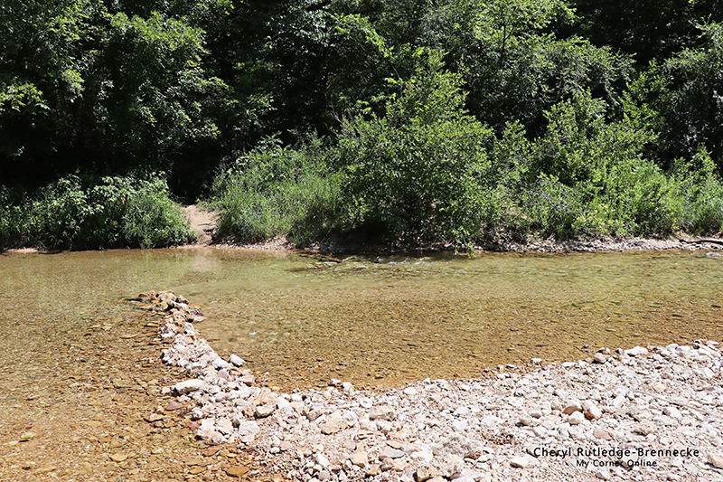
I did not take photos of our camping area. We did enjoy it. There were quiet a few RV's in that area, but we were the only campers. We did camp on a Thursday and Friday, and people were coming in on Saturday when we left. We enjoyed being away from the others with their noise. The shower house is at the entrance of the park, but it is not unusual for me to drive down to take a shower. There was a bathroom nearby. I absolutely loved the place. My favorite thing to do is to river wallow and it was not too much of a hike from the campsite down to the river. In this photo you can see the spot where we came to the river from the trail. Others had built up an area as you can see. I find this is most often done as a safe area for children to play. Sometimes people do this to build up a little spot of rapids.
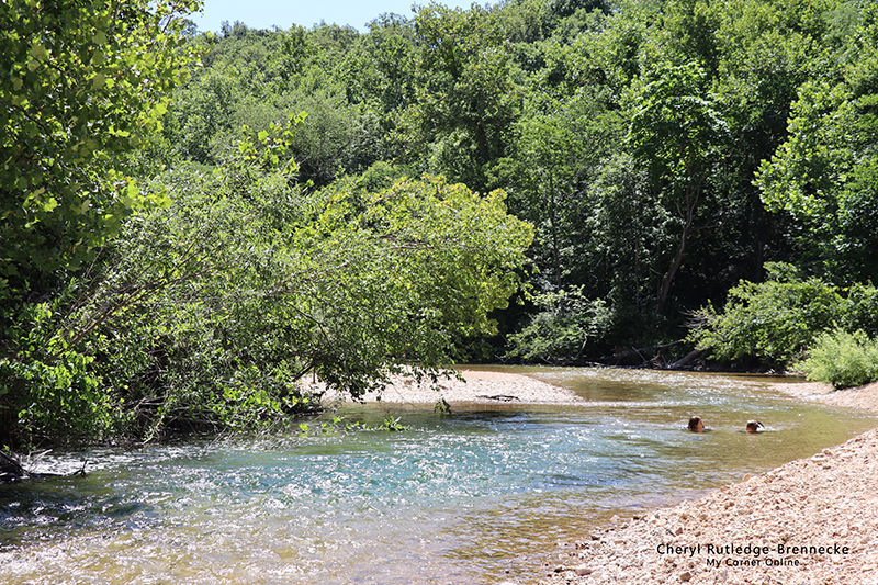
I found downstream my favorite river wallowing place. We actually crossed the river and set p our space to the left gravel bar in this photo. The deep area had a gorgeous color and provided a great spot for swimming while the shallow places provided a great spot for wallowing in our low beach chairs.
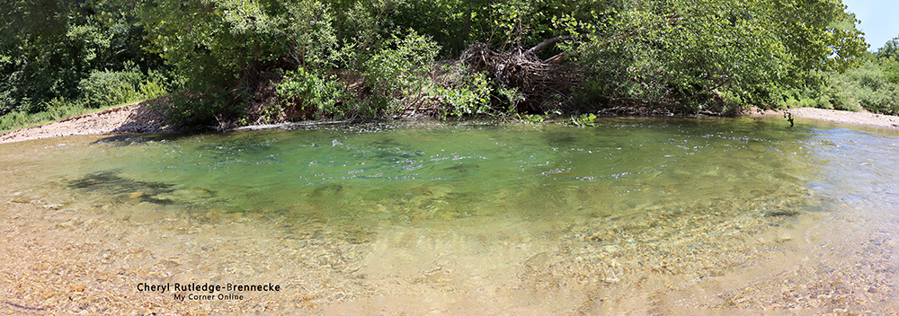
This is a close up of the deeper area in this gorgeous green color. With the current, we would float down this small area and then make our way back up for another trip. It was perfect.
This is certainly one place I would rather keep a secret so that it does not get crowded and can remain a quiet place to enjoy!
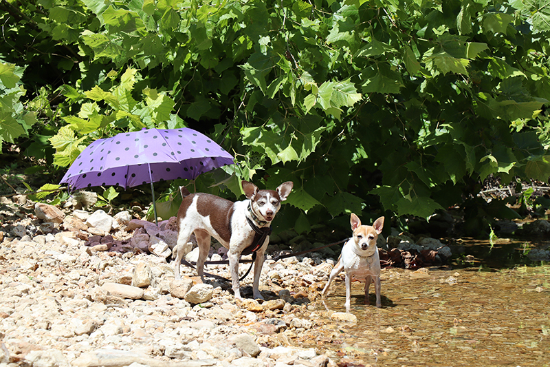
We took an umbrella as we often do and the girls (dogs) sat under it in the shade. Of course, when we come near, they always jump up to greet us.
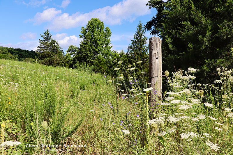
When we first arrived we did drive around to learn about the place. You can go on the road behind the campground and find more areas to swim. We never made it there to swim because we loved our personal place that we had found, but it left an opportunity for later. The road past the river and up the hill caused me to pull over to the side of the road to observe and take some photos of the flowers. As I remember, the entire road in was lined with wildflowers.
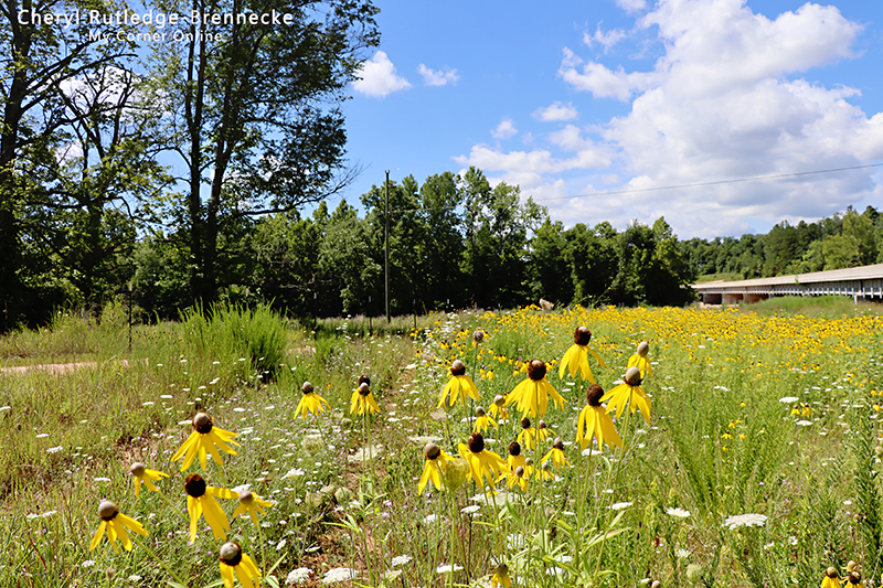
As listed in the first paragraph, we did drive around to nearby areas during our stay. There was this huge field of flowers near the Centerville overpass and I just had to pull off down that road and enjoy them blowing in the breeze for a while.
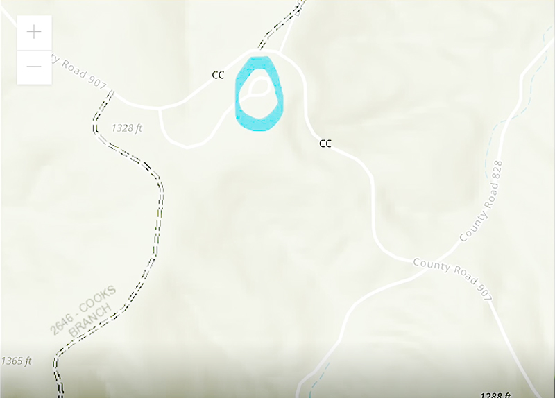
In the list in the first paragraph you can click to see some of the other locations we visited during our trip, but here is a bluff view camping area that is little know. If you like very primitive camping with no showers or toilet, you can visit this place. We always ask people to share things to visit with us and this campground was a tip we received. To find it, I created the above map. It is in the same area as on the way to Cooks Spring up the mountain behind Sutton Bluff.
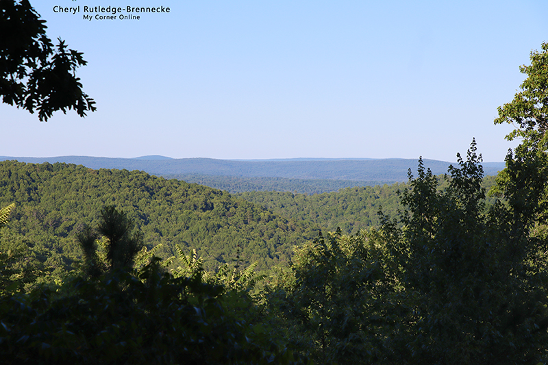
There is only a small window of an area to see the amazing bluff view, but we found it worth our time. I could sit there and look at that view for a while. There are layers of hills in the distance.
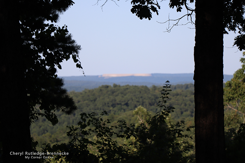
We could see this in the photo in the distance through one area of the trees and wondered if it were the dam near Lower Taum Sauk Lake. That was kind of cool.