Lane Springs Recreation Area and Kaintuck Hollow
Midwest Lone Peak Owners on their first weekend camped at Lane Springs Recreation Area, in Phelps County, Missouri, and then joined up with the SMS (Show Me State) Overland Halloween Trail Run. We had a great time! Most of the trail run was in the Kaintuck Hollow are of the Mark Twain National Forest, not far from Highway 44 below Rolla, Missouri.
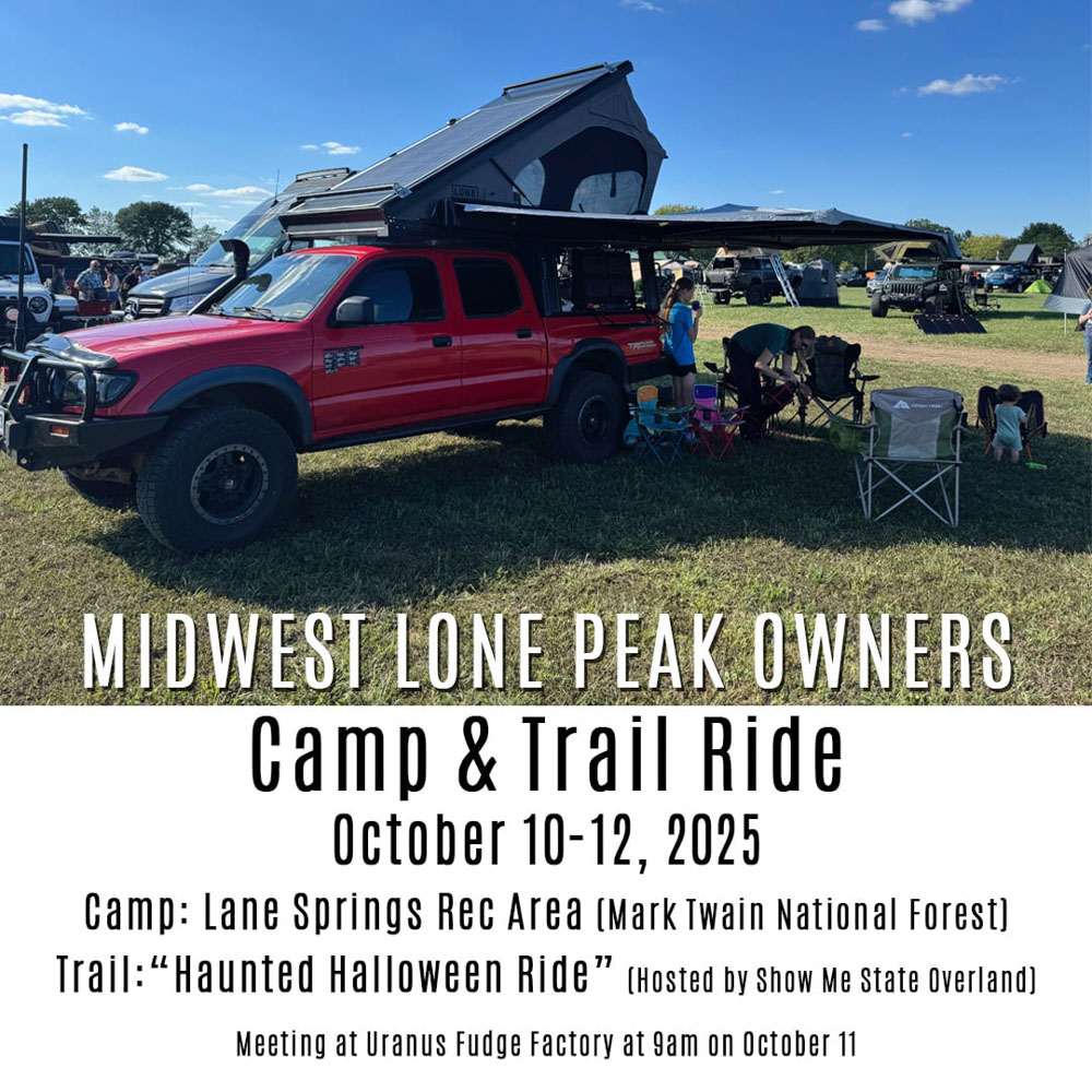
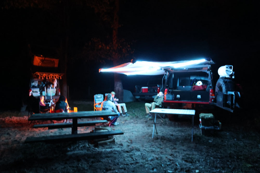
This was the first meeting of the Midwest Lone Peak Owners group and the above the graphic we made to share with others in hopes they would join us. We stayed the night at Lane Springs on Friday, October 10, 2025.
I wish I could have had time to adventure at Lane Springs Recreation Area as there are several hikes and a creek to explore. I bet it is beautiful. Instead, I made the choice to visit Osage County and Maries County instead as we have a goal to visit something in every county in Missouri and we were so close, I could not resist going. This caused us to get to camp too late to check out the recreation area.
There were two Lone Peak campers on our first gathering, along with a third couple who had ordered their camper, but had not received it yet. We plan to organize our second event after they get their camper.
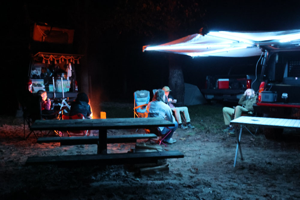
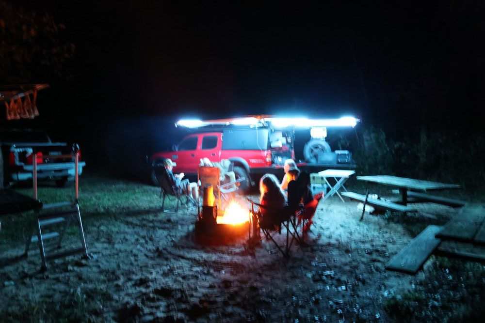
We enjoyed a nice evening getting to know each other and I believe we were all well-pleased with each other. There is always the worry that you will not get along with people new to you, but we all agreed this was a great group of people.
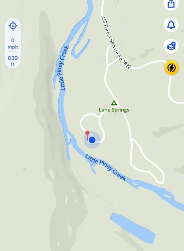
This is the GPS of where our campsite was located at Lane Springs next to the Little Piney Creek. I am sure we will be in this area again some day and we plan to come back to adventure.

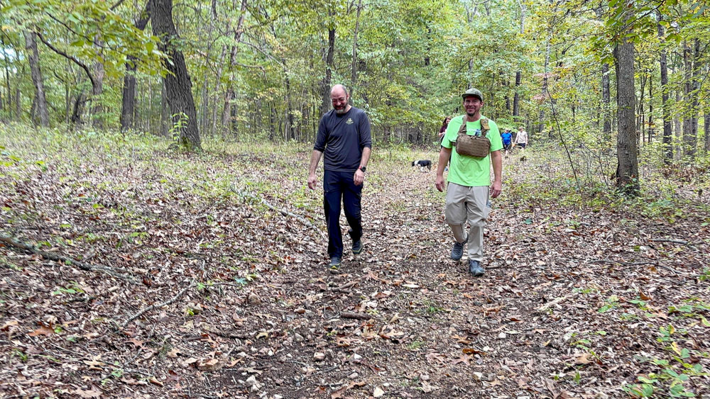
The next morning we packed up early to drive to meet the overland trail run group, and I took a few minutes to snap a few photos in the daylight.
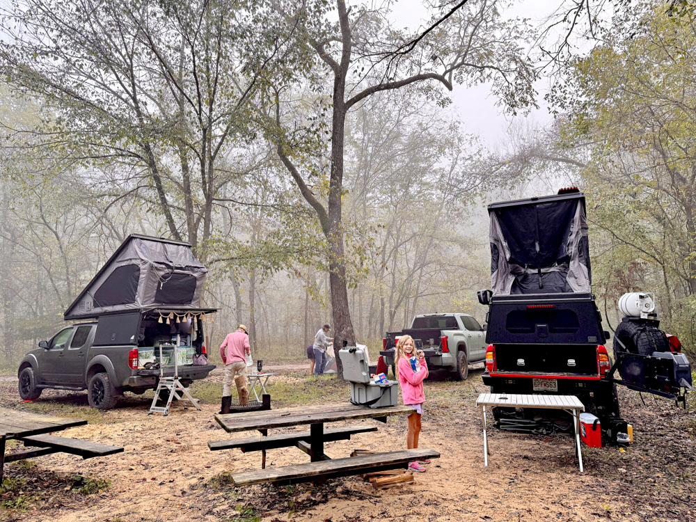
I wish we had parked closer together for a better photo op, but I think they turned out well regardless.

I took this one from the road, but the trees were in the way a bit.

We there it is! Photos documenting our first campout of what we hope to be lots of campouts together with other Lone Peak owners.
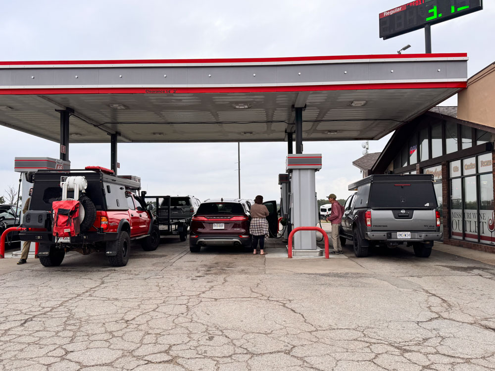
We met up with the SMS Overland (Show Me State Overland) group at Stuckey's gas station in Dolittle Missouri. The event was advertised as: Bring the family out for a "haunted" trail ride. we will explore around Devil's Elbow, see the witches grave, make a brief stop at a Mayfield cemetery. Maybe even take a short hike to a "haunted house" (old homestead) and/ or "witches alter" (natural bridge) pending weather. I thought that was a family friend fun way to have a Halloween event.
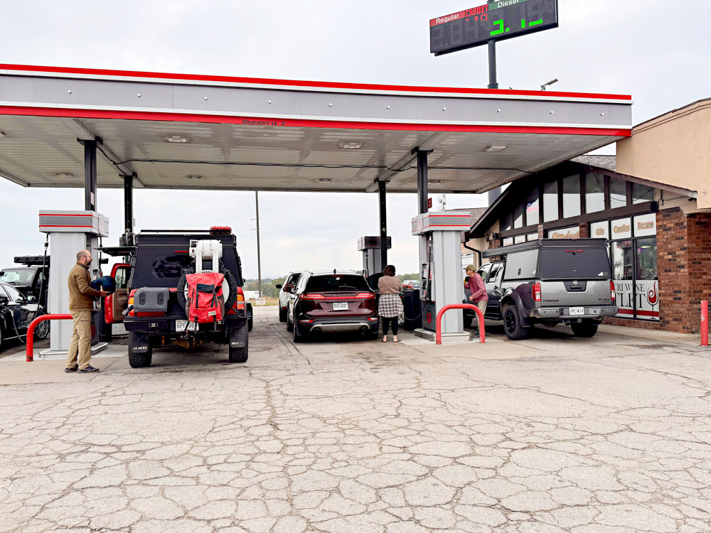
Here I was snapping photos of the two Lone Peak campers filling up gas.


Here are the two Lone Peak campers next to each other in the parking lot. Someday we will have a row of them, huh?

I took a lot of screenshots of the OnX Offroad app as we traveled. My plan was to rebuild the route to share, but now that I am building the website, I feel too lazy to do that, so I am just inserting them all here.
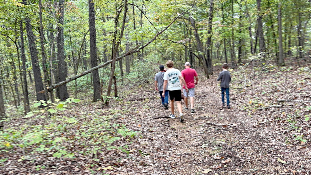
We traveled first to the Kaintuck Hollow Natural Bridge Trailhead.
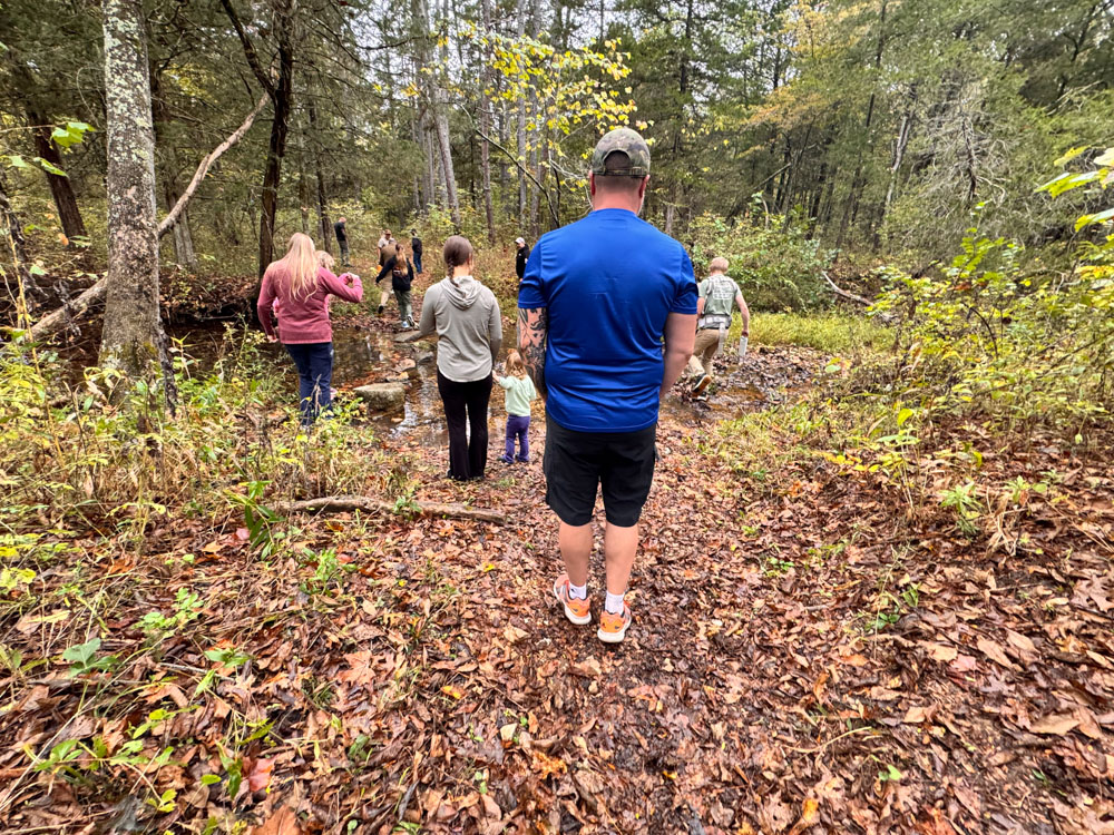
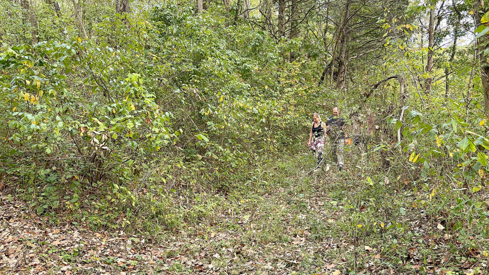
It was a half mile hike to the Kaintuck Hollow natural bridge.
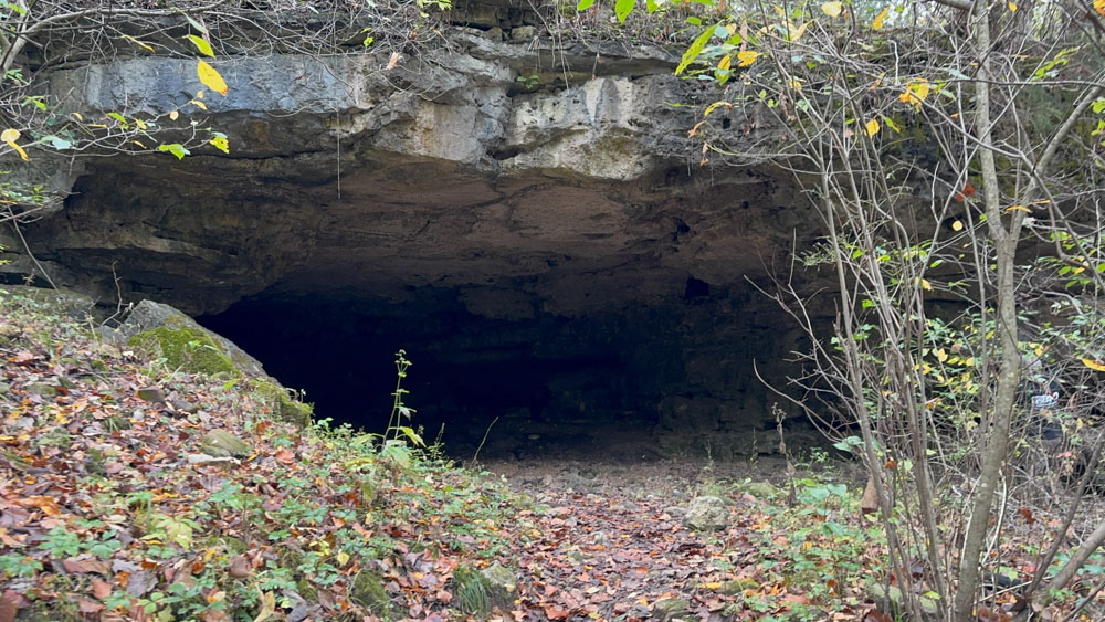
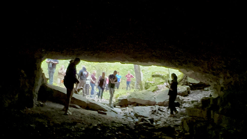
When first arriving, it appears to be a cave.
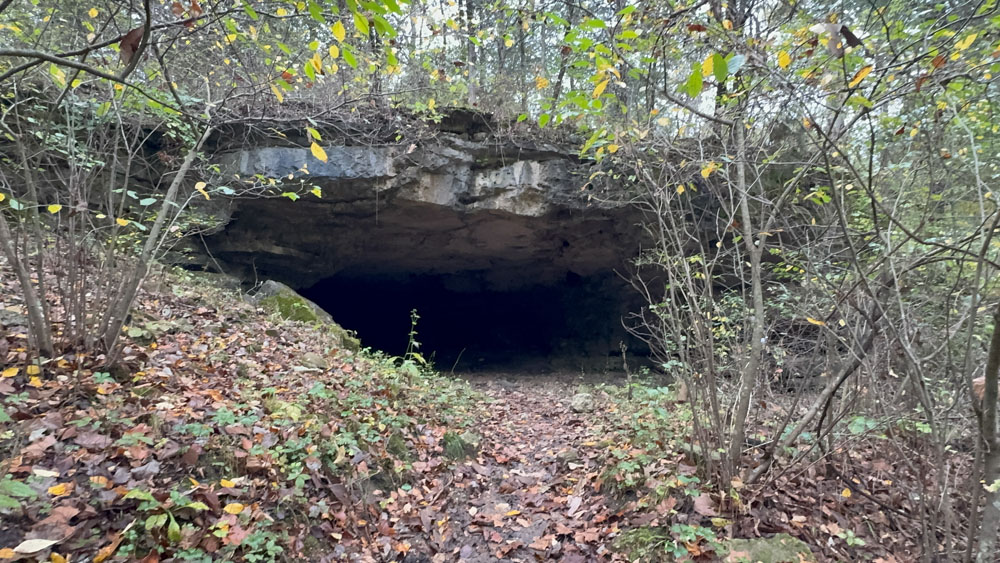
The information is that you walk through a 175 foot natural tunnel.
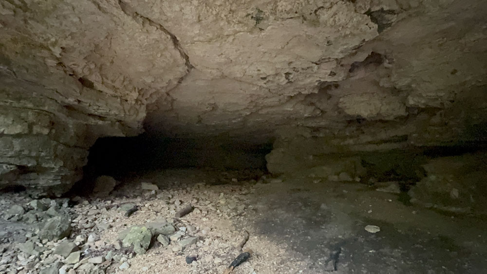
After entering, to the left is this view and it looks as if it ends, but it does not. It rounds the corner to the right at the far distances of the photo.
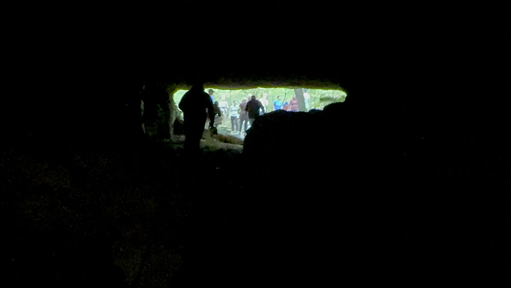
And then you see light and realize it does go all the way through and you are walking under the natural bridge.
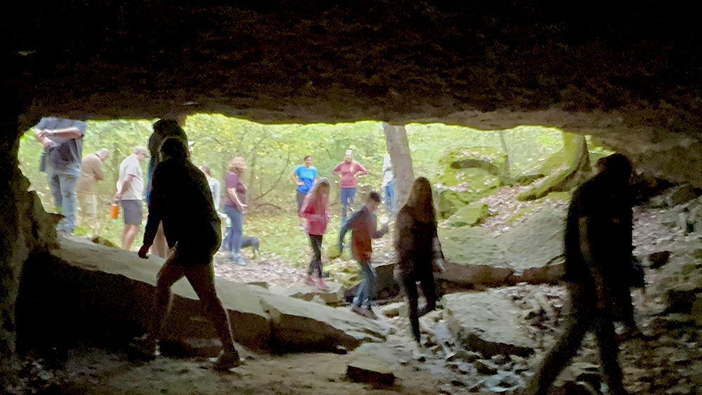

We came out the other side and could see the natural bridge better.
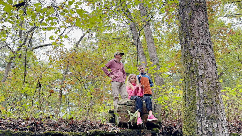
Some folks climbed to the top of the natural bridge.
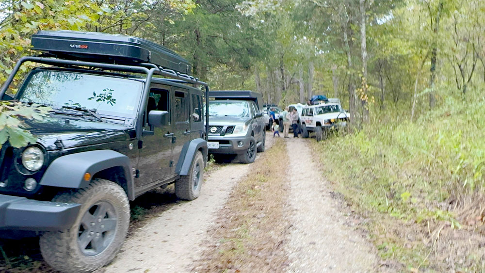
This is the parking situation for us at the natural bridge. Some of us were at the end of a circle parking area, but we were along side the road in.


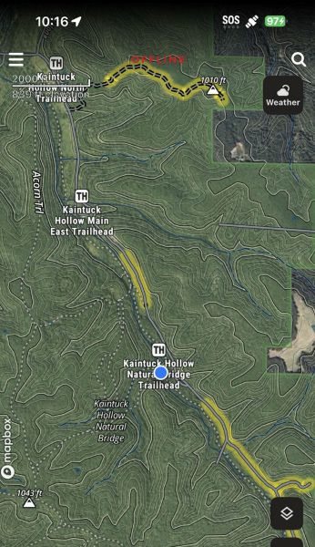
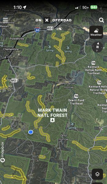
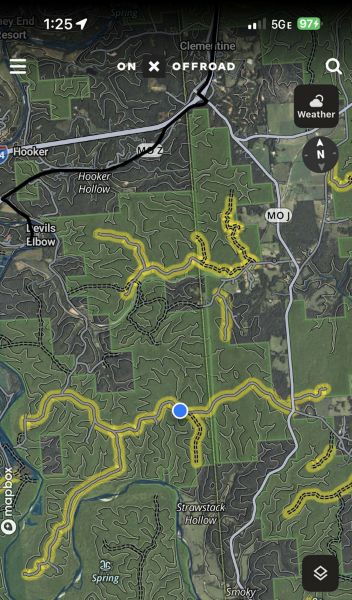
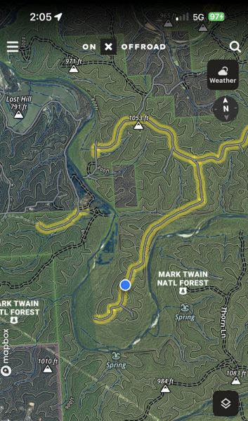
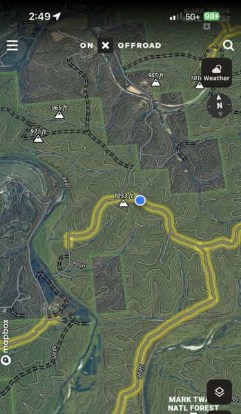
Here are the next screenshots of our locations as we drove. You can see the natural bridge marked at the bottom of this graphic and us driving along the trail.
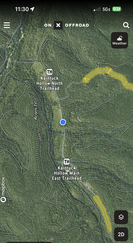
We passed the Kaintuck Hollow Main East Trailhead.

Then we passed the Kaintuck Hollow North Trailhead and turned to where the blue dot is now.
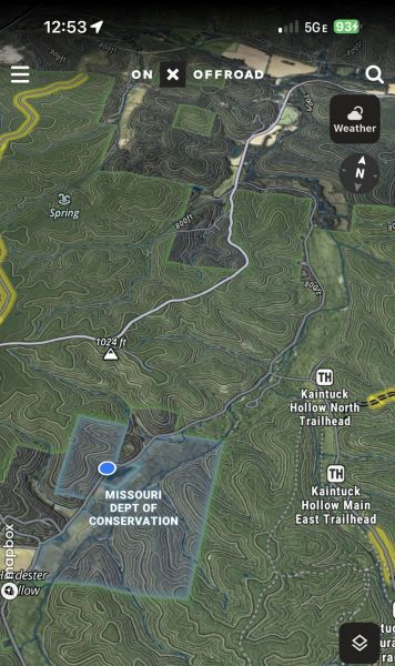
Then we drove through a Missouri Department of Conservation Area, which seems to be Bohigian Conservation Area on County Road 7550 in Newberg, Missouri.
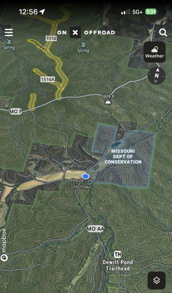
This seems to be MO AA to County Road 7640, passing Dewitt Pond Trailhead. I am noting much of this is in the Mill Creek area.

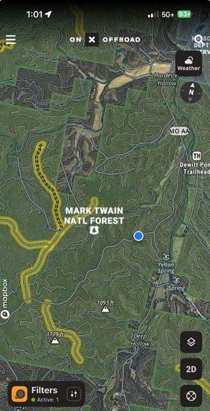
Continuing down County Road 7640.
Continuing down County Road 7640.
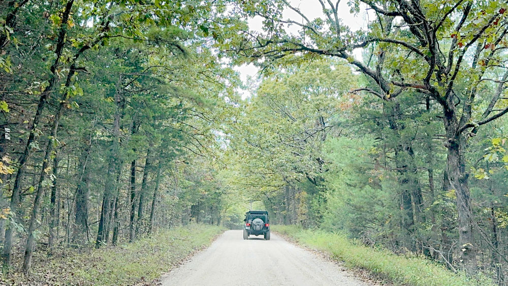
I took a photo where that screenshot is located. I remember we were being careful not to follow to closely because it is important not to catch rocks in the windshield from the vehicle in front of you.

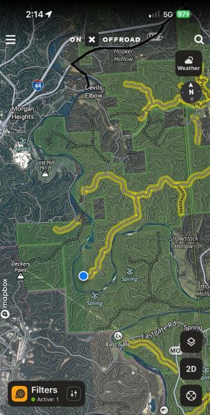
This one is merely zoomed way out on OnX Offroad, which shows the location in relationship to Rolla, Missouri.
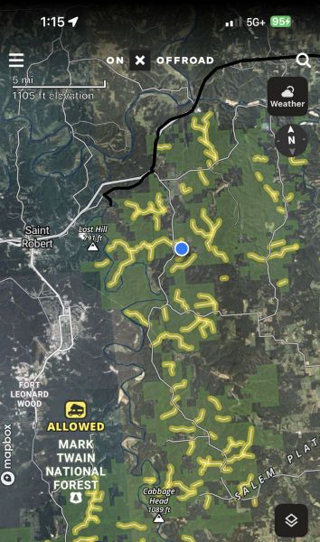
This zoomed out one shows the location in relation to Saint Robert, Missouri.
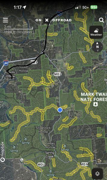
This one shows us on County Road 1730, closing in on the Phelps and Pulaski County line.
Continuing down County Road 1730 now in Pulaski County, Missouri.

This is the intersection of County Road 1730 and Booker Bend, which is also still County Road 1730 if turning right, but County Road 1715 turning left.

We turned left onto County Road 1715.
Because this was a Halloween themed event, we stopped at the grave of Eliza Jane Laycocks Thomas, in the Mark Twain Forest just outside of Devils Elbow.
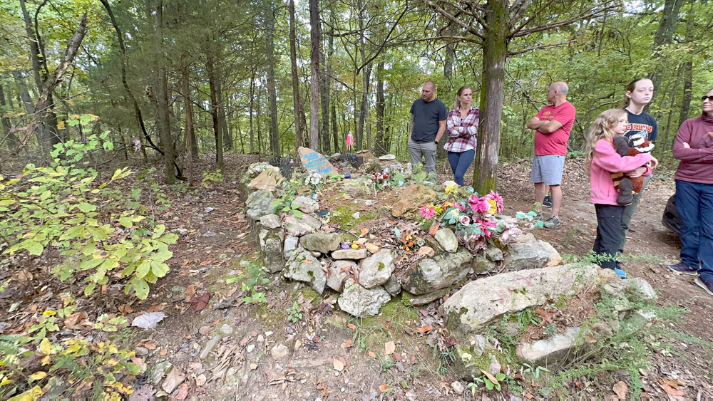
Folklore is that she was a witch and that is why she was buried two miles from the rest of the community's cemetery, which we visited next (see Mayfield Cemetery below). She lived in a cabin in the woods with her husband and when he died her friends urged her to move into the town of Mayfield, but she refused as that cabin was her home. She lived for a couple more years and died of a sickness (not murder as other folklore tells). The myth is that because she lived alone in a cabin the townsfolk thought she was a witch and did not want her to be buried in their cemetery so they made a grave for her by her cabin.

I also read that she is two miles from the rest of the community because she when she married Henry Thomas, they decided to build their home a little bit away from the community, which seems like typical behavior for a newly married couple to me. He died first and she lived alone until about 1897. The other folklore that I read said that the townfolk buried her were she died. While at the gravesite, it was said that the spot was a cistern. It made me wonder if she fell into the cistern and they left her there!

People have put all sorts of odd decorations on the gravesite and our group pointed out a lot of them. It is hard to see them from the photo. It seemed a bit disrespectful to me, although some of the items were okay.

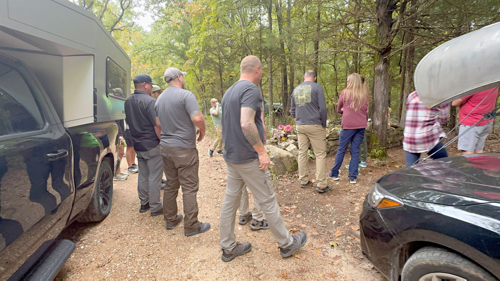
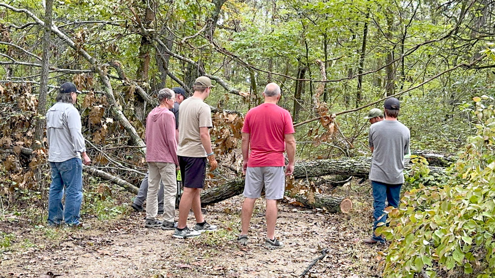
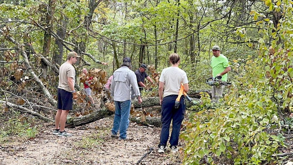
We continued on down County Road 1715 where we found downed trees crossing the road.
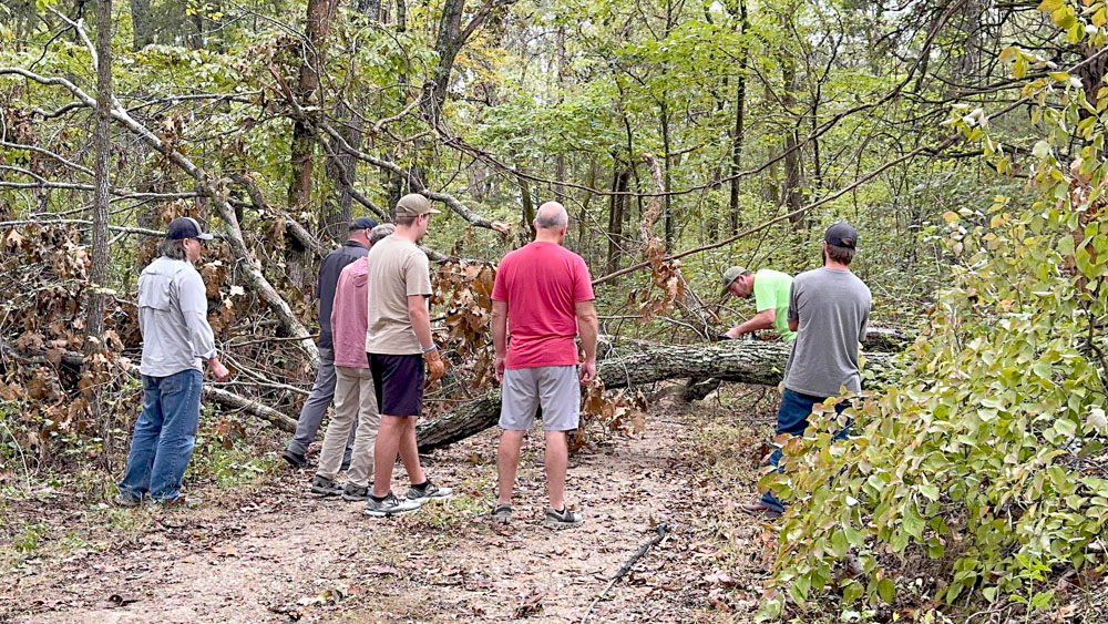
I found great joy in watching all the manly men gather with two chainsaws and manly muscle to quickly move the trees out from the road.

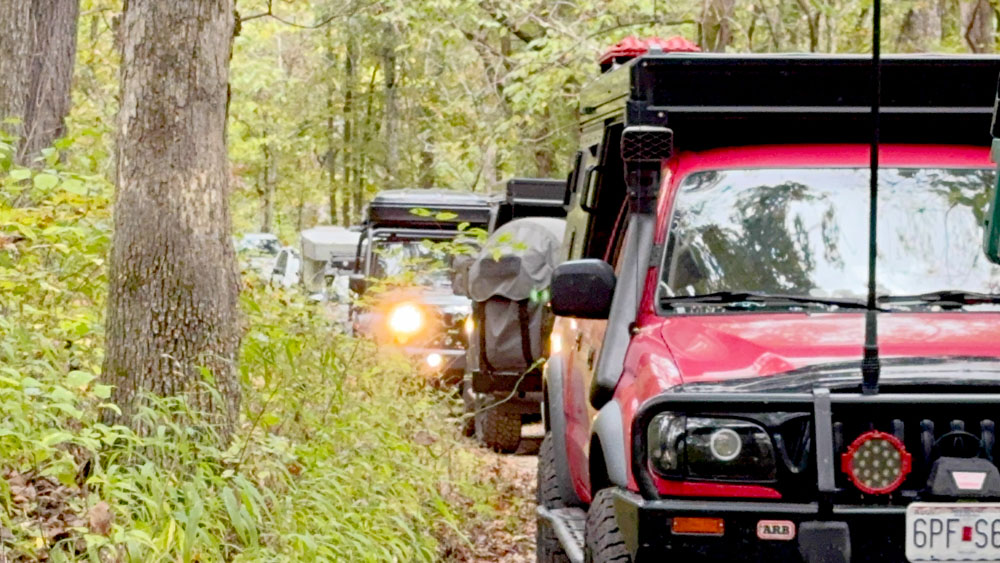
As I was standing by the front truck filming, I turned around and saw this shot and loved seeing the line of vehicles. I believe there were 13 vehicles on this trail run which seemed a good amount to me.
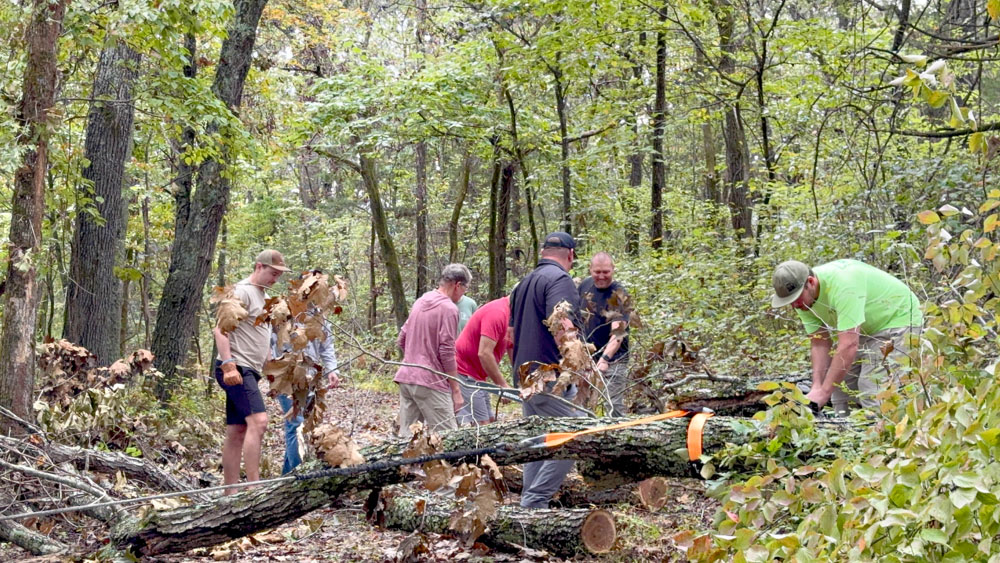
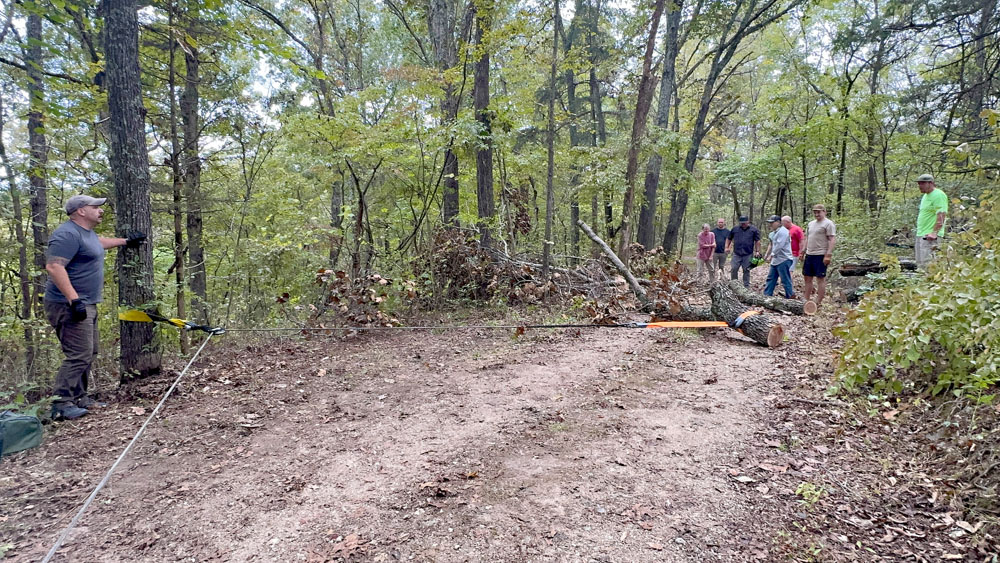
A winch was used from the downed tree, wrapped around another tree, and secured to the front of a truck. (see the above video).
We continued on down County Road 1715.

We continued down County Road 1715 and this is where we stopped at Mayfield Cemetery, which is located on a turn-around loop.

This is where the rest of the townfolk are buried.

Sometimes the simplest things bring me delight, and I enjoyed watching all the vehicles get snug in the small loop turn around. We had to get all down in there to be able to get back out as the road was semi-non-passable width.

This is the group leaving going back up County Road 1715 the way we came.
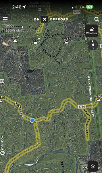
We are back at the intersection of County Road 1730 and 1715.
This time we turned left onto County Road 1730 aka Booker Bend. The dot is where we camped for the night.

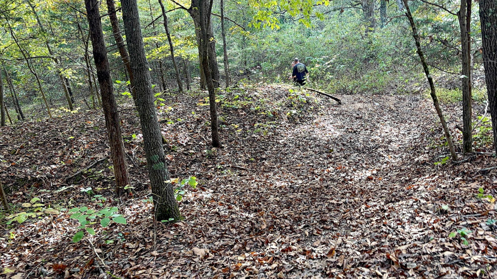
I made my husband's favorite hamburger and potatoes. I stayed back while the rest some of the group hiked the four miles (2 there and 2 back) to Bussman Lodge ruins. The ruins was also a creative part of the Halloween theme.

My hubby went on the hike to what used to be Bussman Resort Lodge.


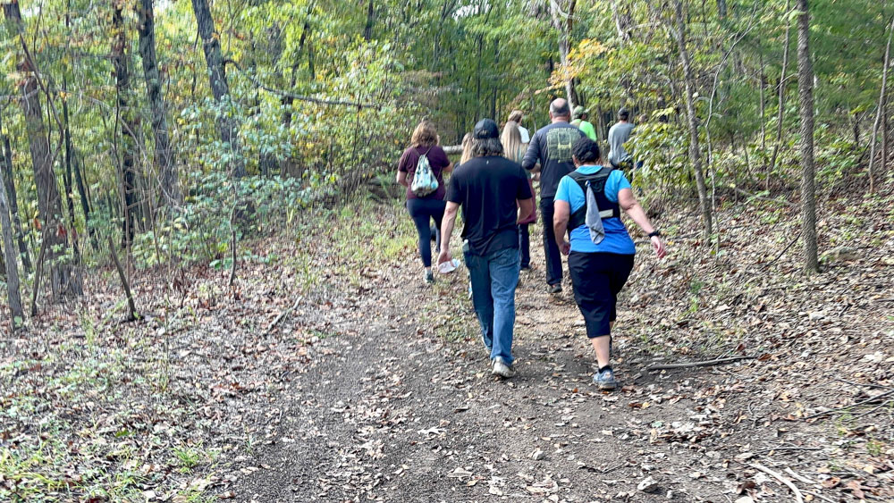
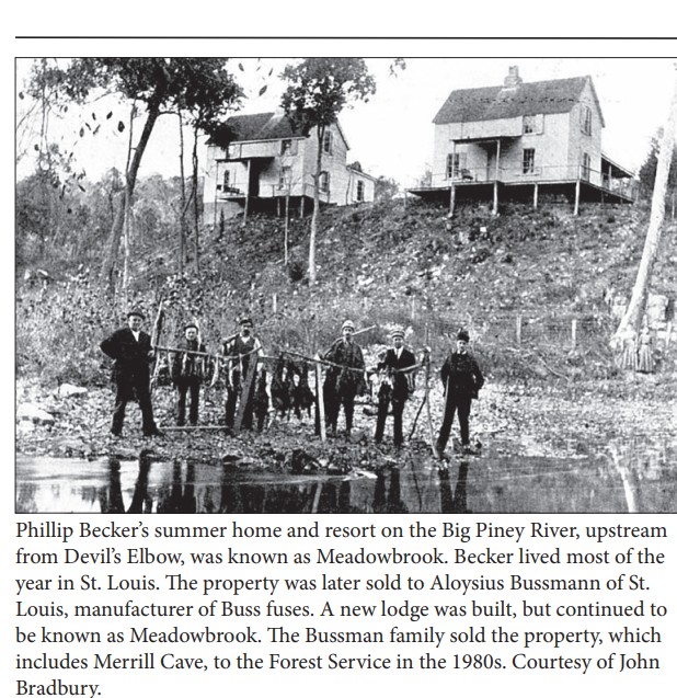
I found this old photo and information of the Bussman Lodge which gives some information. Hubby did not take photos of what he saw, but you can see it in the video above. He did not continue on down the trail as some others did. I did see online a lot more of the ruins that what is shown the video that includes a spring house and spring, foundation of the old garage, the remains of the lodge including two chimneys, and concrete reservoirs for holding bait, a picnic area , the river, a rock bridge, and an old dock.

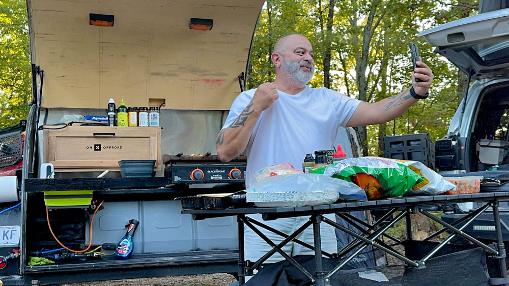
Back at camp I enjoyed watching The White T-Shirt Chef aka Jonathan Cruz do his cooking thing!

We gathered around a fire for the evening and had a good time getting to know each other.


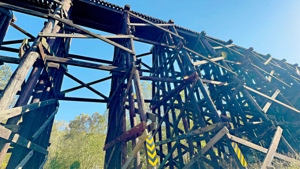
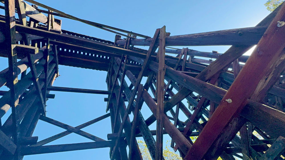
Everyone parted on their own time in the morning. These are screenshots of our location when we were going under the old railroad near Temporal Road (County Highway 1729) and Thistle Road, Devils Elbow, Missouri. We had no idea we were going to see it as we were just taking any road that seemed right to get back to a familiar area to head home. County Highway 1729 is right off of County Highway 1730 near were we were camping.
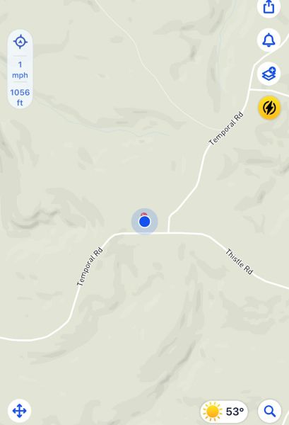
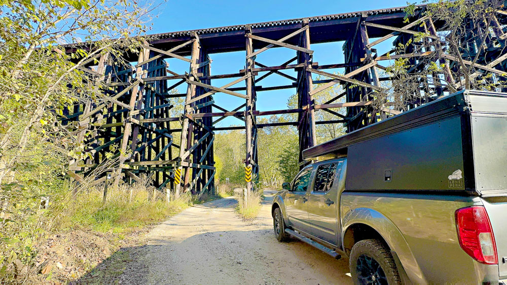
I have read it called the Temporal Road Railroad Trestle Bridge which was built in 1941 by the Army to supply Fort Leonard Wood. Apparently it is still in use today. It is located in Pulaski County.