SMS Overland New Year's Trail Run and Camp
We joined the SMS Overland New Year's Trail Run December 31, 2025 through January 3, 2025, although the group stayed for one more night and continued the run on January 4. We were in the Mark Twain National Forest in the surrounding area of Eminence, Missouri. What a great time!
It is a long video, but it does cover four long fun-filled days!
My truck is washed and I am happy to report no pinstripes on my truck, although my Lone Peak proudly shows off a few badges.
PAGE UNDER CONSTRUCTION
Thanks to Jeremy and Ashley Schumaker for planning and leading such a great run. In the above video they shared with me media they took of my truck at minutes 7:46 (goes with 6:48), 23.47 (which goes with 22:47), 25:39 (goes with 24.59), and 46:31 (goes with 45:31). It seems my program inserted the videos a snippet after where they were to go and I did not catch it. Grrr. There is my snippet, the next, and then the video from their view. I am not going to do it over at this point as I have already created this video twice because Adobe has discontinued a program before the next is fully functional, but I will fix it for my own files.
December 31, 2025
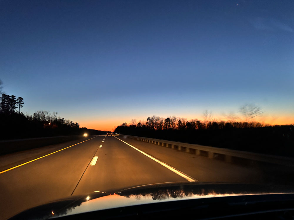 I love driving Highway 60 west at sunset, especially when we hit the straight shots with the hills and valleys and huge wide-open sunset views. We left after work on New Years Eve.
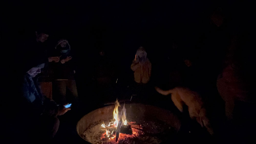
We rang in the new year around a campfire. My backside was colder than I realized and went I got into the tent, I had trouble warming up because it was chilled to the bone, but my front side was toasting and warm from the campfire.
January 1, 2026
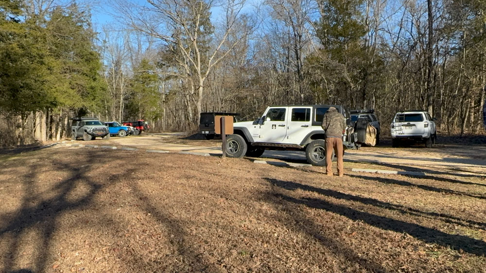
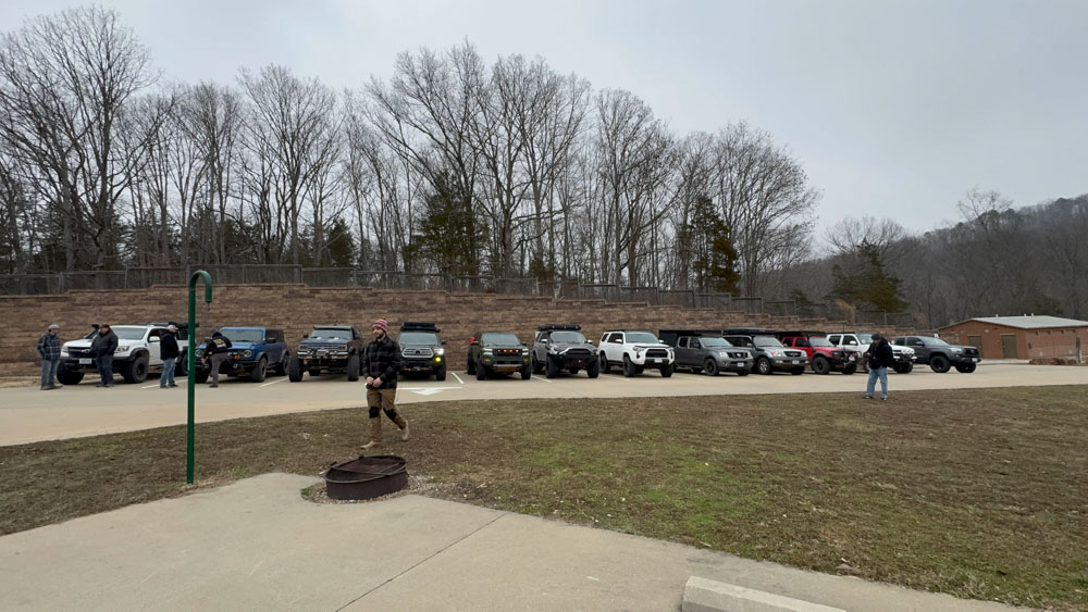
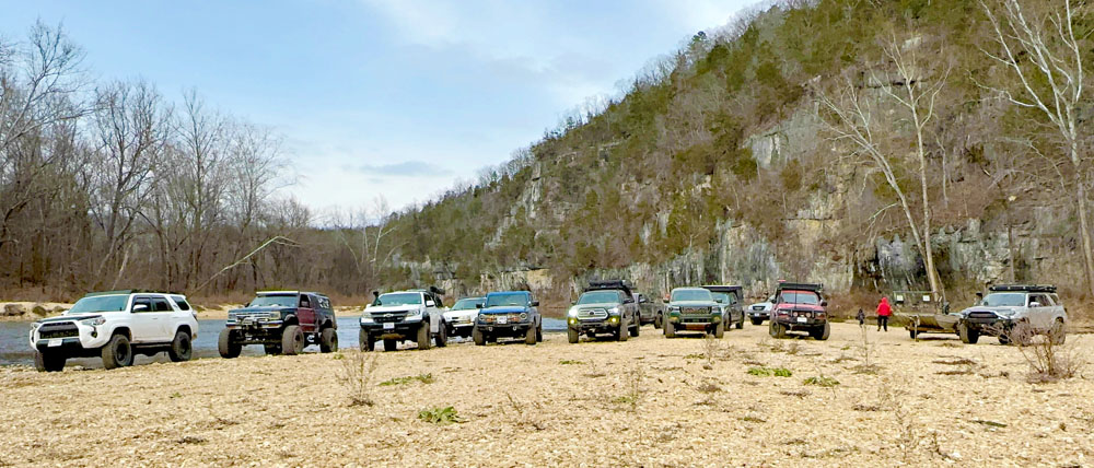
We woke up at Akers Ferry Group Camp along the Current River, had breakfast and a meeting and headed out for the day. Our camper is behind the sign in the middle of the photo and the other two Lone Peak campers are in the group to the left.
See this page for Welch Springs and previous videos of this place.
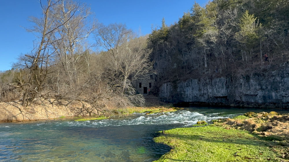
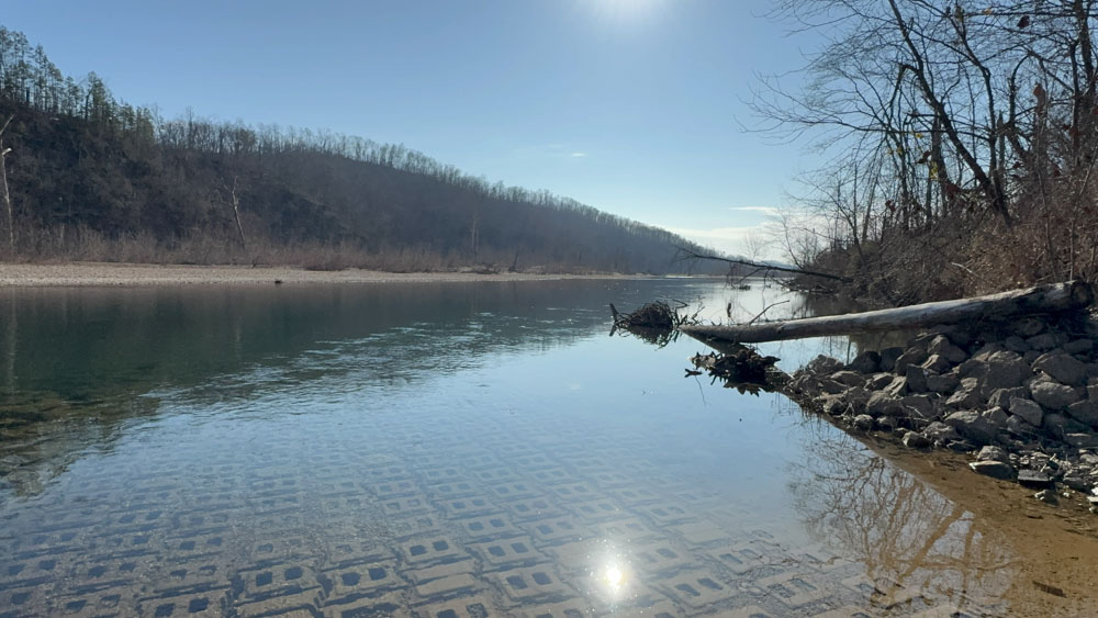
We went to Welch Spring first and hiked down the short path. I have been here before, but not in the winter. I love seeing the face in the hospital ruins every time I come. Once you see it, you cannot unsee it. The door is the mouth and the two windows are the eyes.
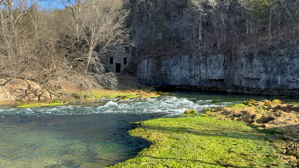
The watercress was still green against the blue water and it was beautiful as always.
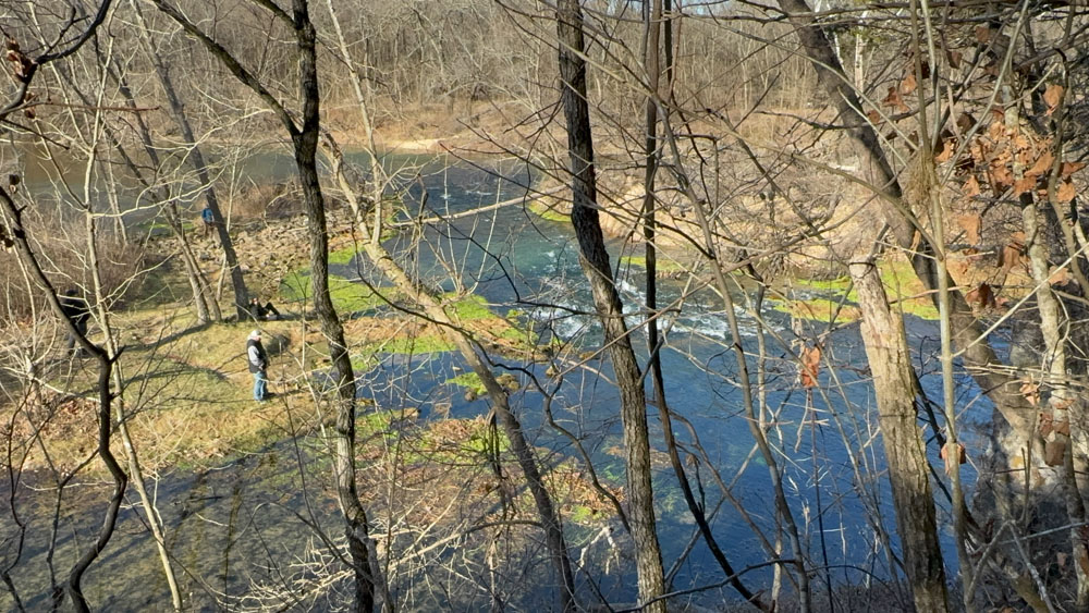
I had intended on kayaking some day to get to the ruins from the river as I had never been on that side, but there is access on a trail that climbs up on a bluff. We were told by other people standing around last time we were there that it was too dangerous, so we did not attempt it. This time some folks were taking the trail, so I decided to make a go of it. It was difficult to get up, but I managed with a little determination. I enjoyed this view from the trail at the top.

Walking along the bluff, this is a view dead center looking out. Beautiful!

Walking along a little further on the bluff is another view. I like how the views change just when you move a little bit.
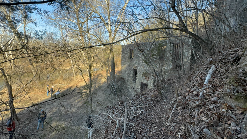

The trail goes around the back side of the ruins. At the corner into the bluff it is a tight squeeze and I had to do some acrobatic positioning to get my big behind through there! With a little determination, I made it. Thinner folks went right through.
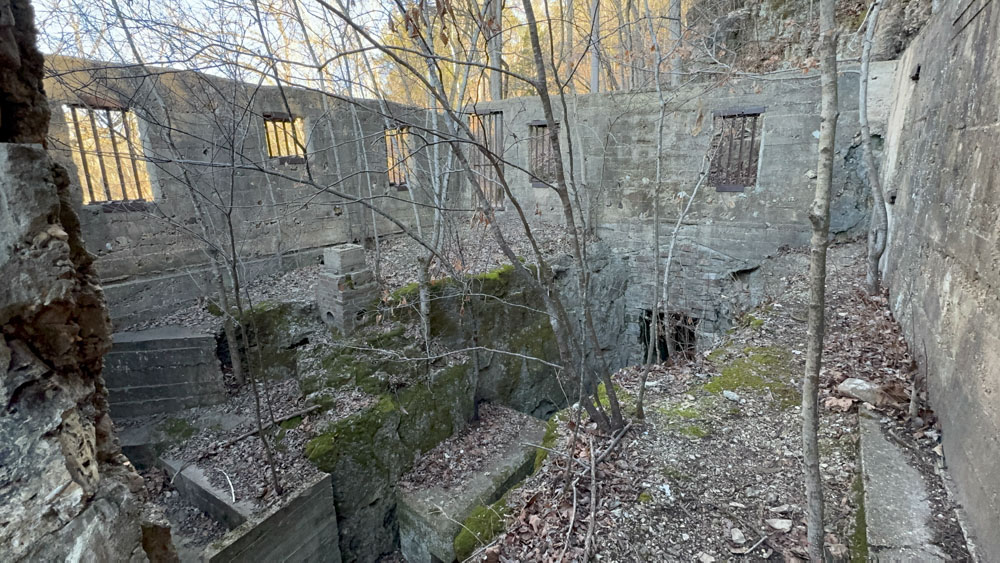
Before I walked around the back side, I stuck my camera into the window from the trail. I love how the place is built right into the rocks. The stairs and walls were adapted around the use of the rocks. I wish I could have seen it back in the day when it was in use.
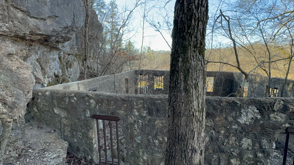
I made it to the other side around that tight squeeze!

These steps are iconic!
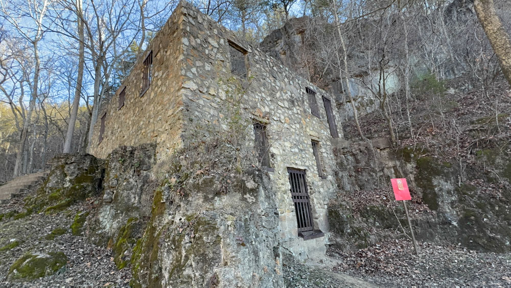

See, there is the face up close and personal!
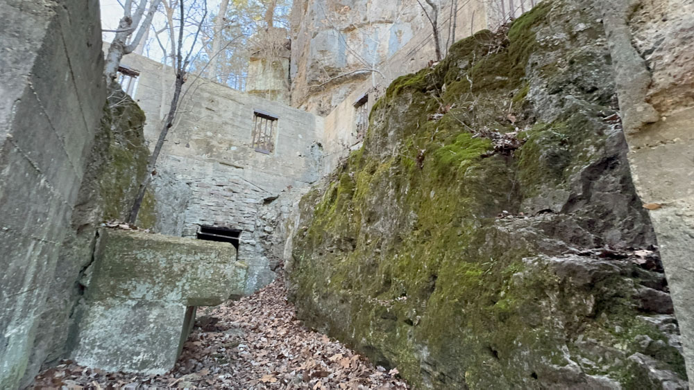
Where did the beds go if there is so much natural rock inside? I guess it is missing a few stories. Maybe this was the basement. There is an older photo. See this page for Welch Springs.

There is a staircase on the left built to go above the natural rock.

This is taken from the spot at the top of the stairs. The "face" is seen here on the other side.
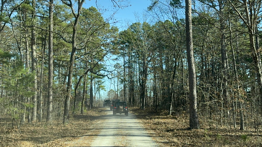
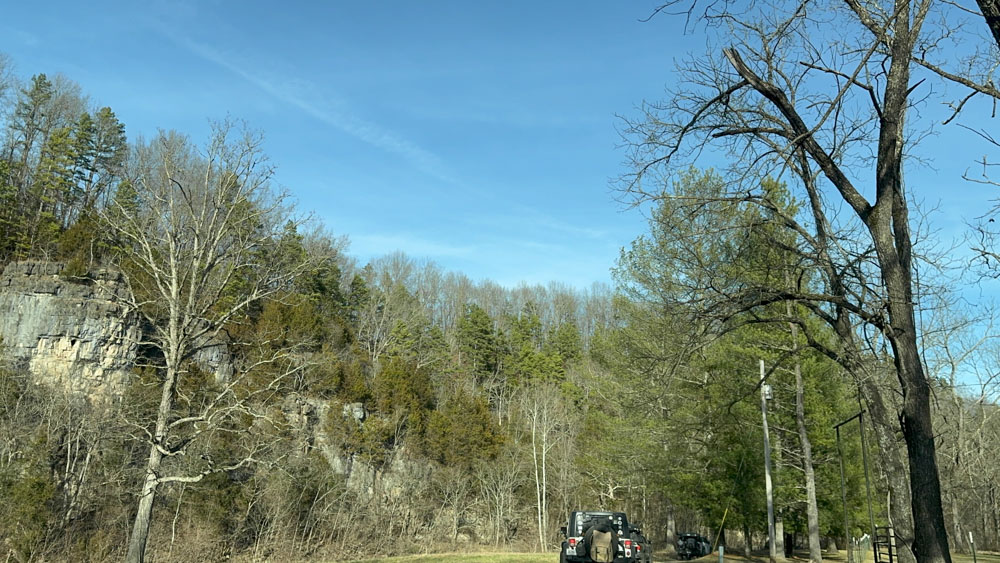
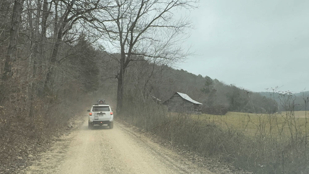
We left and did some overlanding and had a great time. I decided this time I would not follow my GPS and instead try to just enjoy my time, so I really have no idea where we went overall. This shot I believe though is on the way to Devils Well (see my website page for Devils Well).

We had lunch at Devils Well and I did not go see the feature because I was chatting and meeting people.
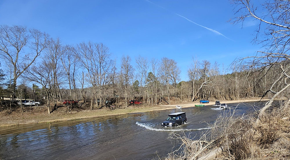
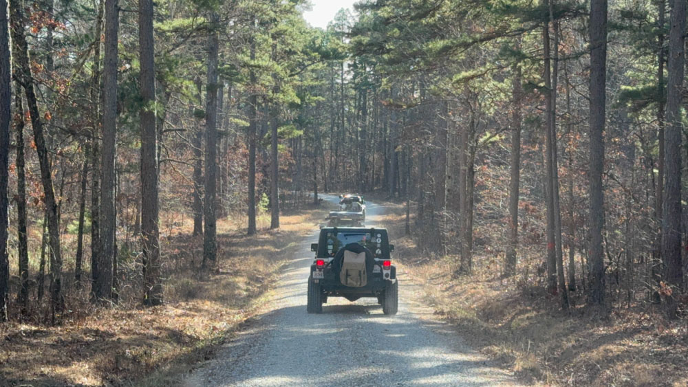
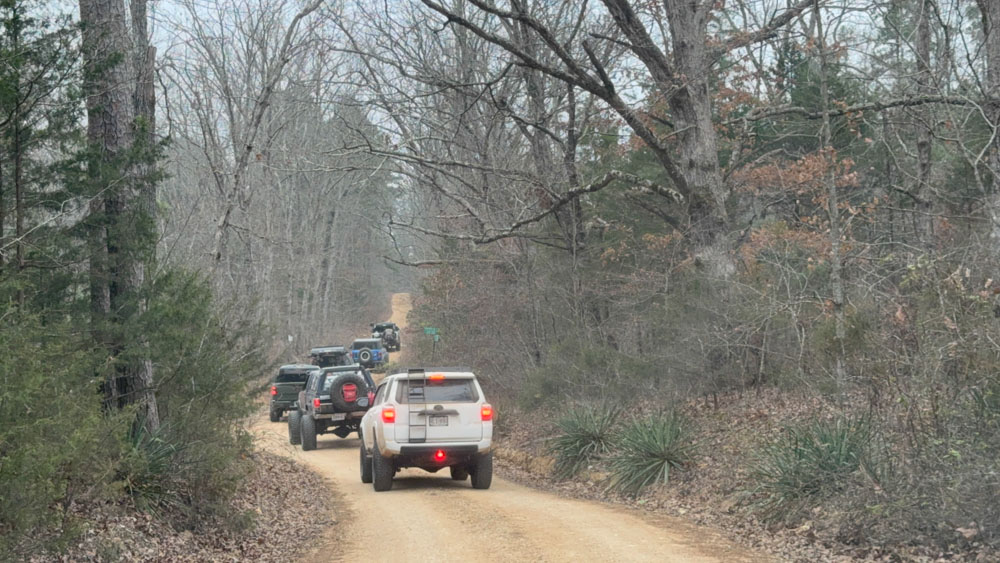
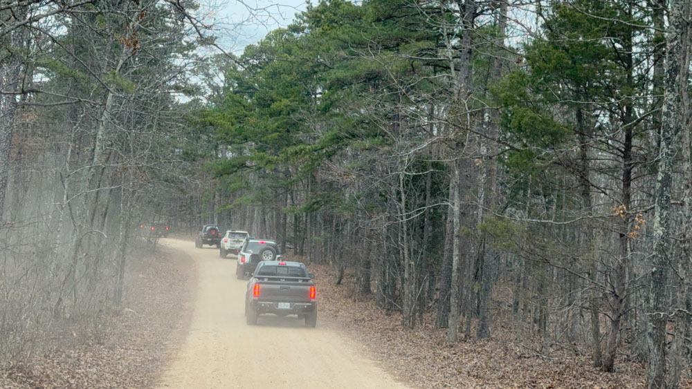
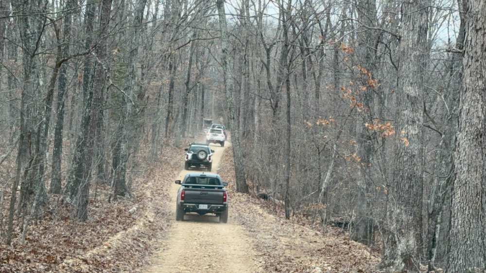
Then I did my first water crossing of the weekend! We crossed the Current River at Akers Ferry. Wow! That is a long way across! I knew they would winch me out if I got stuck. It was good to be with people I trusted. So I just went forward and kept my foot on the gas so as to not stop and keep the momentum going. That is my truck in front on this photo, and the line of vehicles following, but two had crossed in front of me.
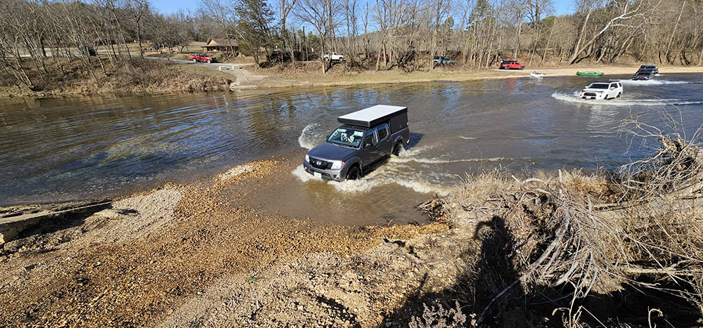
I made it! Thanks to Ashley Schumacker for taking these photos of me crossing the Current River. I think I will always remember it. Now I have been in the Current River many times and kayaked it, but I have never driven across! This is where the old ferry used to cross and I have a video of us crossing using the ferry on this page.
Next we drove through Sunklands Conservation Area and I had never been here. The conservation has the most remote spot in all of Missouri. The area contains the longest conspicuous sinkhole in Missouri, which is nearly a mile long and 200 feet deep and 600 feet wide. It is so big that you cannot stand and just look down at a sinkhole, but rather just know you are driving right through it.
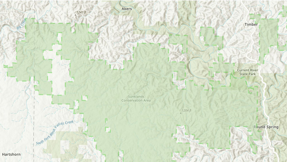
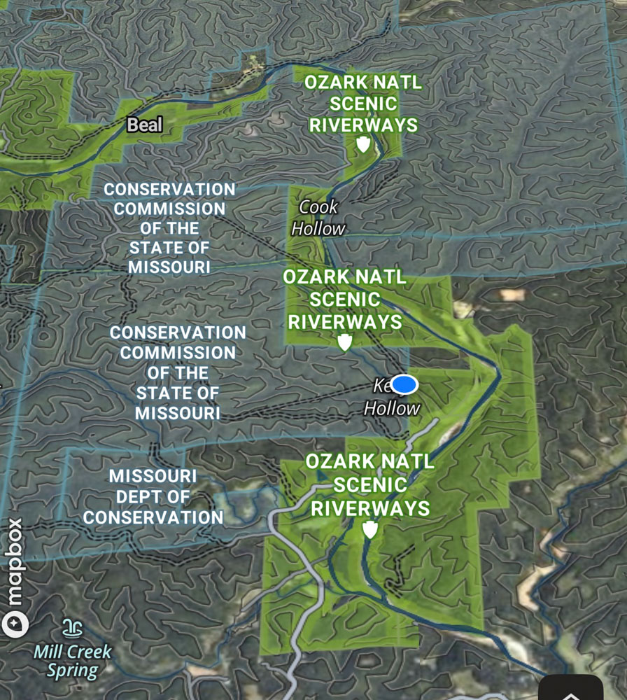
Sunklands is a very large area! You can see where we crossed the Current River at Akers Ferry at the top of the map and then we drove into the conservation area.

We ended up in downtown Eminence for a gas fill-up and then spent the night at Echo Bluff State Park. Echo Bluff is just above Round Spring on this map. The next day we left out of Echo Bluff and entered the Roger Prior Pioneer Backcountry which you can see on this map on the right. The map gives a good general idea of the amount of land we covered over the two days.

Somewhere along the way went went down this huge hill with this huge amazingly wide view with the sun directly overhead. It was awesome, but it did get dusty with all the vehicles so the photos are not good.
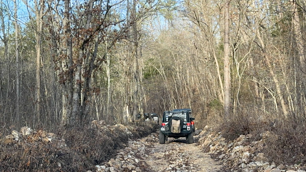
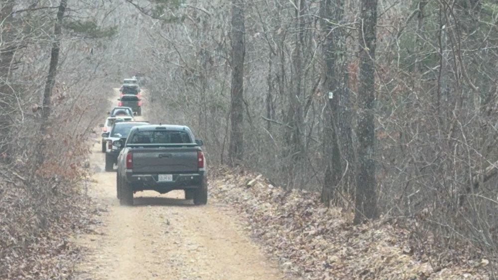
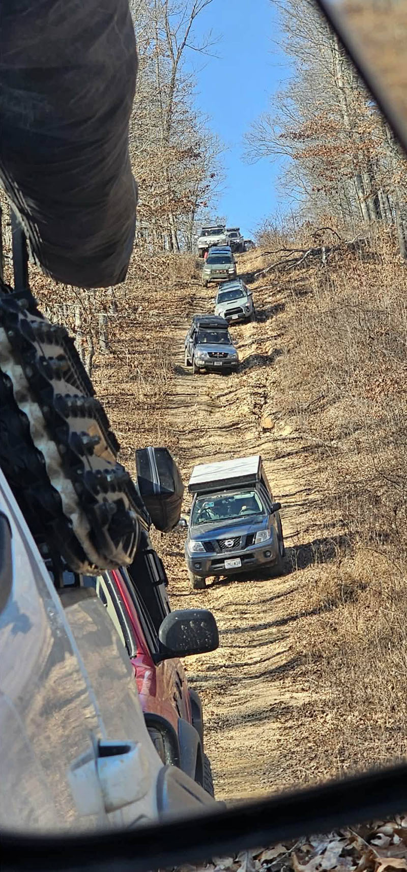
Here you see the trail did get a bit rougher.
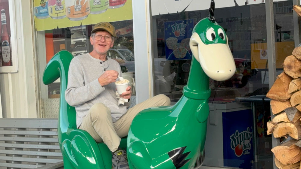
In Eminence hubby road Dino the Dinosaur while eating ice cream and someone decided to put a quarter in it to make it go.
Here are the two other Lone Peak campers in front of us as we were entering Echo Bluff State Park for the night. We have been here many times before so you can see my Echo Bluff State Park website page for more.
At that was our first day of January 2026!
January 2, 2026
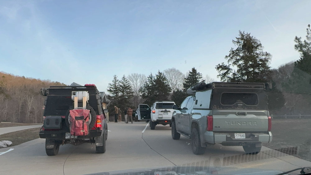
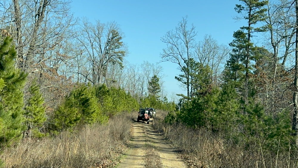
We lined up at Echo Bluff the next morning for a photo op and a meeting before heading off. I had no idea what my day had in store me. We did more water crossings than I could count!
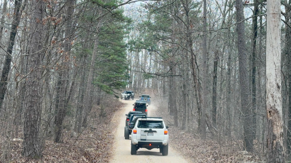
The Roger Pryor Pioneer Backcountry trail began right in the middle of Echo Bluff State Park.
"In the fall of 2001, Leo Drey announced that Pioneer Forest's largest block, some 62,000 acres in size, would be dedicated to providing primitive dispersed recreation, and named in honor of Roger Pryor, a friend, advisor, and a leading voice for conservation."
At one time we were following Blair Creek, but I did not watch the GPS this time, trying to enjoy the ride instead.
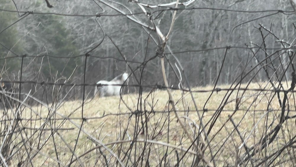
Several times we saw the wild horses of Shannon County (see that website page).
Our guides also told us we were in the Pioneer Forest which is maintained by the L-A-D Foundation.

We passed this Spring.


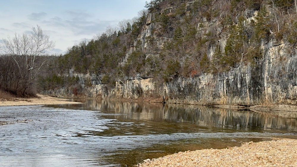
We stopped at a gravel bar for lunch and it was a beautiful spot with a clear water crossing and small rapids. I could have camped here and sat in the water had it been warmer weather.
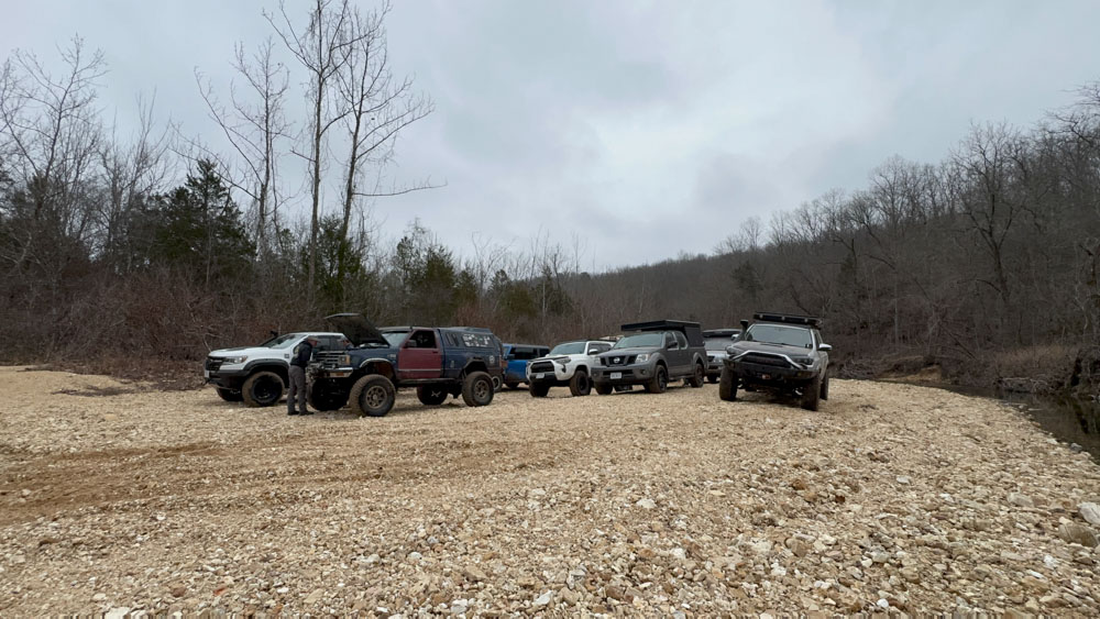
This is the vehicles stopped for lunch.

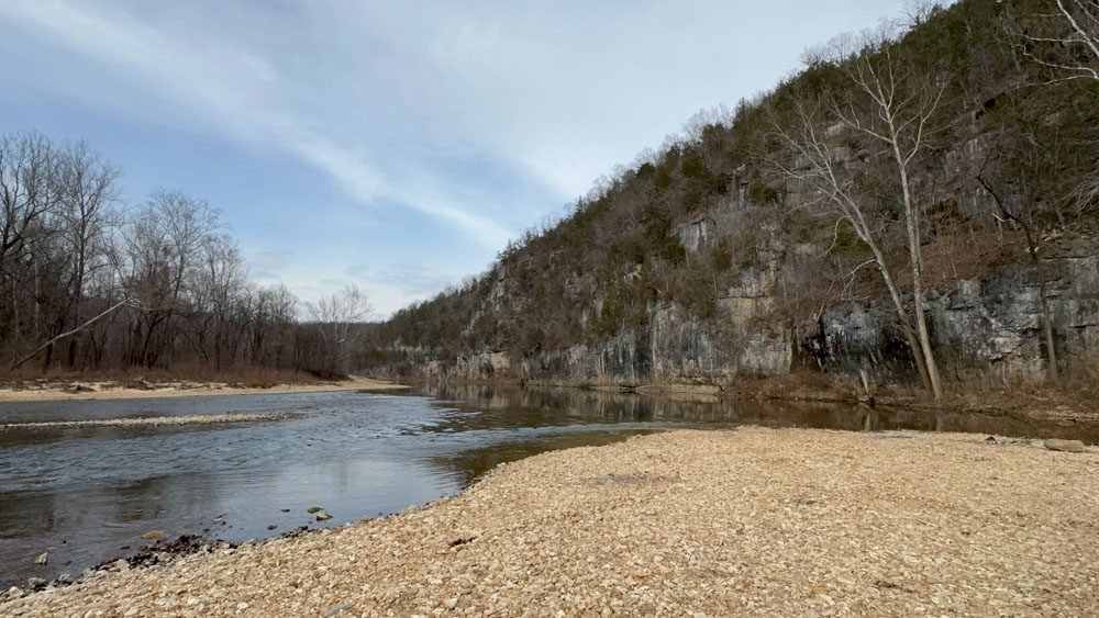
I have no idea where we were, but we stopped on this gravel bar with the large bluff and it was a beautiful scene. I believe this may be the Current River.

I did not get photos of the water crossings, but I filmed most of them in the above video. We had a great time. This seemed rather extreme to me, yet it was called a beginner overlanding trail ride. If this is the beginner level, I think I am comfortable staying at this level!

I did get a GPS screenshot of where we camped for the night near on the Million Dollar Gravel Bar. It was a great gravel bar too and I would go back here in a flash! We were on Highway 106 which is east of Eminence, but we came out of the Pioneer Backcountry onto Highway 106 further down and traveled towards Eminence, turning onto County Road 533.
January 3, 2026
When we woke up the next morning it was spitting freezing rain. We stood around a campfire and watched the Eagles in the distance. There were at least six Eagles.
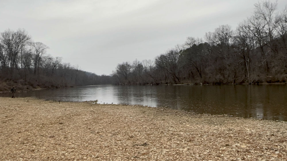
This is look up river towards Powder Mill Campground.
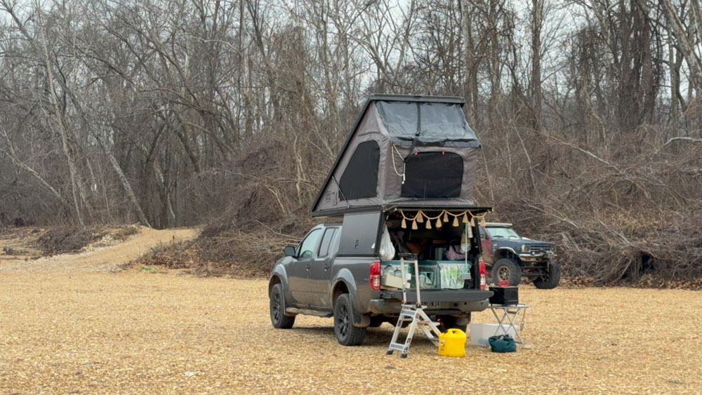
Here is our camper! I picked a spot in the middle where the front tires were up hill to level the tent for the night.
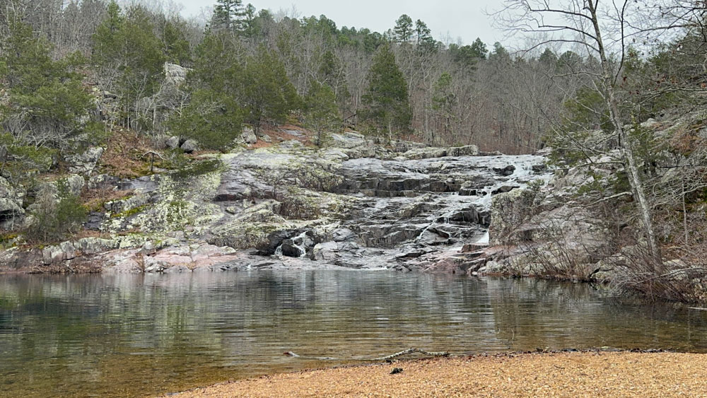
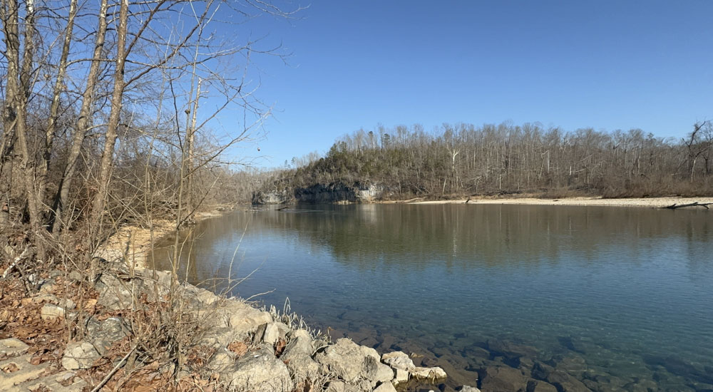
We left the next day and visited Rocky Falls (see this website page). We have been here many times.
Then we drove to Klepzig Mill (see this website page) and parked and got out a while.

Then we drove for a while and ended up at Peck Ranch (see website here) and went through the back country of that conservation area.

Some of the back roads were a bit bouncy and rough and there were some water crossings.
We went down this huge hill that was a steep grade full of gigantic ruts. I certainly had to be careful to avoid the ruts and go slowly. That was kind of wild! Jeremy Schumaker took this photo from the lead vehicle and my truck is there at the bottom of the photo with the white tent roof.
We stopped once more along the Current River at this location, which was not far from Van Buren.

We came out onto Highway 6 from County Road M. When we got to Van Buren, we parted ways with the rest of the group and came home. They camped the final night at Goose Neck and went exploring again on January 4 before they headed home.
It was a great experience and a great weekend with some great people.