Harry S Truman Dam and Visitors Center
Harry S Truman Dam and Visitors Center is in Benton County, Missouri, and we visited on August 9, 2025.
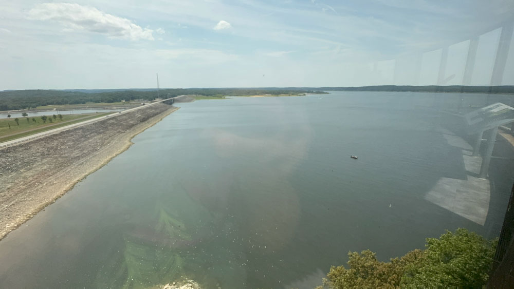
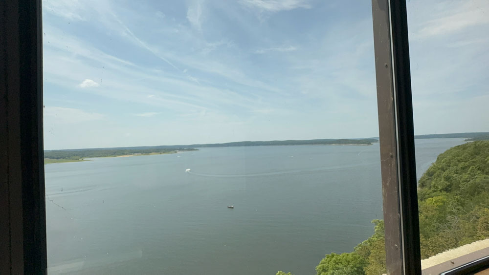
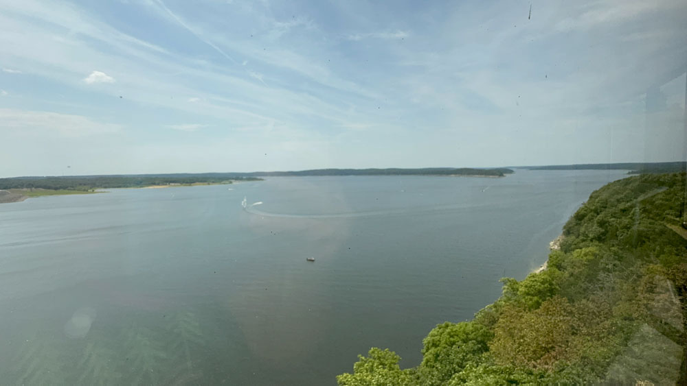
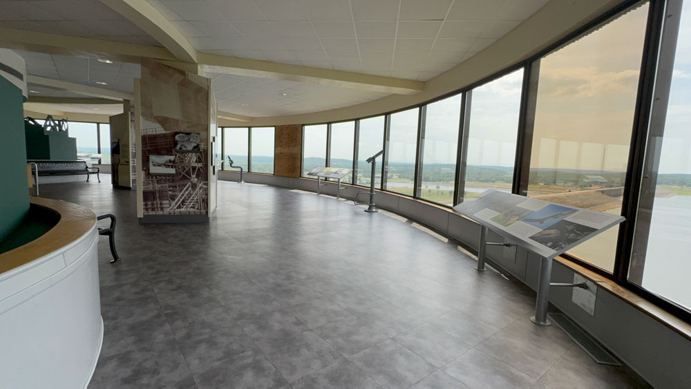
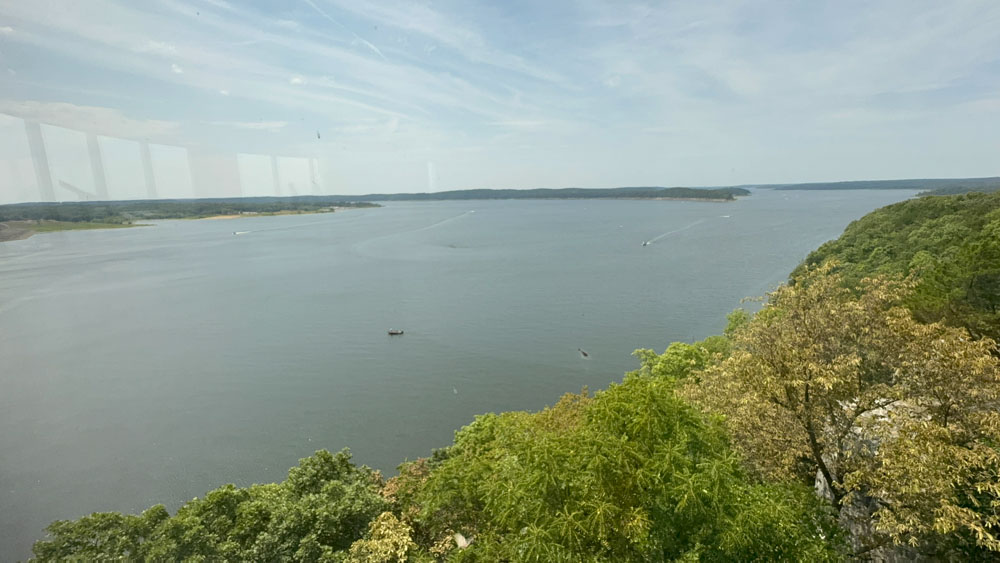
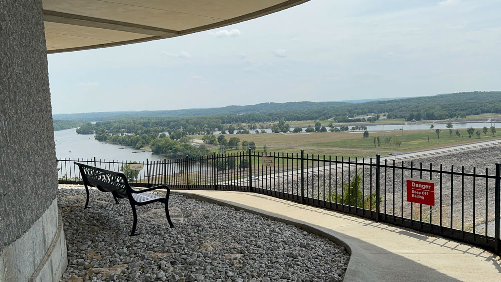
I am not much of a “museum” tourist, but occassionally we find ourselves visting one. This Harry S. Truman Dam and Museum was a good one! It has a rotunda that overlooks the lake with an amazing view. There was more in the muesum than I had time to read.
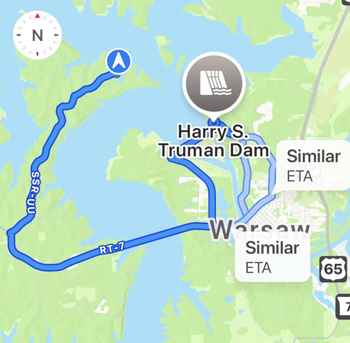
This is the drive from Harry S. Truman State Park to the visitor's center near Warsaw, Missouri. With the reservoir being named the same, it seems everything has the Truman name in this area of Missouri.
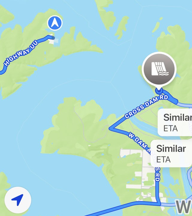
I don't know why, but I had a great laugh about the very non-original name of "Cross Dam Road." As you cross this road over the dam, you can see the unique building on the hillside. It makes you wonder what the building is, until you realize you can actually go into it.
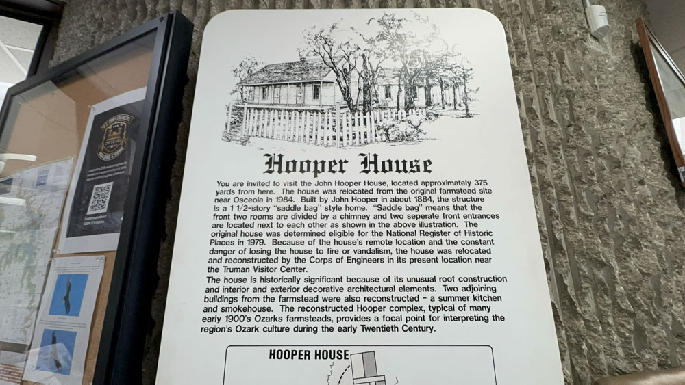
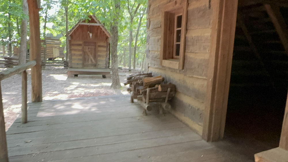
On the other side of the parking lot is the John Hooper House and other buildings put together like a late 1880's mini-community.
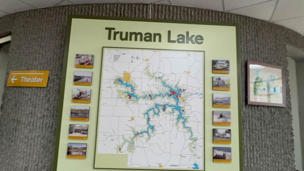
Truman Lake is huge and this map made that very evident. It was quite detailed.
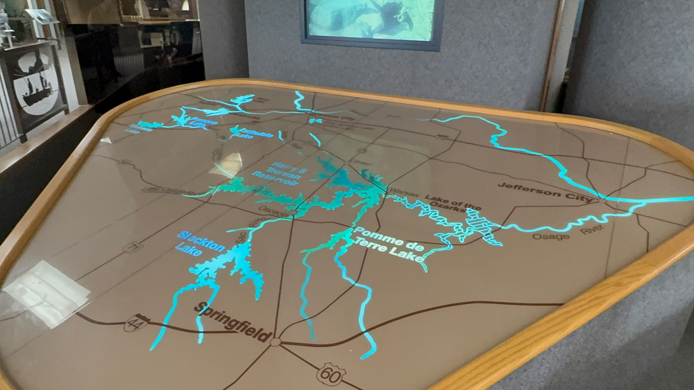
I learned so much from this presentation and map. I could have learned a lot more if I had time to stay and listen, but the dogs were with hubby in the hot day outside, so I was touring quickly. I could not believe how many man-made-by-a-dam lakes were in this part of Missouri and that they are all connected with the main purpose of keeping the Lake of the Ozarks from flooding.
I most especially liked the visual of all of the lakes in western Missouri and how they are all connected. When we were getting ready to travel, we kept saying “isn’t that the Lake of the Ozarks?” “Uh, no. So what is it?” I had no idea all of these many dams to build the many lakes were all created to keep the Lake of the Ozarks from flooding. It’s a HUGE system of waterways they have going on, all connected. We visited three of them on our trip, but still have more to visit. We are not much of “lake” people as we cannot afford to rent boats and there is not much else to do otherwise. We are “river” people. It is good to learn about these areas of our state though.
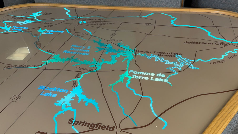
I could also see the the Sac and Osage River Confluence is a roadside park, where the rivers meet, and it made sense that Osage River does flows generally in a northeasterly direction, joining the Missouri River near Jefferson City, Missouri, as it is south of the Lake of the Ozarks, so that would cause it to flood going that direction. The map made it all make sense.
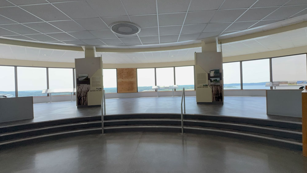
Oh, the view from the rotunda was stunning! The windows look small, but in person they provide an extremely wide-angle view of the lake to enjoy.
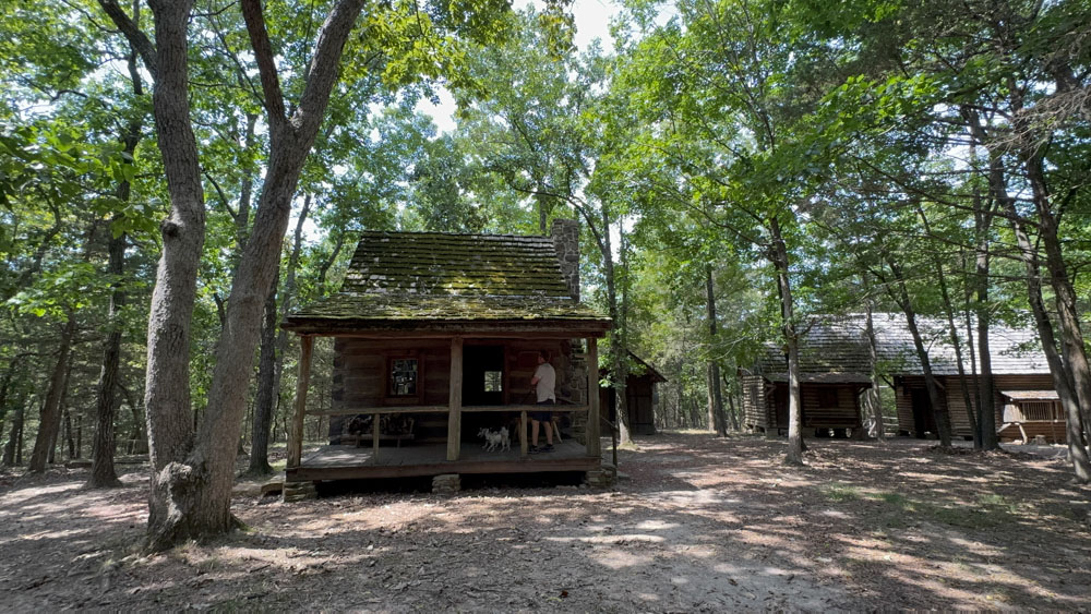
We both walked over to visit the little village as described above.
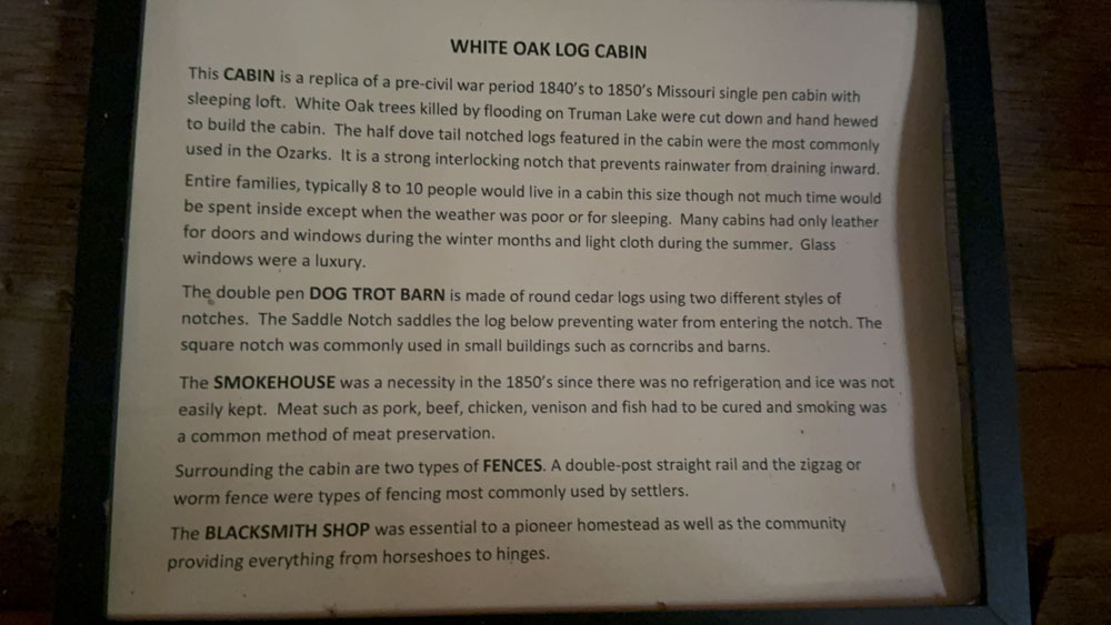
We found this small framed writing about the cabin and the other buildings on location.
Then I took the dogs under the rotunda while hubby went into the museum. The dogs got to visit this spot twice, once with each of us while we took times touring the museum.