Des Arc, Missouri
My Granny was born in Des Arc, so since I was in the area, I wanted to drive through the town. We drove through Des Arc on the way home from camping on September 14, 2025.
Granny, Lucille Jane Schnell, married Wright, married Treadway, was born July 28, 1900, in Des Arc. Her parents are Gilbert Lulden Schnell (Shnell) Jr. and Rubein Jenevery "Ginevie" "Jenny" "Gennie" Douglas. In the 1900 census, Gilber was living in East St. Louis, Illinois with his parents, and Gennie was age 16 and living in Des Arc with her grandparents, William Bevin Douglas and Margaret Denice Harbison. William and Margaret did not live in Des Arc very long. The couple moved a lot, presumably chasing work, having been in Belleview in 1884, Graniteville in 1887, Leeper in 1889, Grandin in 1892, Leeper in 1894, Piedmont in 1897, Des Arc in 1899 & in 1900, Graniteville in 1902 & 1904, Caledonia in 1908, Belleview in 1910, St. Louis in 1920, Belleview in 1930, and Ironton in 1940. In 1910, William is in the logging industry as a teamster.
I found a video: Introduction to Ozarks Studies - Lecture 26: Grandin: The Big Mill & Tall Timber, one of the places they lived. The broader Ozark region experienced a major logging boom in the late 1800s and early 1900s, and the logging industry ended in the 1920's. The railroads were used to transport the logs, and Des Arc and Leeper, and other cities where they lived had a railroad industry.
Was Gilbert Schnell ever live in Des Arc?
I found some maps of the railroads through the area which covers all of the towns mentioned above.

I like the 1894 Commissioners official railway map of Missouri and The State Historical Society of Missouri. Here is a screenshot of the applicable area and I have circled in blue the towns mentioned. The railroad goes right through them.

Scrolling up th page, here is another screenshot with towns circled in blue. Belleview is not shown, but it is north of Graniteville on the way to Caledonia.

There is a Commissioners official railway map of Missouri. Completed to January 1st 1888 that is available with The State Historical Society of Missouri and Library of Congress. There is also a 1890 Commissioners official railway map of Missouri and 1891 Commissioners official railway map of Missouri.

There is an 1897 Galbraith's railway mail service maps, Missouri at the Library of Congress.

There is an 1872 New commercial and topographical rail road map & guide of Missouri.
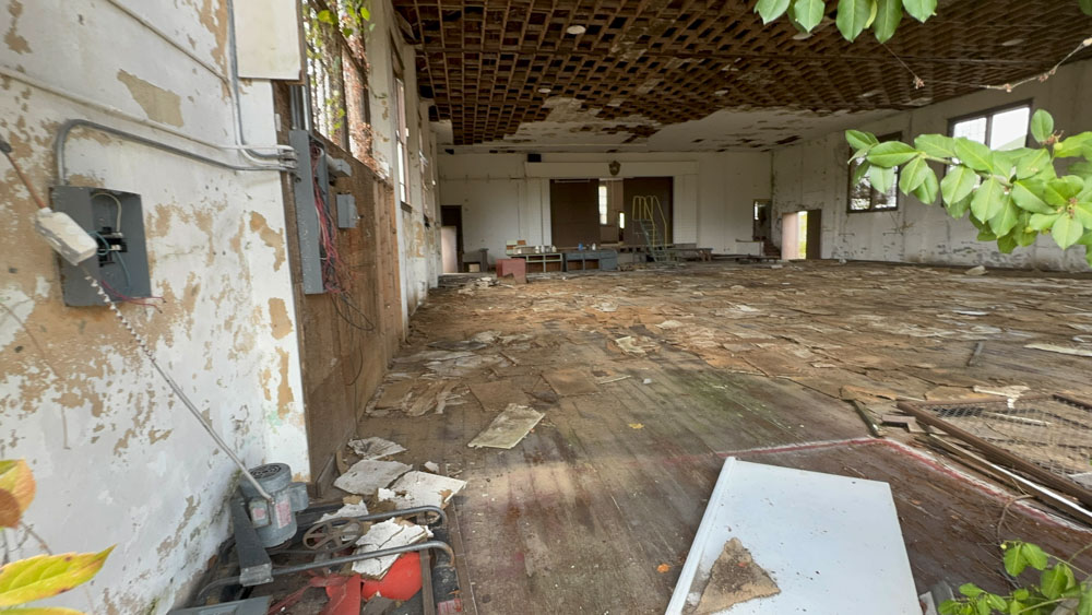
An EF3 tornado hit Des Arc on March 14, 2024. An EF2 tornado hit Des Arc on May 16, 2025. I watched social media and saw the damage done to the small town.
There is not much left in Des Arc during our visit, but the cemetery is really nice.
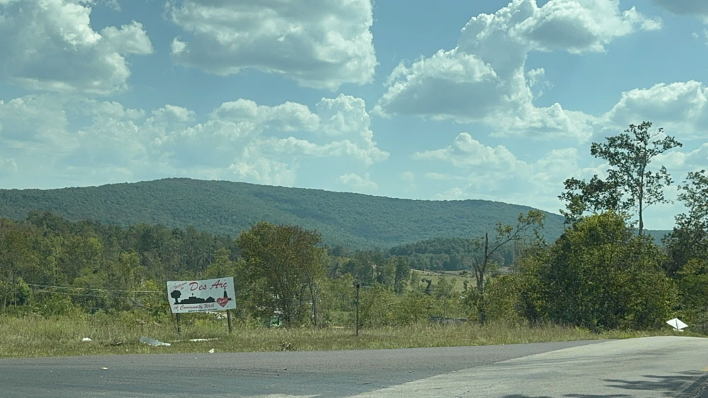
I could immediately see when driving by Des Arc on the way to camp why Granny would have been born here because the town sits below a small mountain in a valley, just like Arcadia Valley which she loved so much. I thought from maps that the Highway 49 went straight through the town, as highways often do when you are traveling and you go right through them before you realize you were ever in the town. That is not the case with Des Arc as it sets in a valley next to Highway 49 and we had to turn off the highway to drive down into the town.
Des Arc, Missouri, was officially established in 1871 and is located in Iron County. The name "Des Arc" may come from the French "des arcs," meaning "the bend," potentially referencing a bend in railroad tracks, though the State Historical Society of Missouri suggests it could be a corruption of aux arcs, which is linked to the origin of the "Ozarks" name. The community has been a site for district assemblies for the Missouri District Church of the Nazarene in 1912.