Cahokia Mounds State Historic Site
Cahokia Mounds, Illinois, April 21, 2019
Cahokia Mounds is a special place for me because I have history that leads to Cahokia in my ancestry. First is my ancestor Regis Marechal (Richard Marshall) whose mother was a half-breed Cahokia Indian. Second, my ancestor Marie Josephe Marechal was born in Cahokia in 1745, so her parents Nicholas and Jeanne Illeret Marechal lived there and also were married there in 1735. It is also mentioned in the story of Celadon.
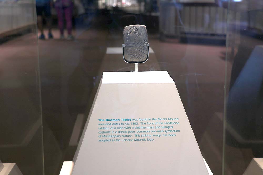
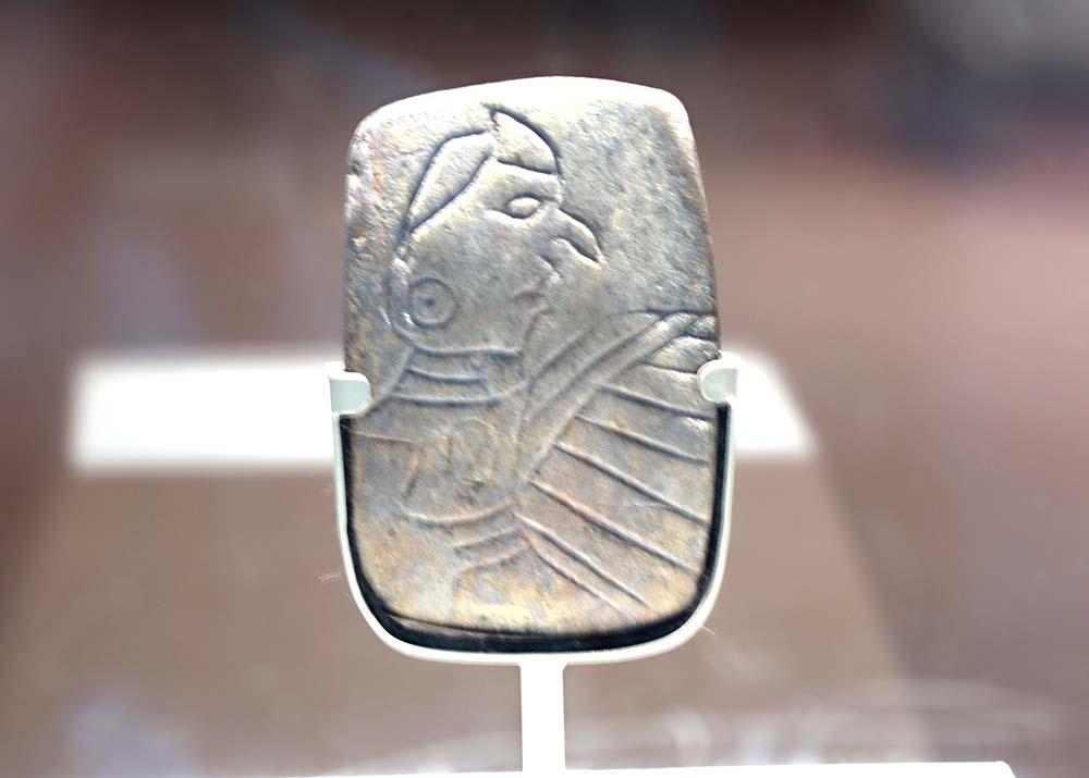
There are many photos in the above slideshow, but I wanted to also share a significant amount here because there is history for me in Cahokia. The most significant piece in the museum is The Birdman Tablet. I was surprised at how small it was. The reason that it is important to me is that my ancestor Regis Marechal (Richard Marshall) did a carving in a small stone and left it for his wife to pass down in the generations. I believe that he was utilizing the same skills as his Cahokian ancestors and keeping alive the same craft of carving in stone.
The sign says "The Birdman Tablet was found in the Monks Mound area and dates to A.D. 1300. The front of the sandstone tablet is a man with a bird-like mask and winged costume in a dance pose, common bird-man symbolism of Mississippian culture. This striking image has been adopted as the Cahokia Mounds logo."
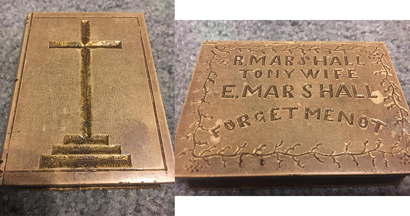
This is Richard's stone carving. I had gotten the measurements at one time, but do not know where that note is at this time. significant is that it is also very small like The Birdman Tablet.
It was hard to get a close up through the glare of the glass case.
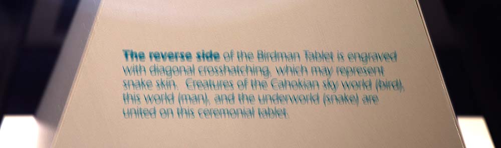
This sign says "The reverse side of the Birdman Tablet is engraved with diagonal crosshatching, which may represent snake skin. Creatures of the Cahokian sky world (bird), this world (man), and the underworld (snake) are united on this ceremonial tablet.
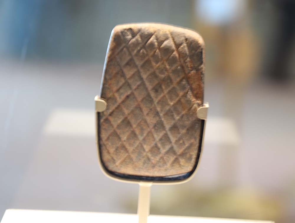
This is the back.
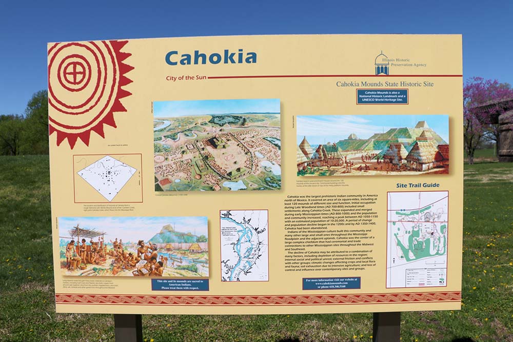
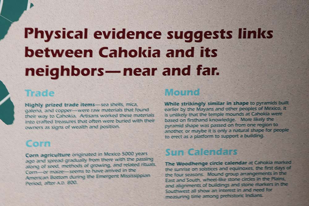
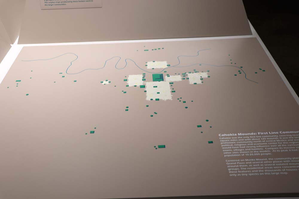
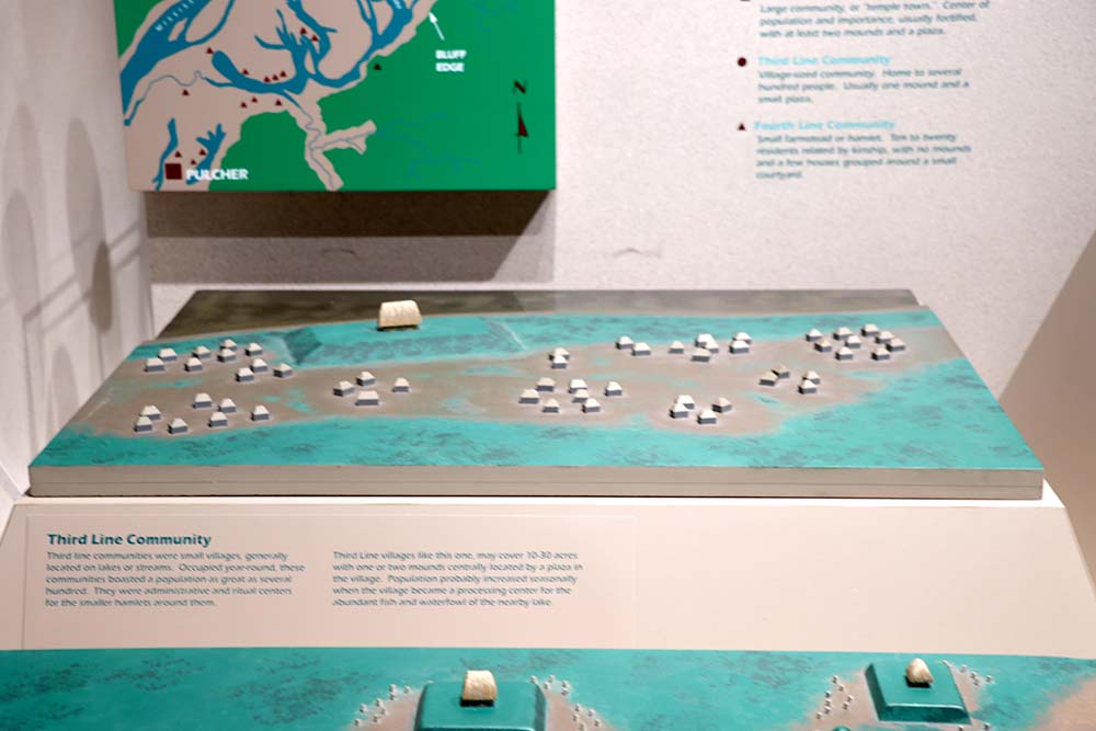
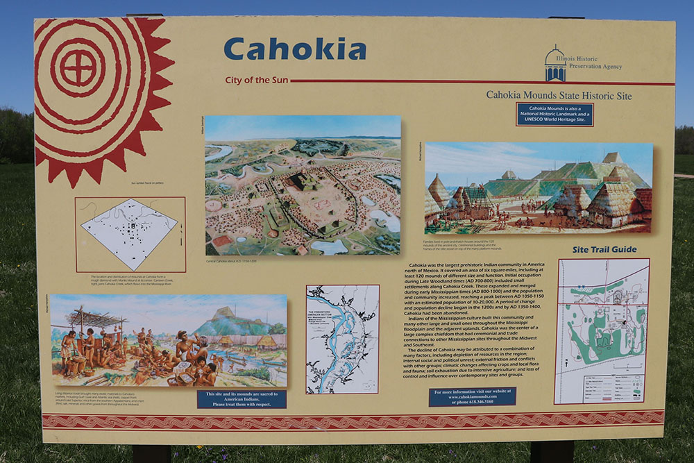
This sign says that Cahokia was the largest prehistoric Indian community in America north of Mexico. It covered an area of six square miles, including at least 120 mounts of different size and function. Initial occupation during Late Woodland times (AD 700-800) included small settlements along Cahokia Creek. These expanded and merged during Mississippian times (AD 800-1000) and the population and community increased, reaching a peak between AD 1050-1150 with an estimated population of 10,000-20,000. A period of change and population decline began in the 1200s and by AD 1350-1400, Cahokia had been abandoned. Indians of the Mississippian culture built this community and many other large and small ones throughout the Mississippi floodplain and the adjacent uplands. Cahokia was the center of a large complex chiefdom that had ceremonial and trade connections to other Mississippian sites throughout the Midwest and Southeast. The decline of Cahokia may be attributed to a combination of many factors, including depletion of resources in the region; internal social and political unrest; external friction and conflicts with other groups; climatic changes affecting crops and local flora and fauna; soil exhaustion due to intensive agriculture; and loss of control and influence over contemporary sites and groups.
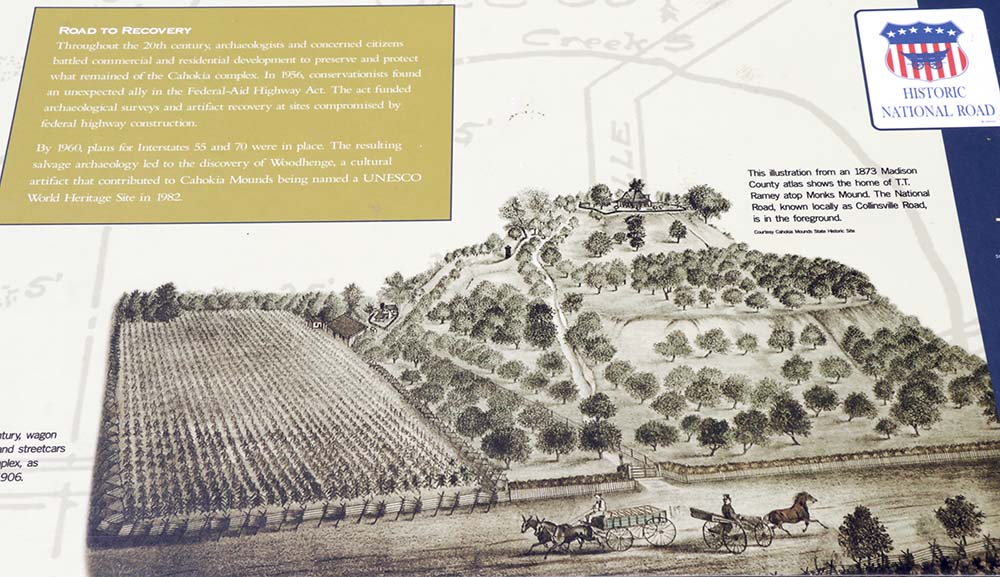
This sign in the museum shows what it looked like in an illustration from 1873 Madison County atlas and shows the home of TT Ramey atop Monks Mound. The National Road, known locally as Collinsville Road, is in the foreground.
I took some notes from the movie that is show inside the museum as follows:
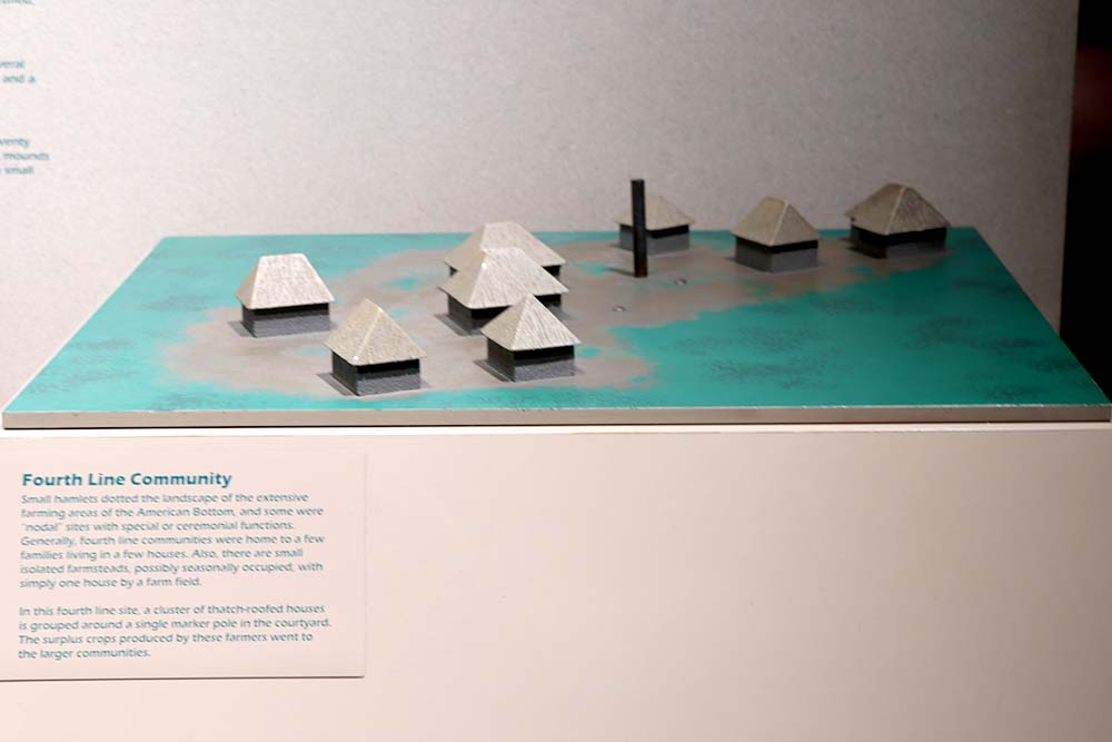
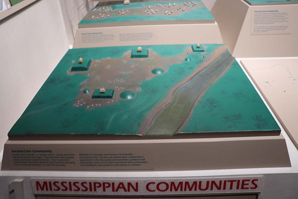
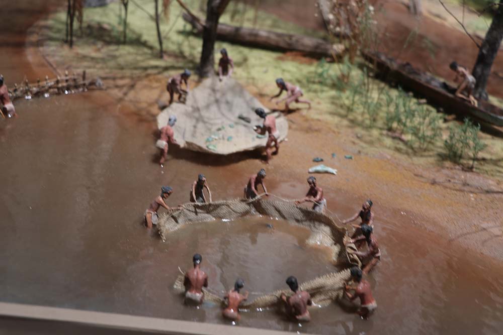
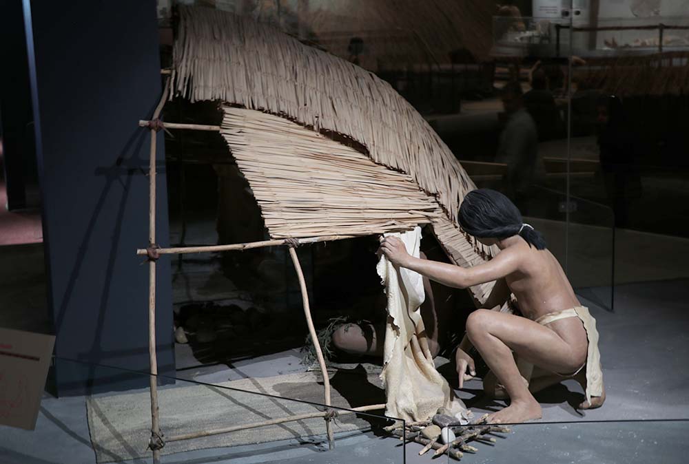
Monks Mound is the largest earthen monument in the Americas. If only we could go back in time to unravel the mysteries of this place. Over 12,000 years ago people moved into the area. Mississippians built the mounds. They grew squash, corn, sunflowers, and other crops. Corn (maize) grew well here and they had surplus. Great numbers could live here, up to 20,000 inhabitants. This meant some people did not have to farm and could specialize in other areas to form a whole society. They traded goods all across America. There are different types of mounds for different purposes. Flat topped mounds were where temples or other buildings were erected. Rich top mounds marking boundaries. Conical burial mounds. One mound greater than all the others was at the center of the community. This was the home of the chief. His wealth was immeasurable and his authority unquestionable. Service rendered to the chief was as service rendered to the gods. The people dug the earth and carried it on their backs up the hill to build it bigger and bigger. The baskets were 50 to 60 lbs each. 15 million trips over a 3 year period. Where the Mississippi and Missouri converged, it formed the lush American Bottoms. Other villages formed, such as St. Louis, in this area. Small houses were built as far as the eye could see in Cahokia. It was the city of power, vitality, wealth and security and prevailed for several hundred years. Cahokia was divided into areas for different purposes and there were miles of stockade walls for protection. There was a unique sun calendar that we call woodhenge. What contributed to the decline in the late 1200's or early 1300's? No one knows. Disease? Changes in climate? Declining resources? Conflicts from the outside?
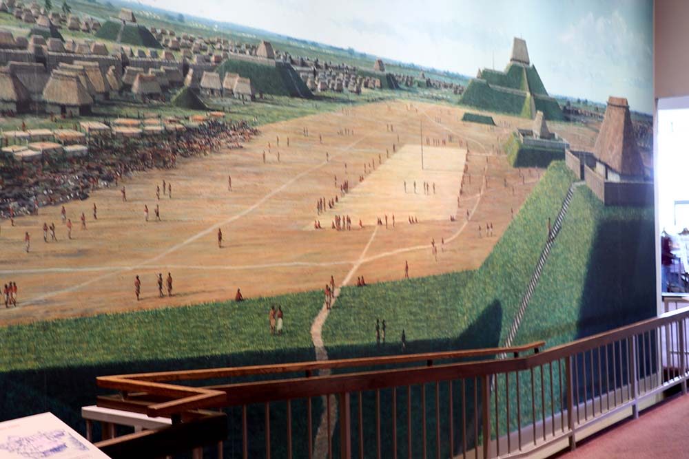
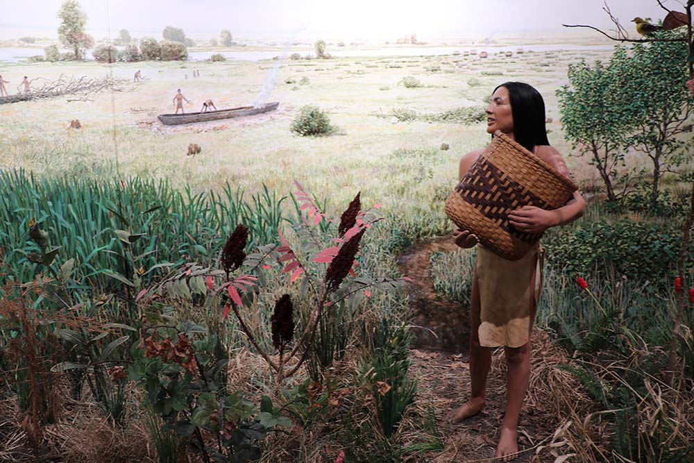
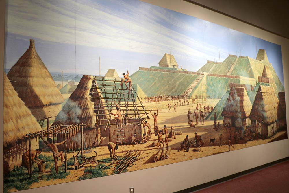
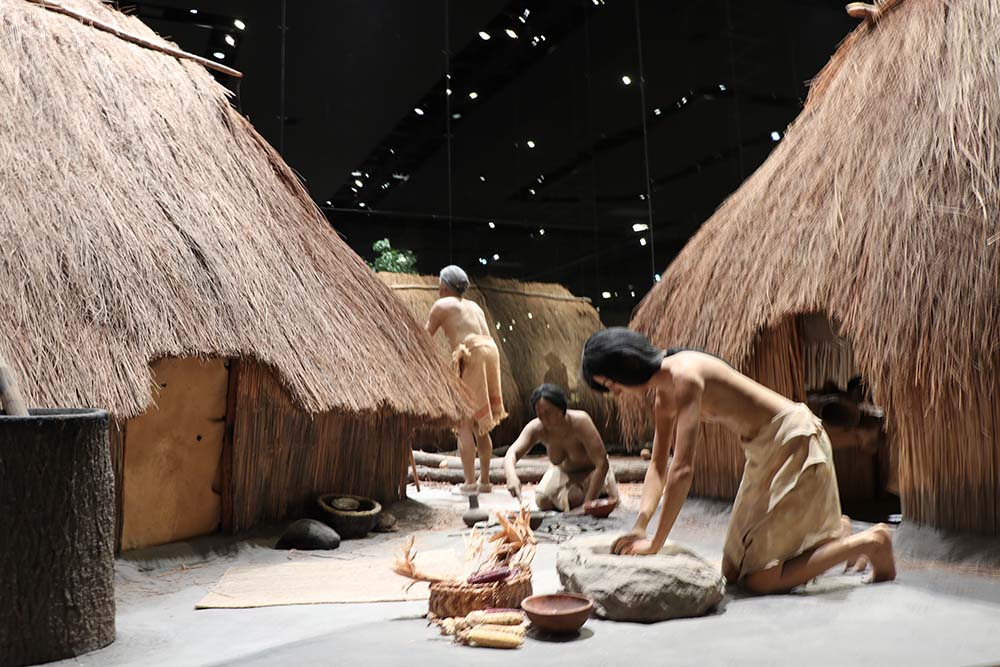
This is a mural in the museum showing what the city might have looked like while in use.
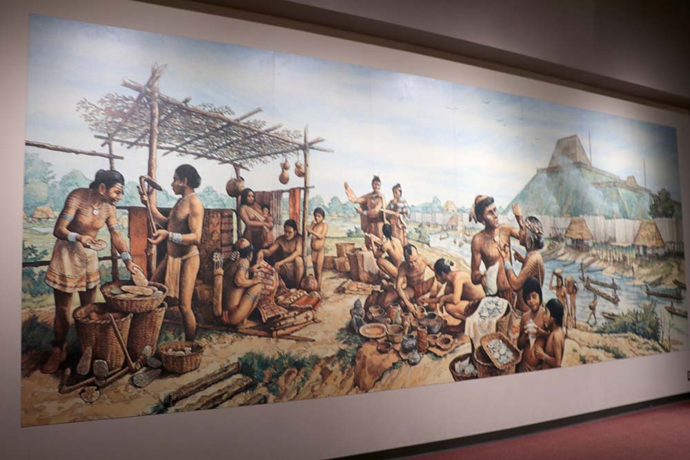
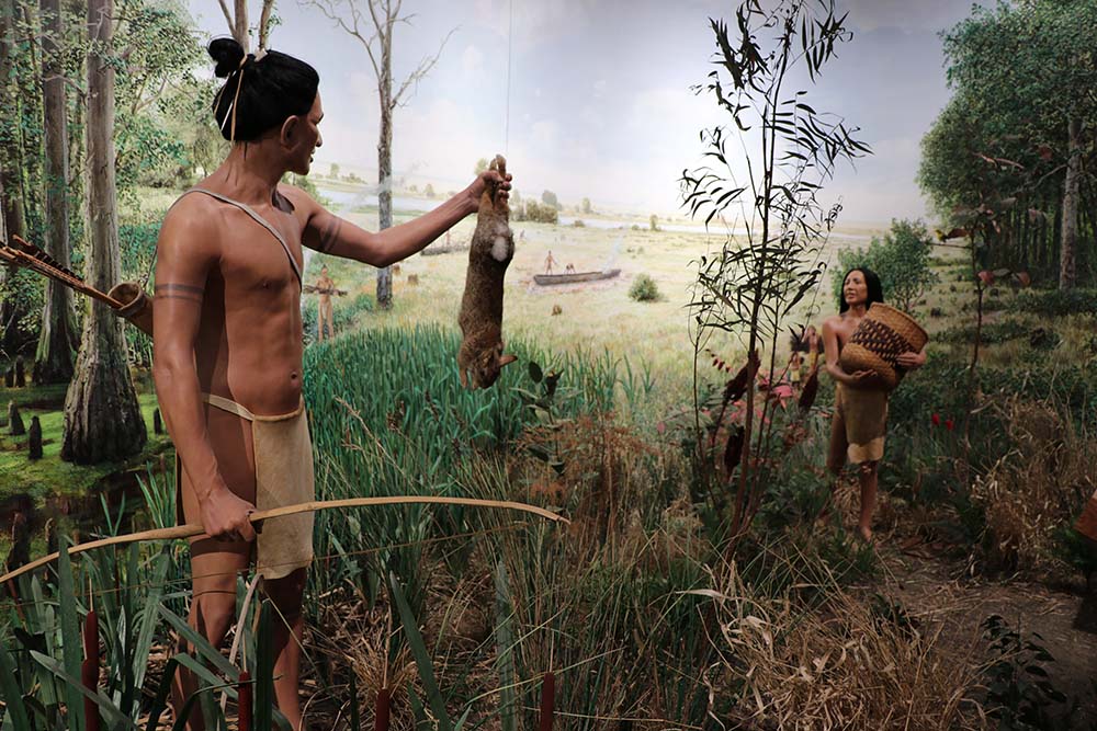
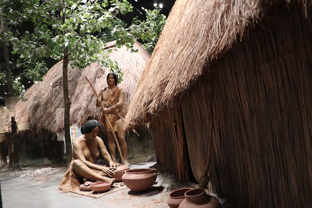
This is another mural in the museum. Since I know these were my ancestors, I love to study the details of the way historians believed they lived.
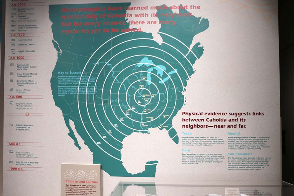
This shows how far reaching Cahokian Indians were at the time. There is evidence of them trading and communicating with other Mississippian Indians far away. It is amazing to think of how far they traveled with only horse at that time.
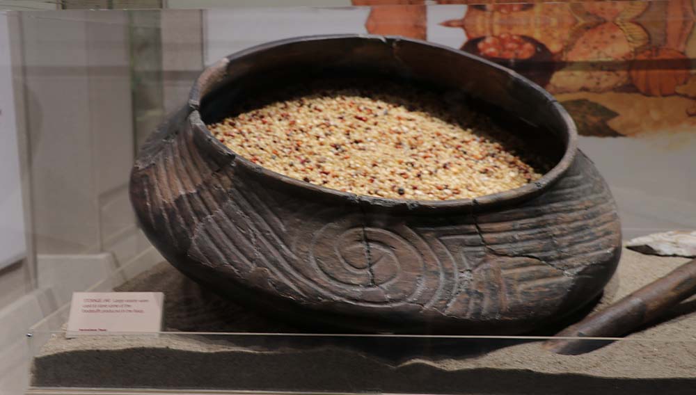
This is a blurry photo, but in the museum there are a lot of pottery artifacts. I like the swirl on this one with the lines.
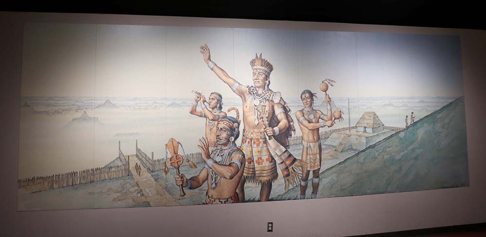
The paramount chief and his attendants greet the rising sun from the top of Monks Mound. Among some later Mississippian peoples in the Southeast the chief was believed to be related to teh Sun and that may have been true at Cahokia as well.
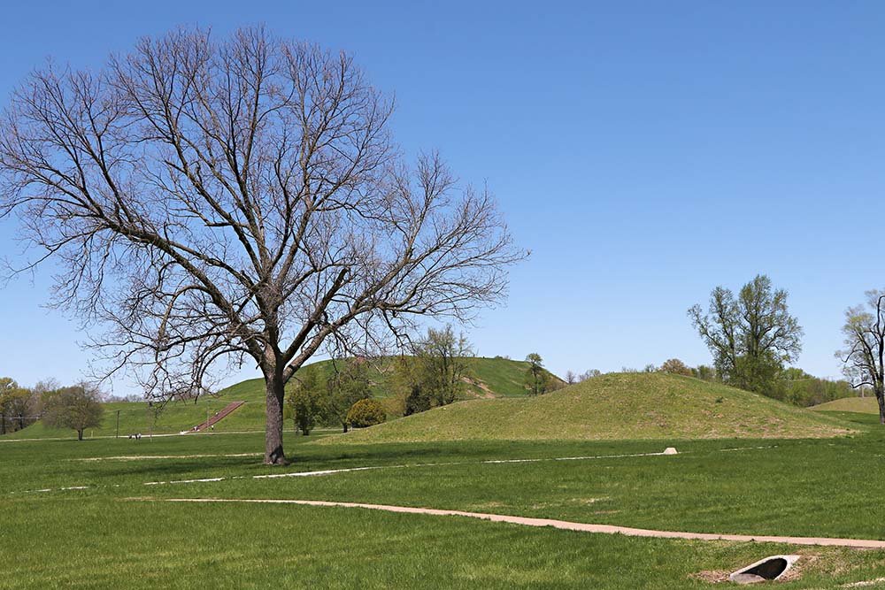
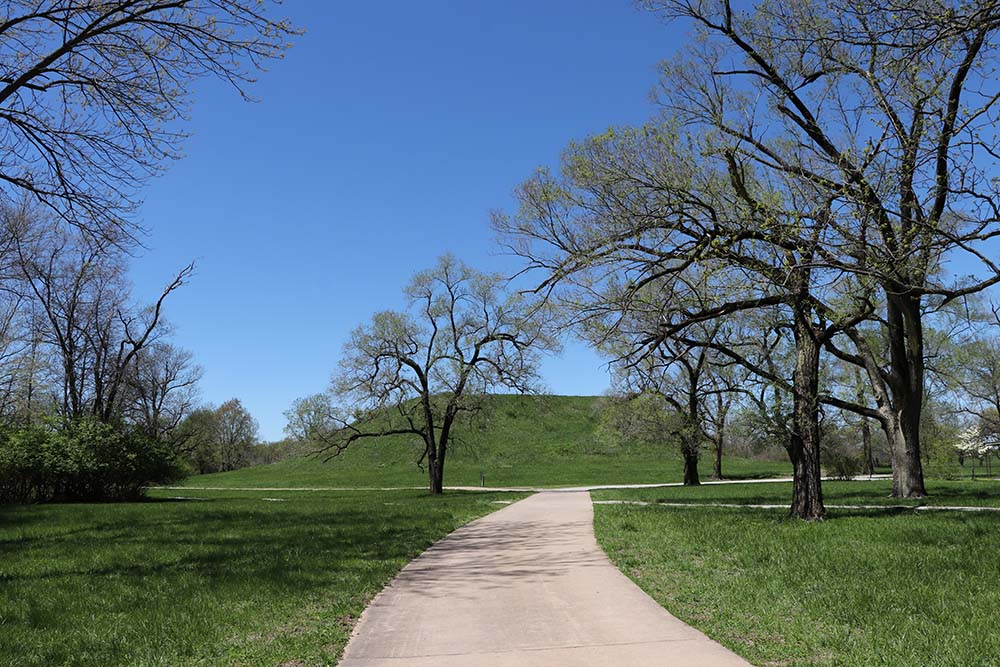
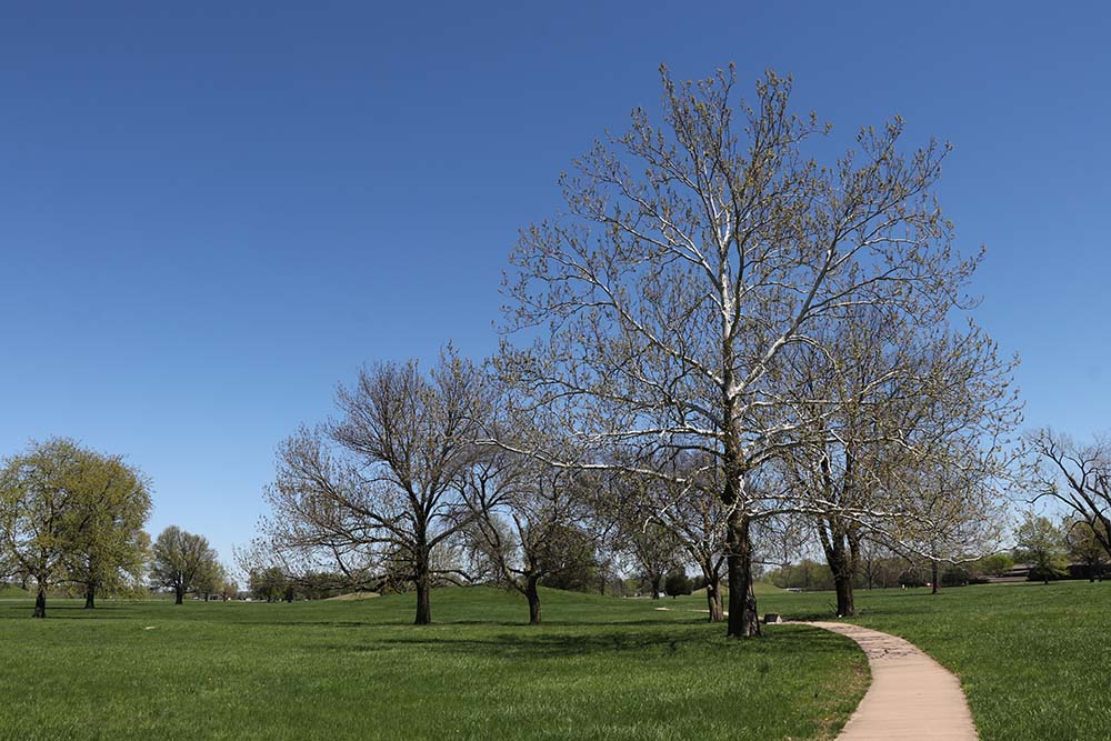
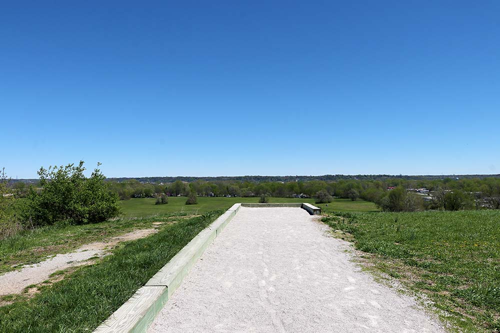
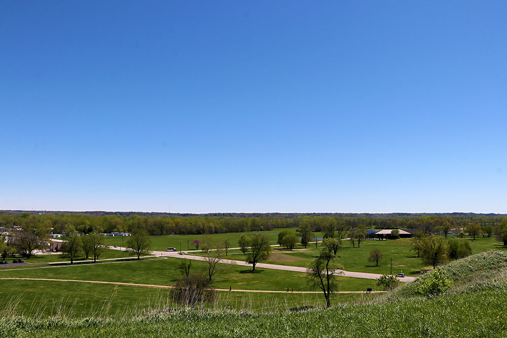
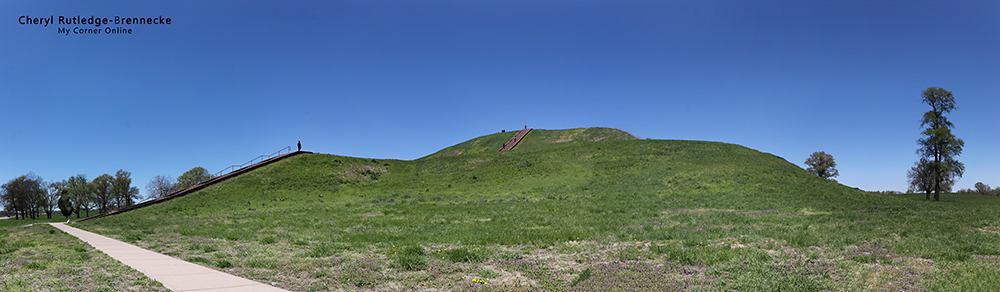
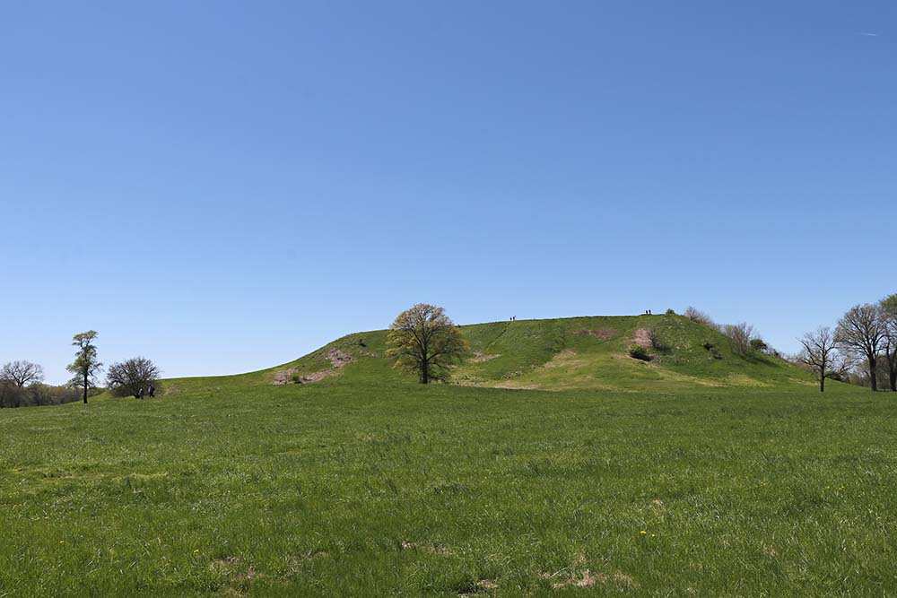
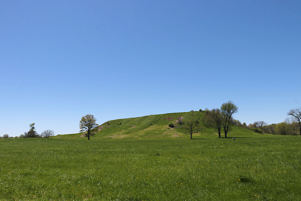
You could spend a long time reading in the museum. Then you take a trip outside and walk the paths to see a variety of mounds of varying types. That is Monks Mound in the distance with other mounds nearby.
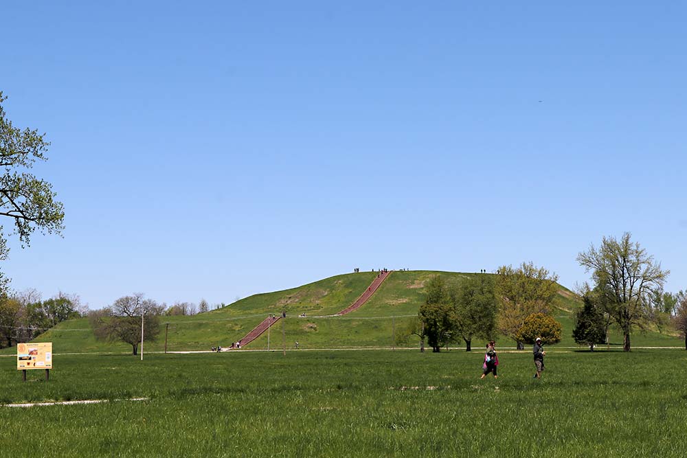
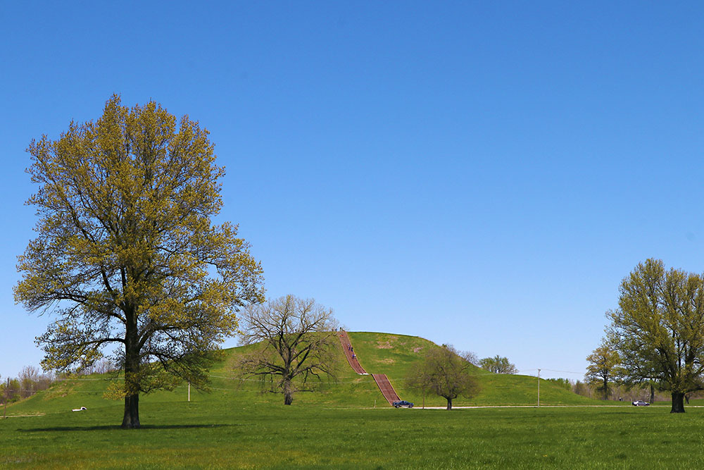
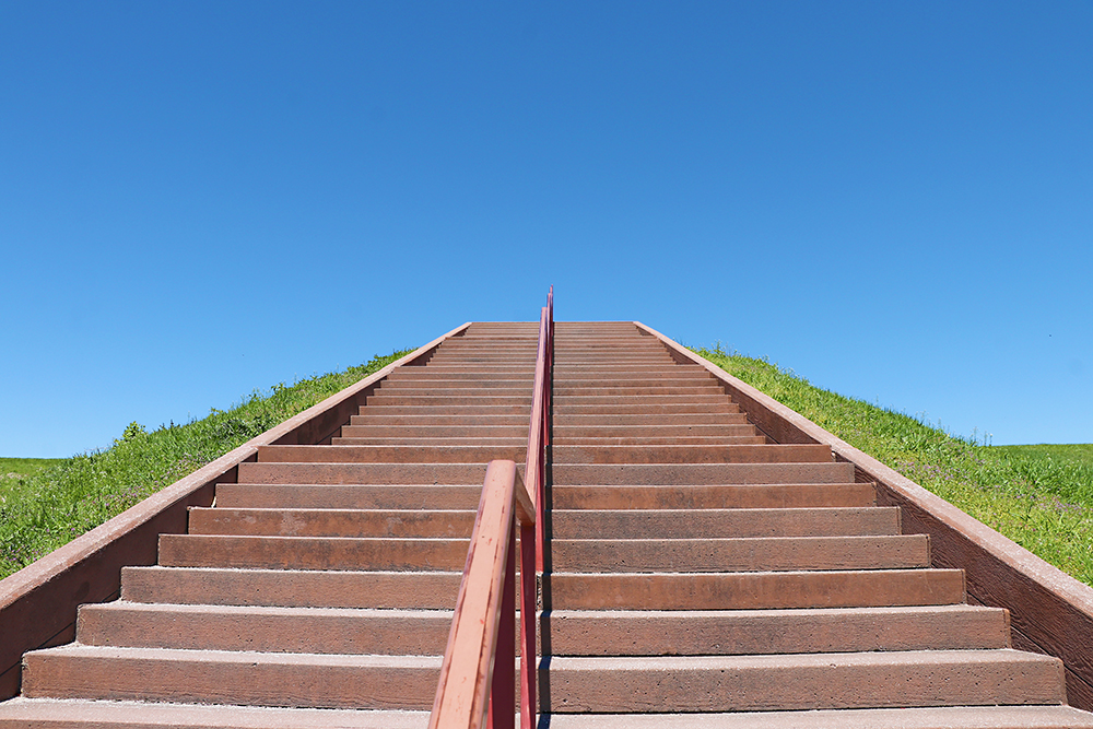
We passed up Monks Mound several times before we climbed the stairs.
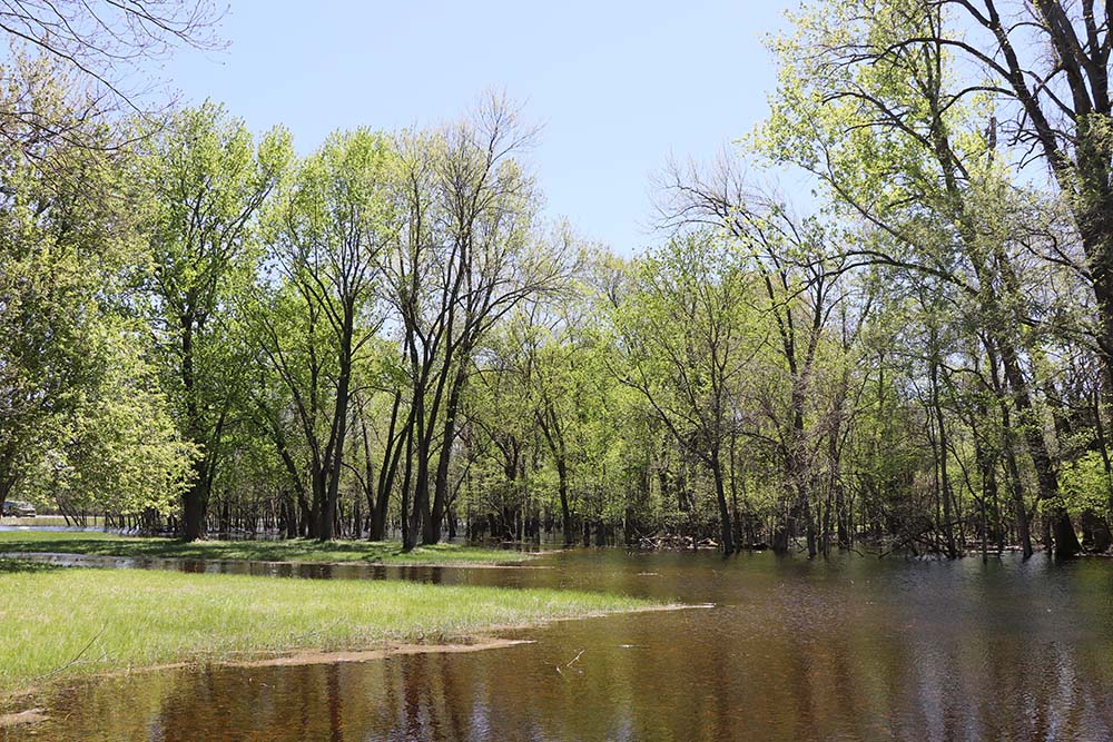
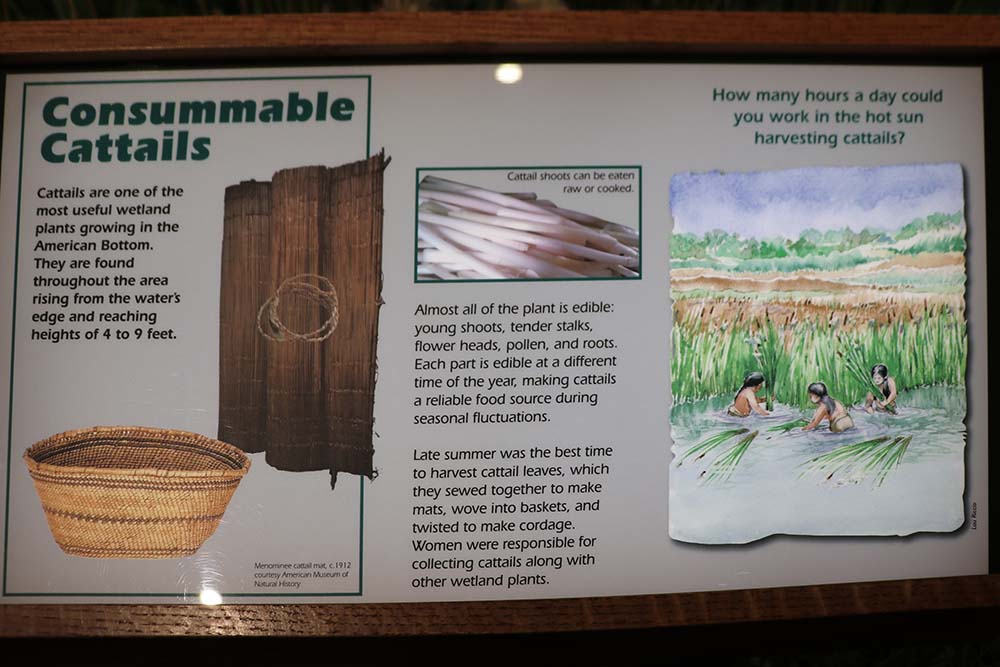
I took several photos of the swamp-like water. It struck me because the Indians would have had to deal with flooding just like we do today.
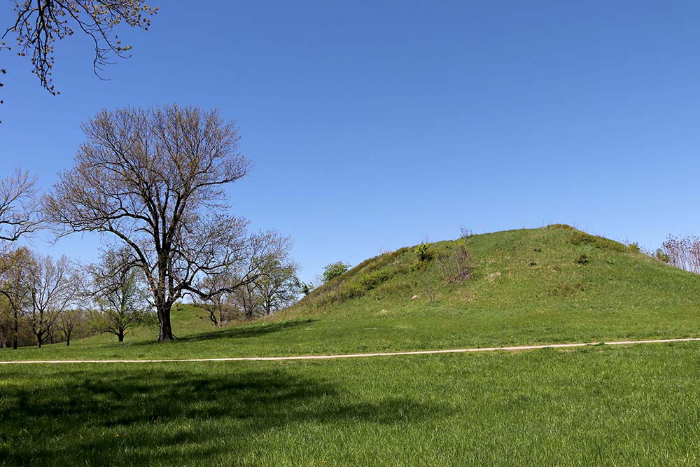
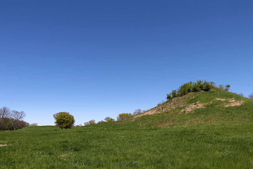
You can tell this one is a flat top mound.
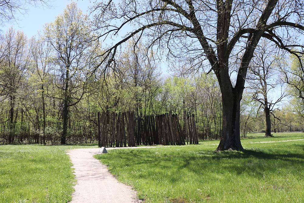
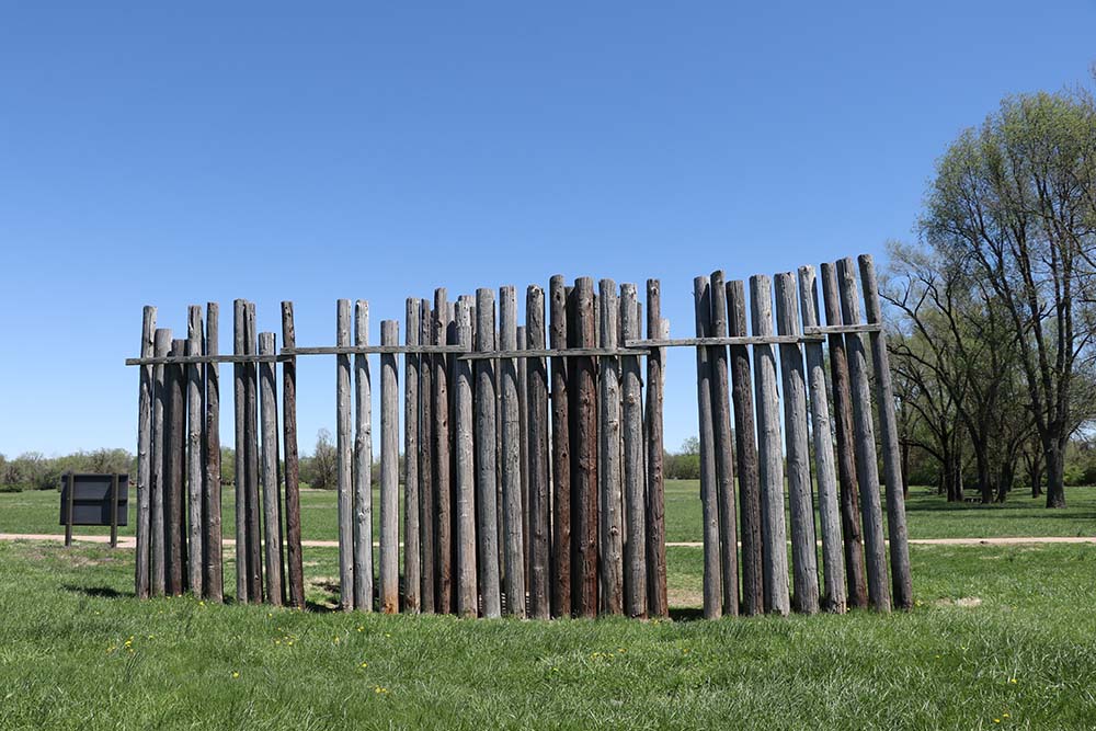
There is a stone as you can see in front of this explaining what it is.
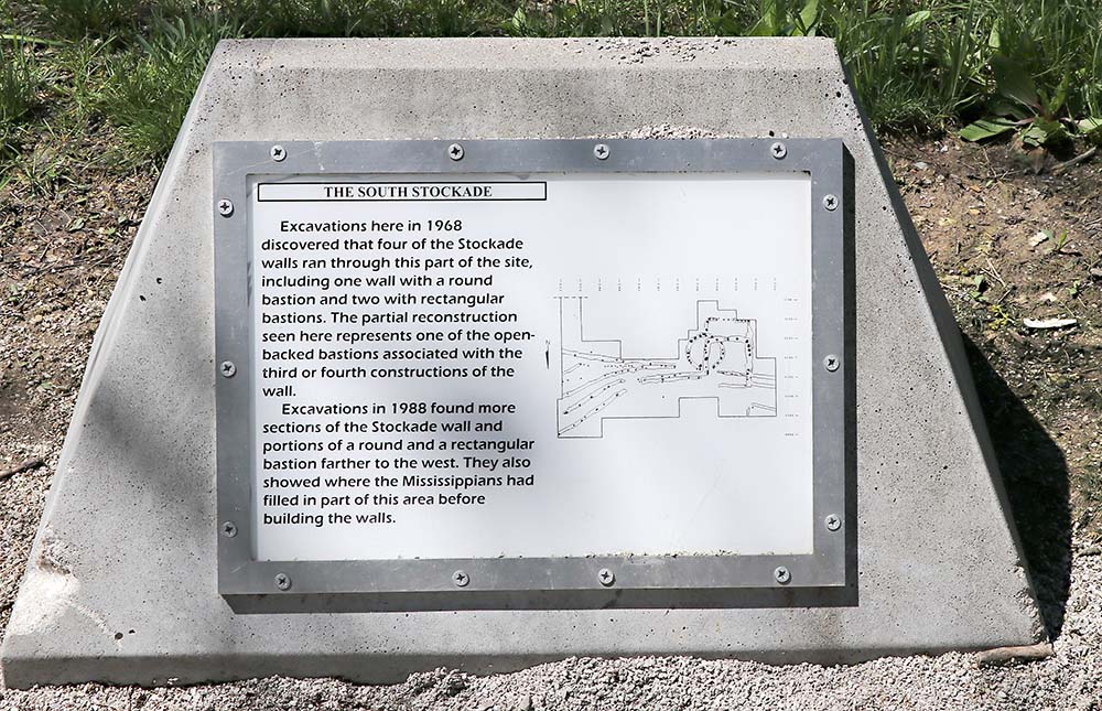
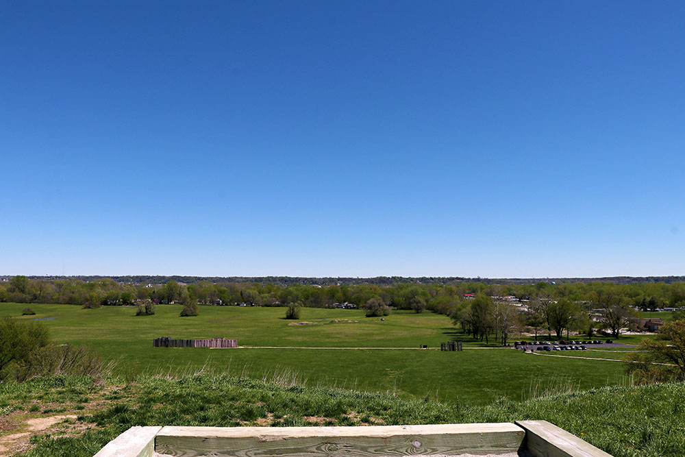
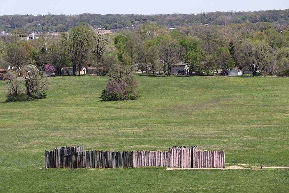
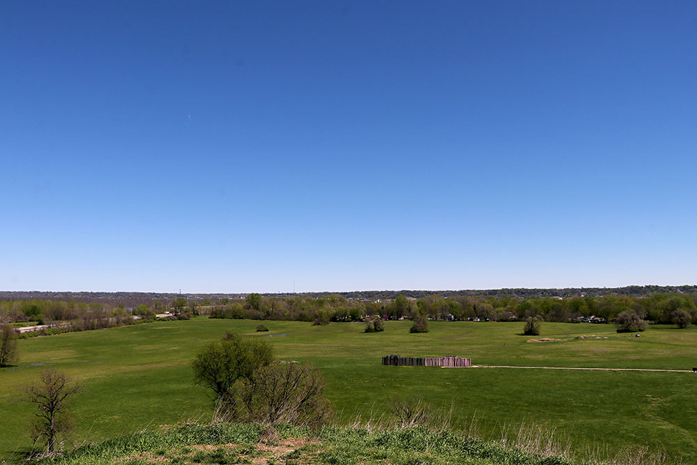
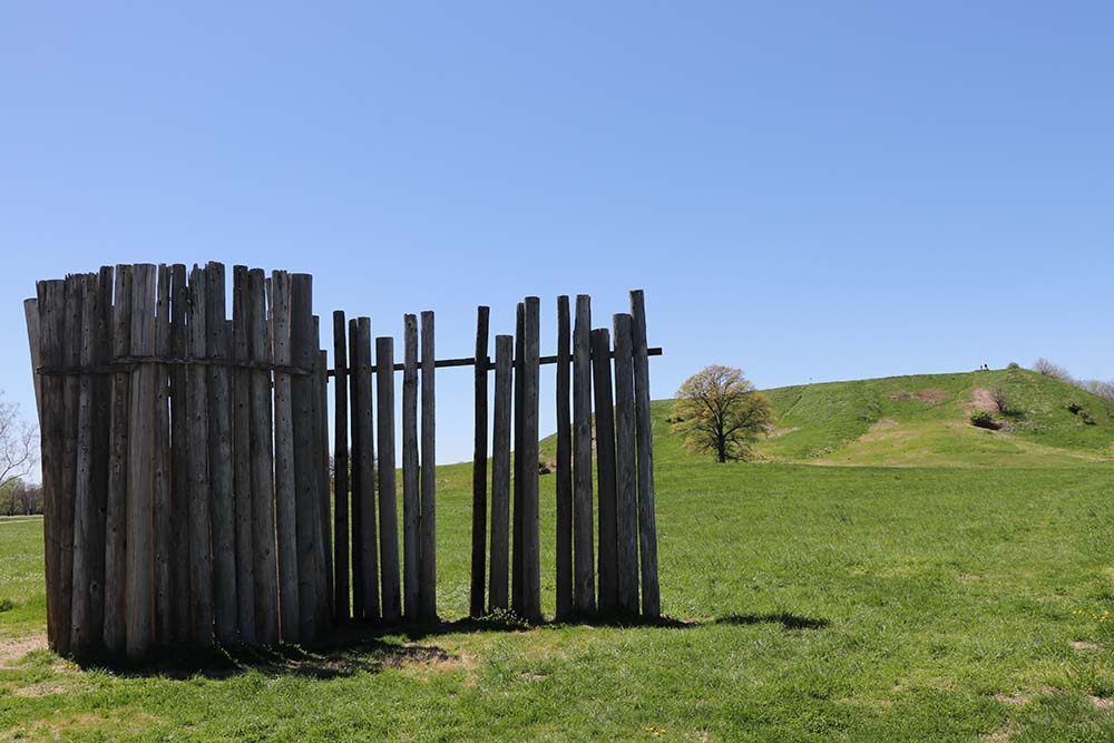
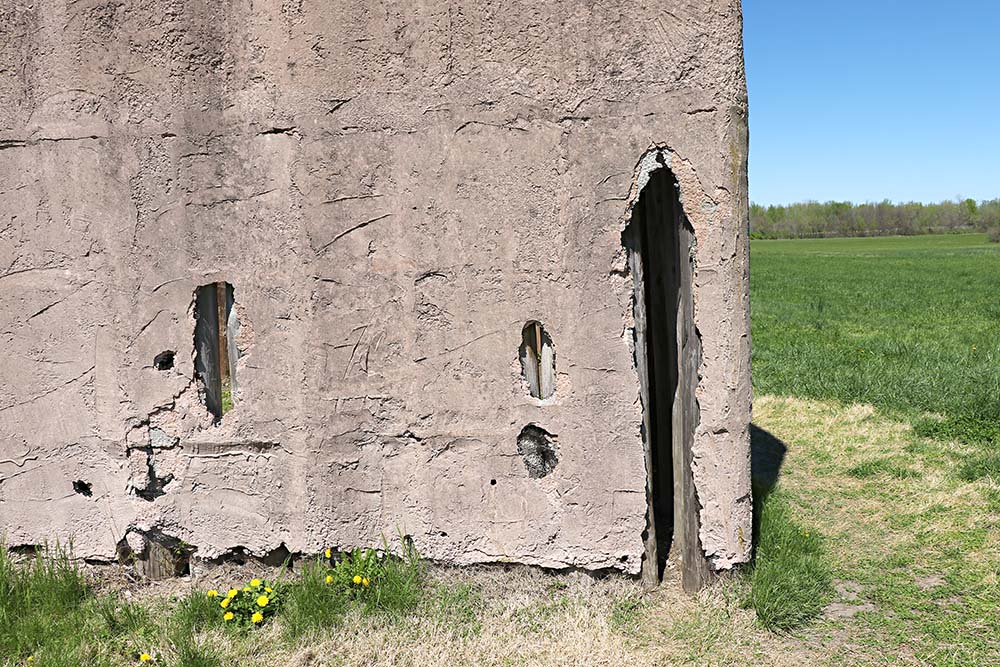
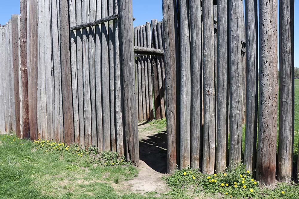
This is the stone which tells us it is the South Stockade. I believe you can read this sign okay.
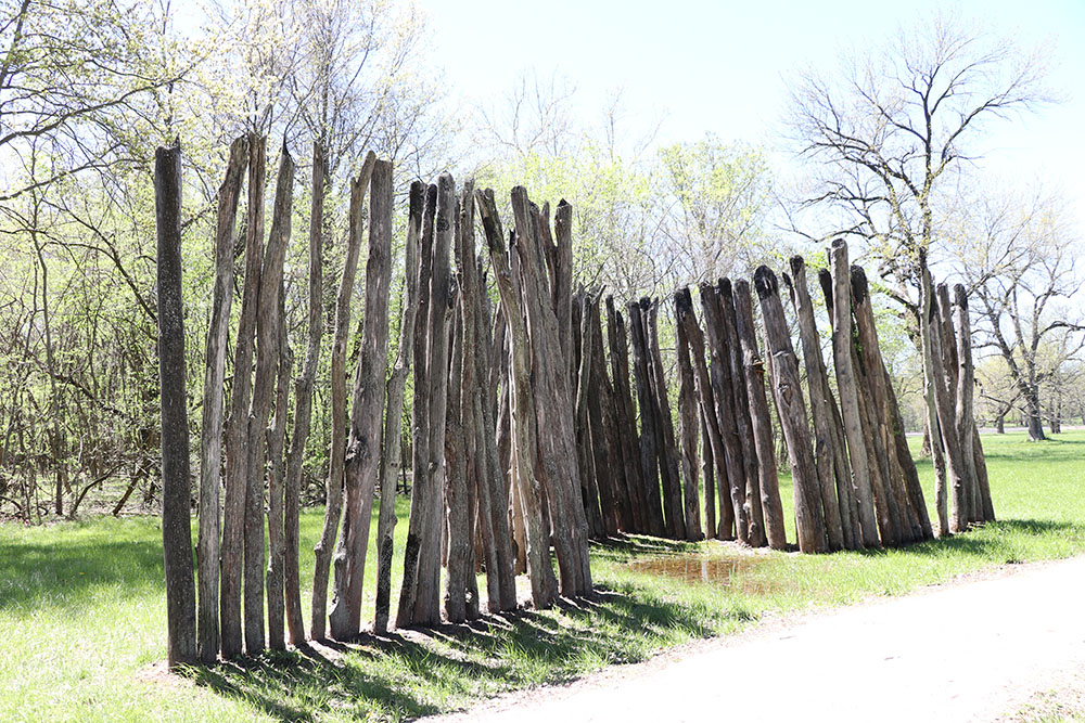
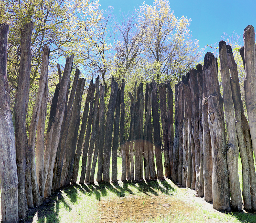
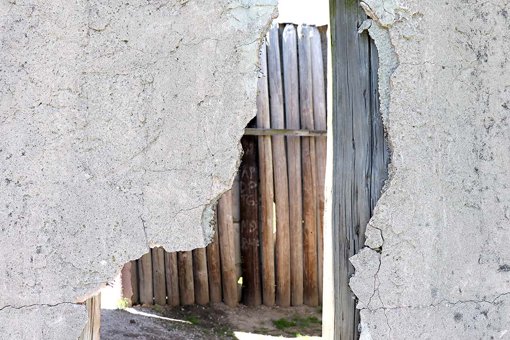
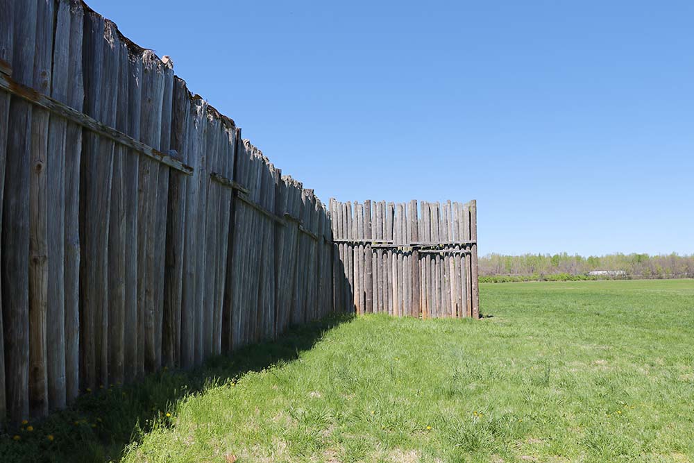
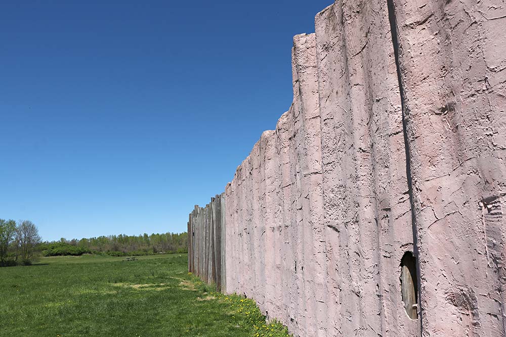
More photos of South Stockade.
 T
T
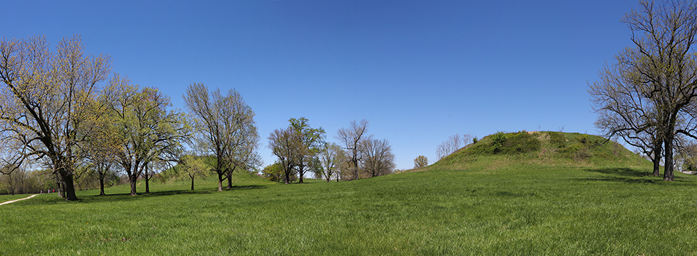
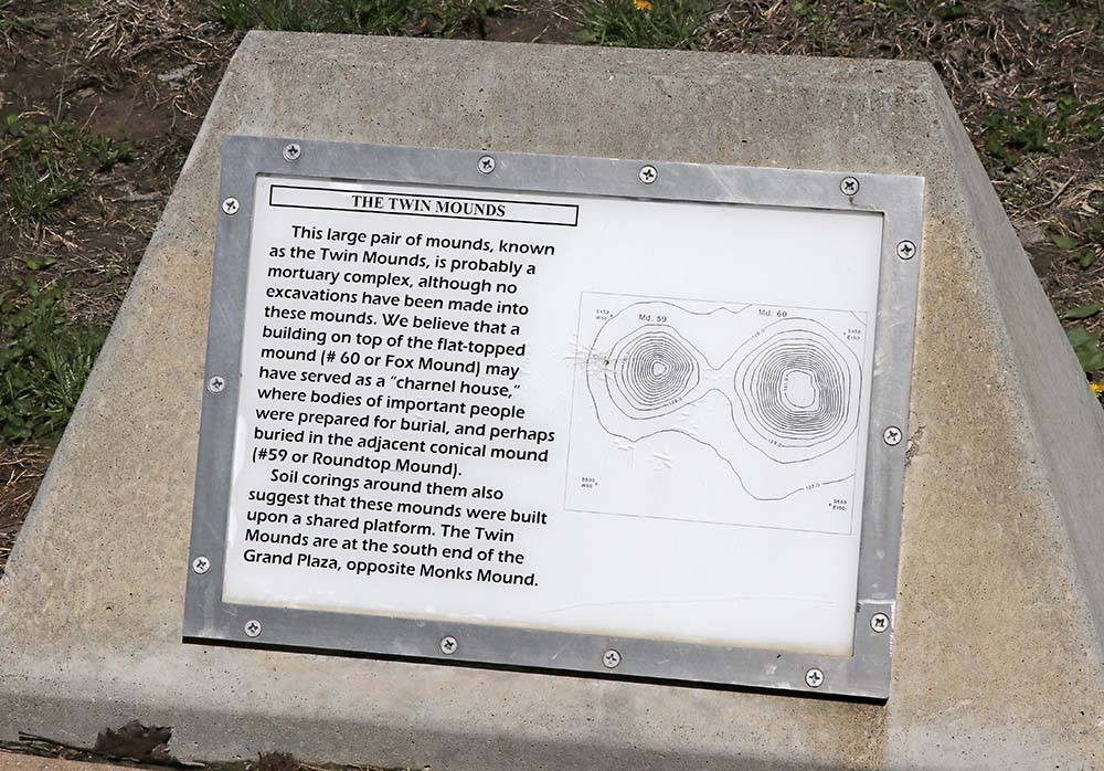
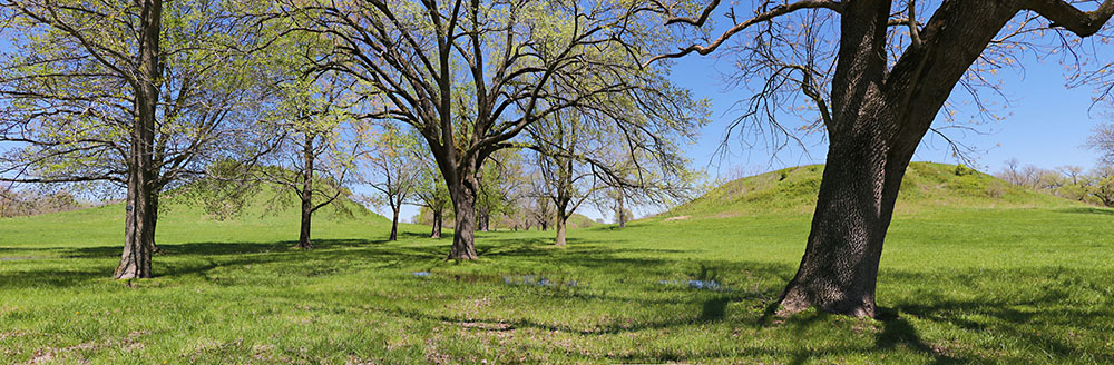
This is a panorama photo of the Twin Mounds.
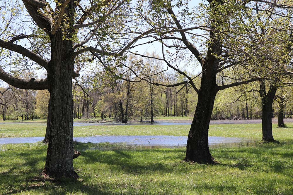
More swamp-like waters.
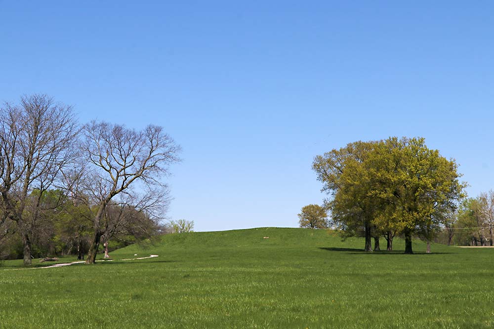
This is Monks Mound again as I begin to cross the field towards it.
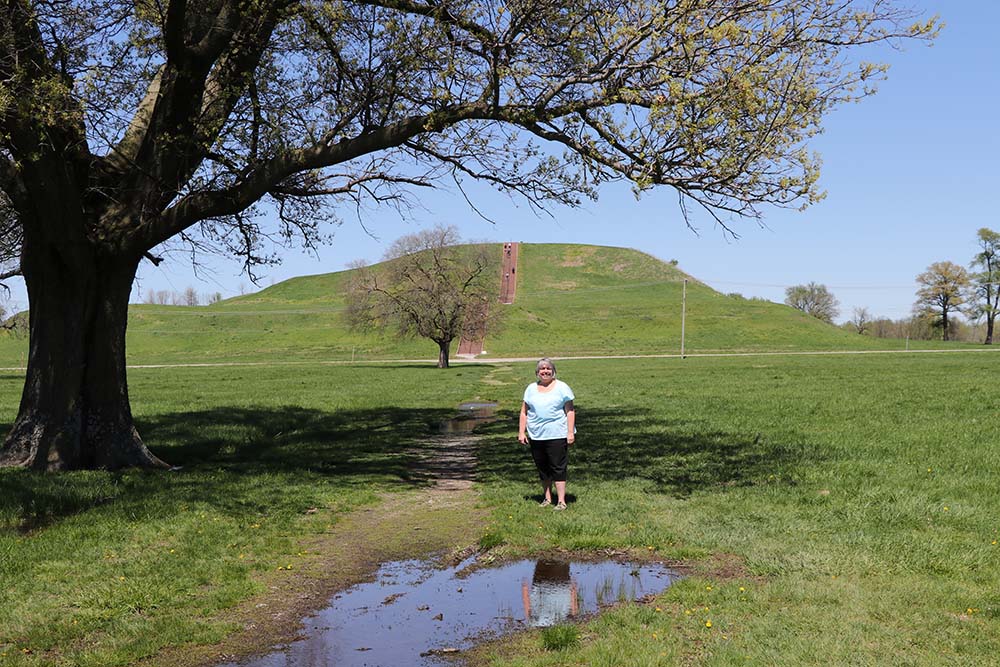
Since I have ancestry here, I took photos of me and my son who was with us in the land of our ancestors.
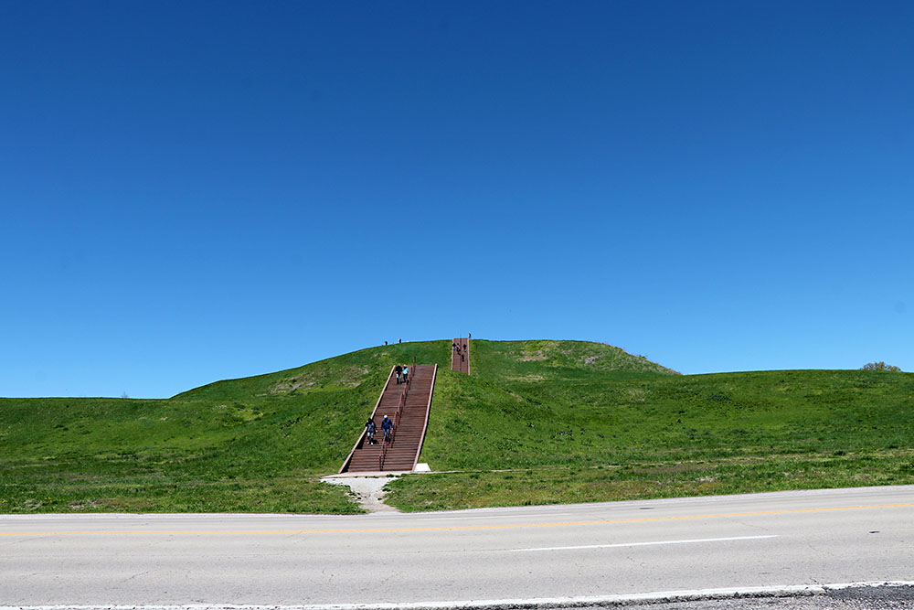
There is no way to capture the height in photos and those steps are not done justice in photos either.
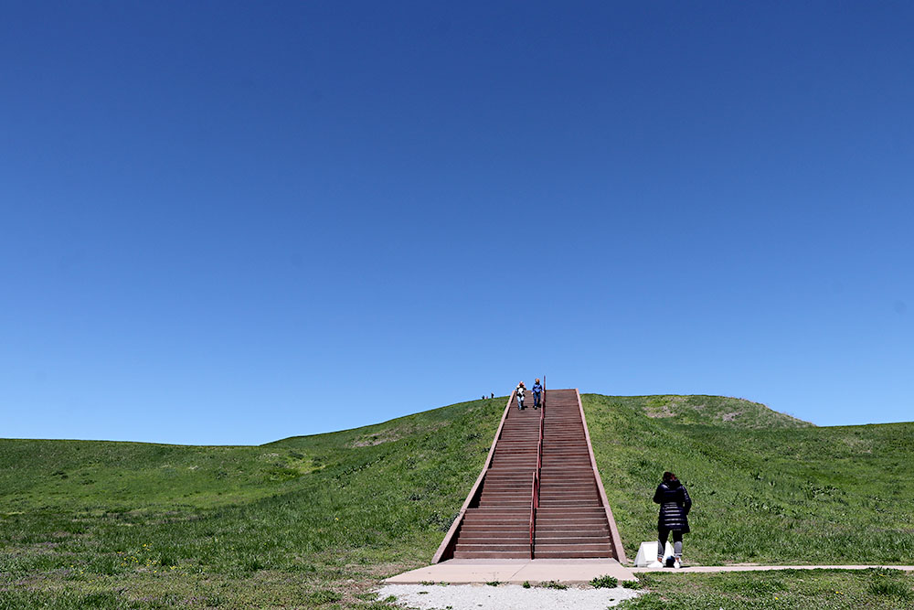
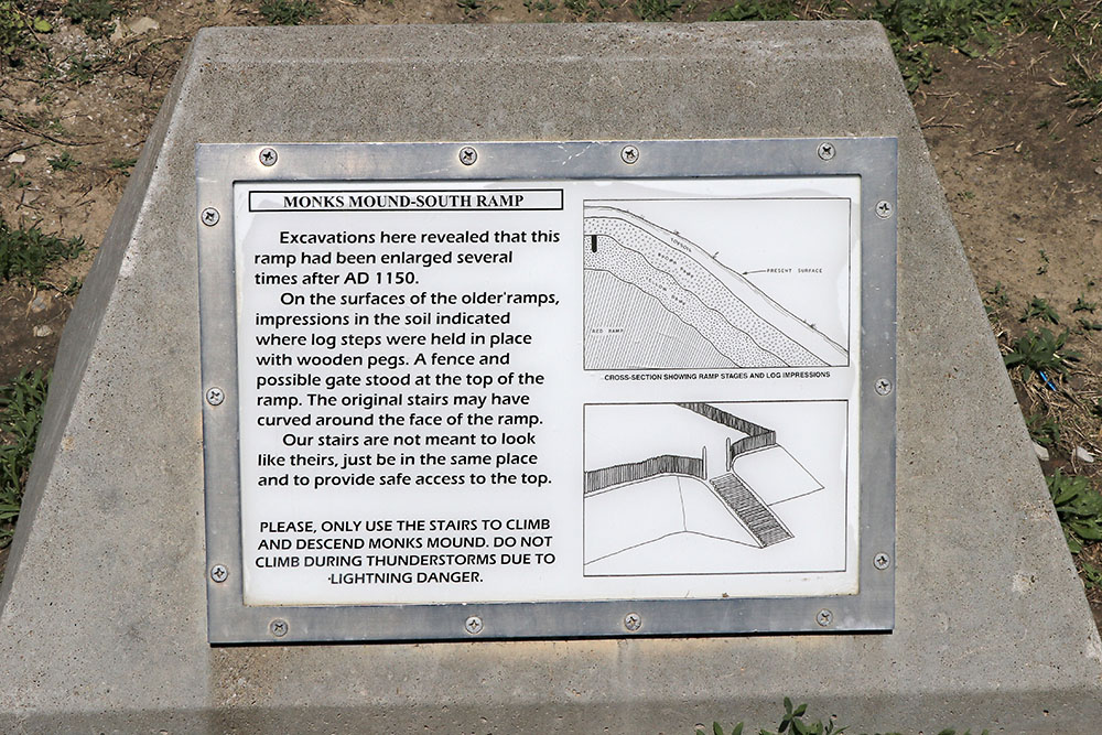
This is the sign at the base of the steps. I think you can read it.
I love this photo.
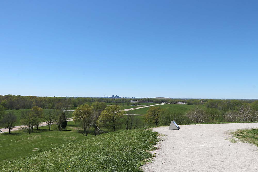
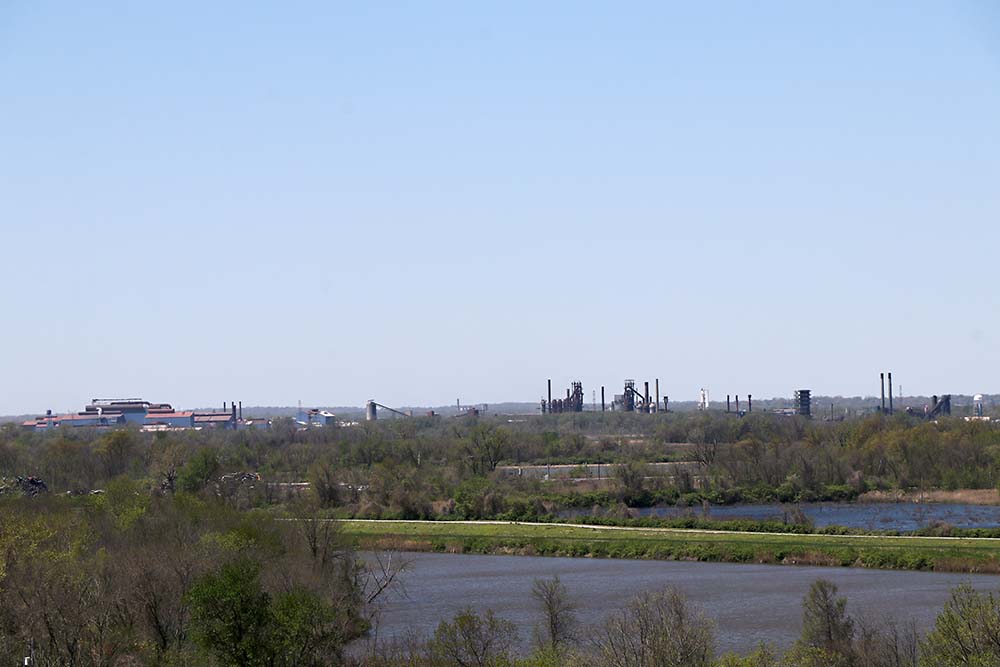
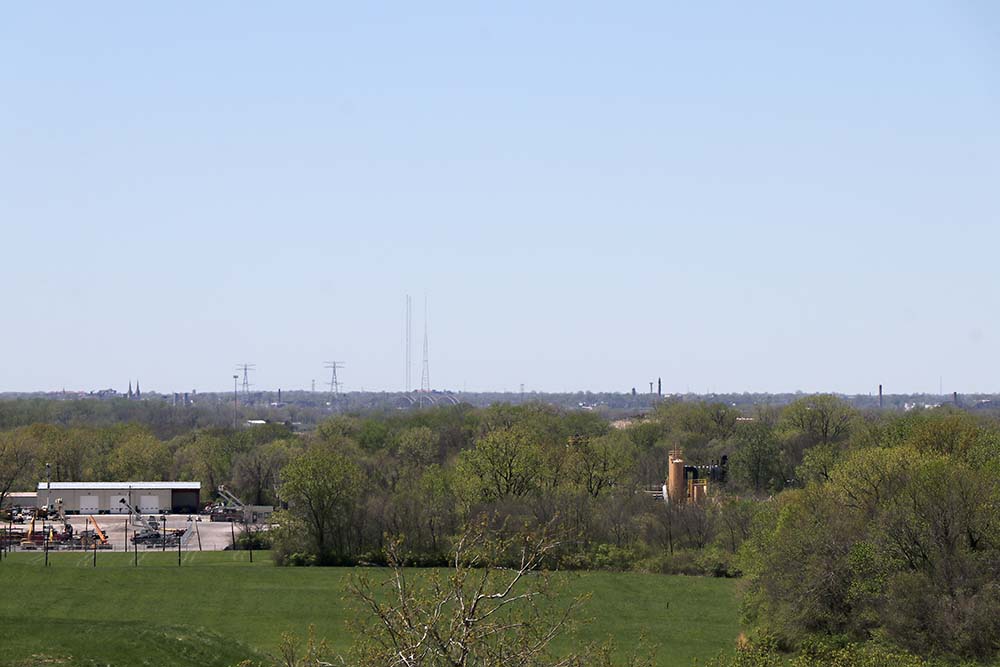
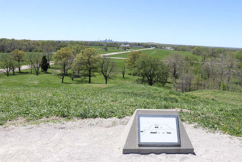
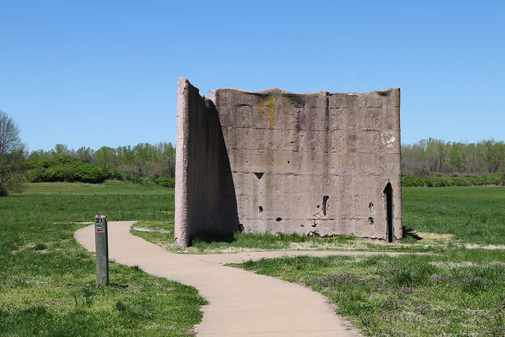
When on top of Monks Mounds the sights in the distance are amazing and there are more concrete blocks with reading information. Here you can spy the arch in downtown St. Louis.
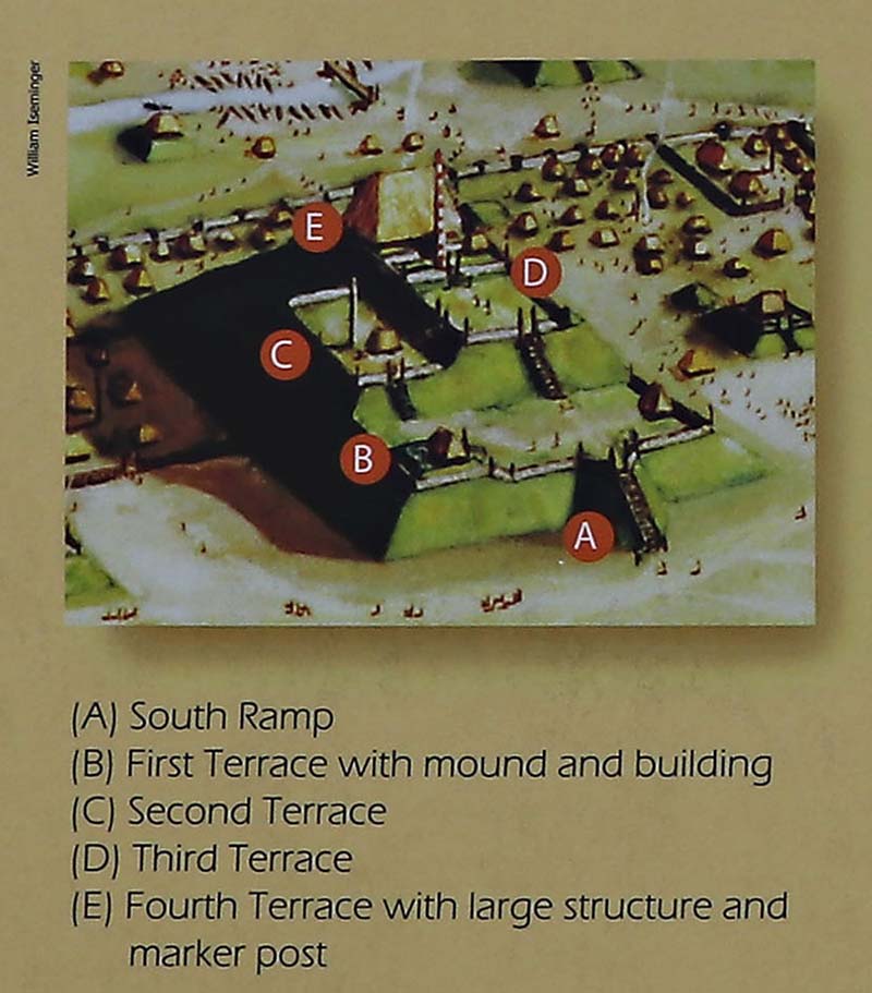
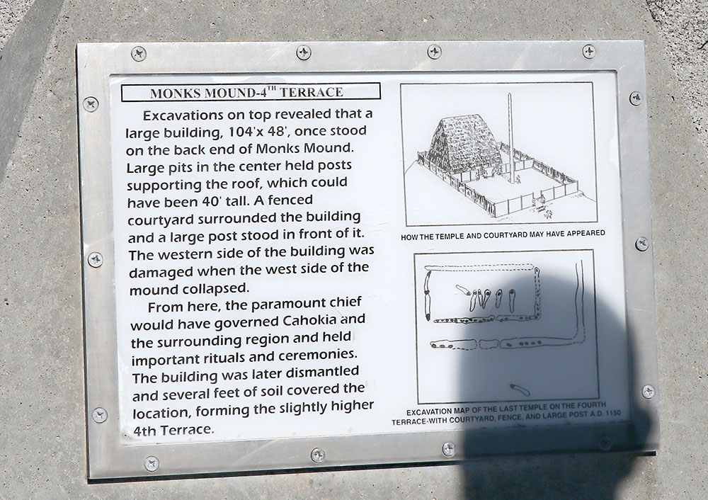
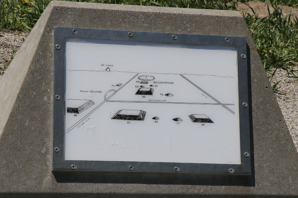
This describes the spot in the below photo.
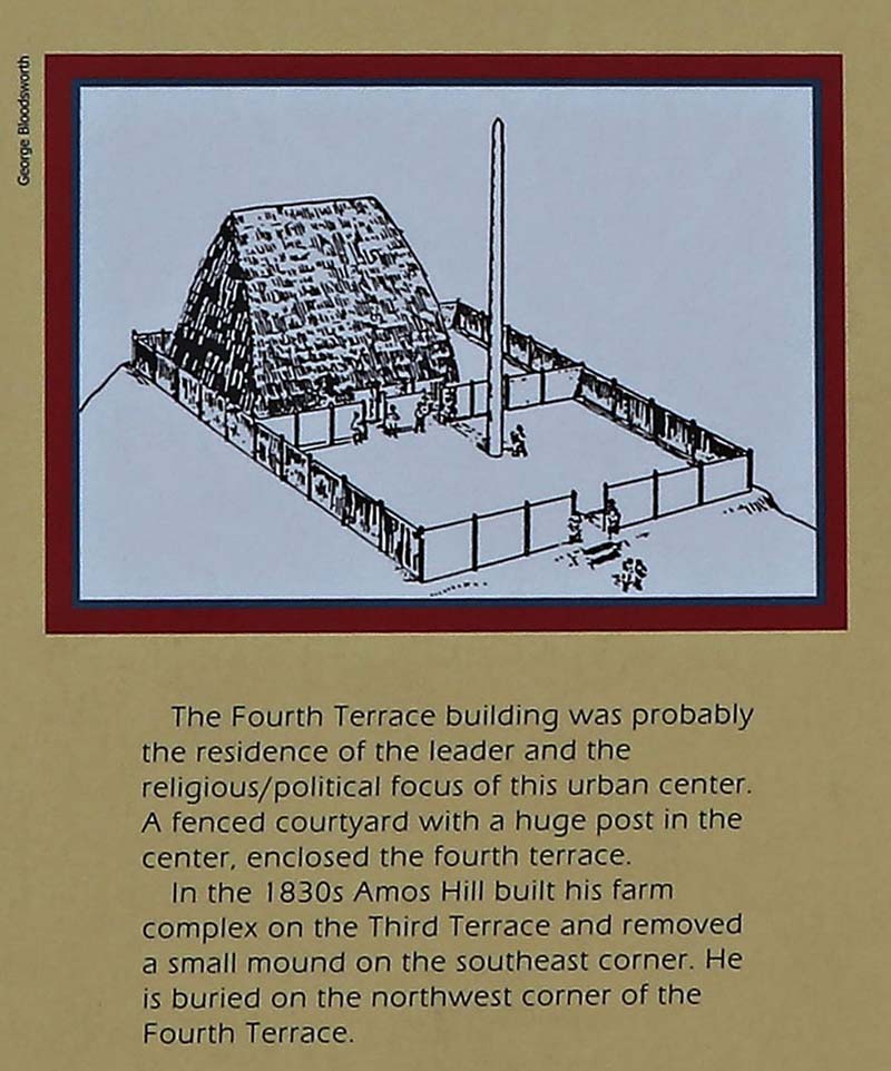
You can see a concrete sign on the ground in this photo. Below is what this sign says about the 4th terrace building for the chief.
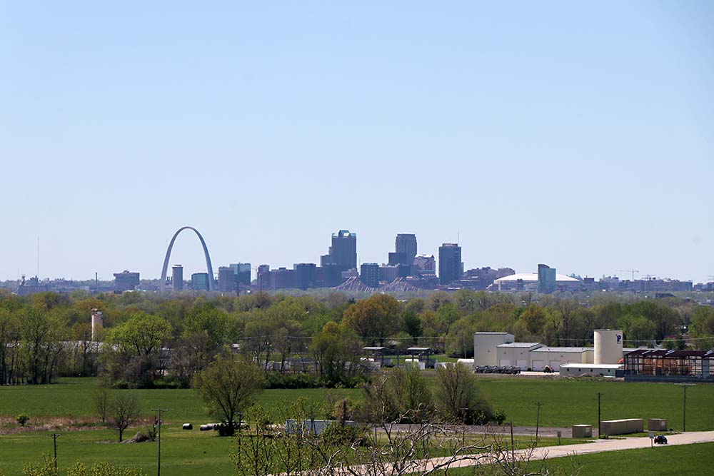
Zoomed in image of the below with a view of the arch and downtown St. Louis.

This is another view where you can see the northern stockades.
We visit these in the below photos once back on the ground.

This is the sign and you can see all of these things in the distance in the above photos.
Each view is a different direction looking out from the top of the mound. I almost forget as it has been several years since I visited now.
In the below photos we will visit the Woodhenge which is a short drive down the road. You can see the things in this in the above photos.
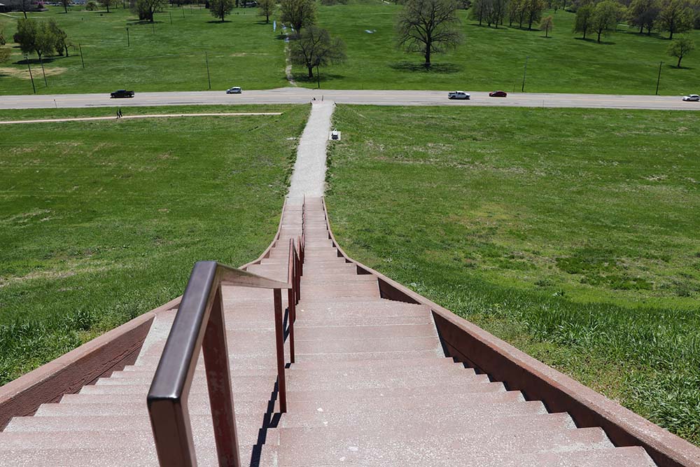
Headed back down.
We are walking over to the northern stockades when this photo is taken of the other side of Monks Mound.
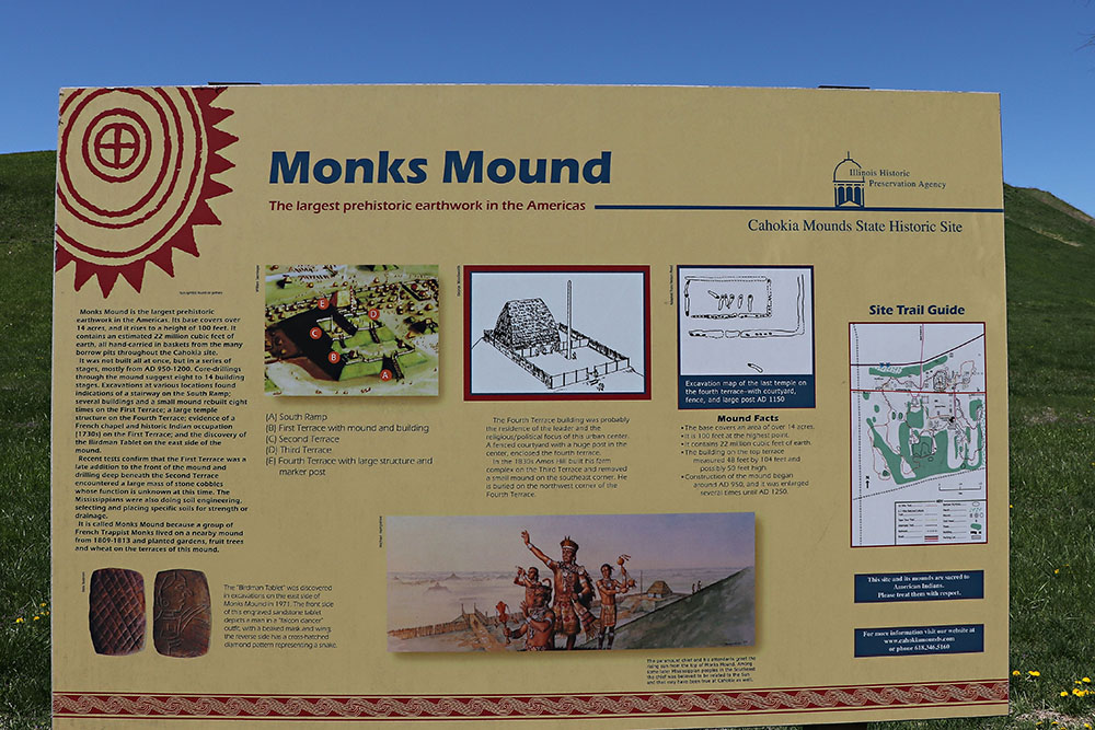
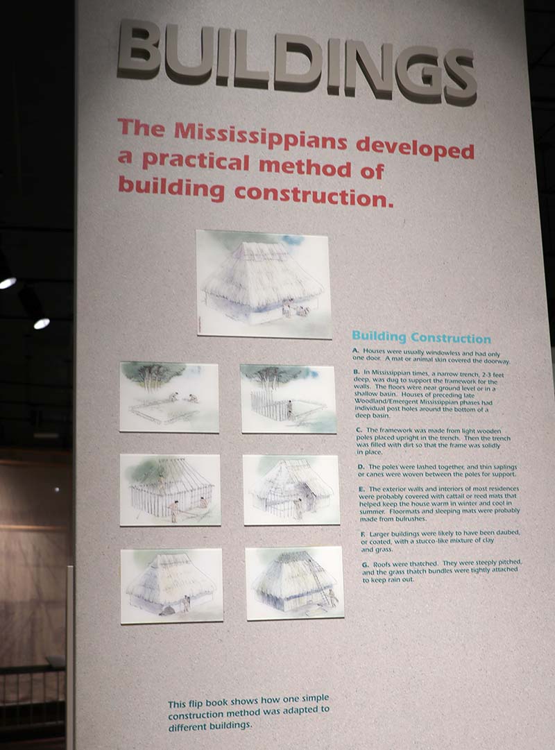
This sign says: Monks Mound is the largest prehistoric earthwork in the Americas. Its base covers over 14 acres, and it rises to a height of 100 feet. It contains an estimated 22 million cubit feet of earth, all hand-carried in baskets from the many borrow pits throughout Cahokia site. It was not built all at once, but in a series of stages, mostly from AD 950-1200. Core-dillings through the mound suggest eight to 14 building stages. Excavations at various locations found indications of a stairway on the South Ramp; several buildings and a small mound rebuilt eight times on the First Terrace; a large temple structure on the Fourth Terrace; evidence of a French chapel and historic Indian occupation (1730s) on the First Terrace; and the discovery of the Birdman Tablet on the east side of the mound. Recent tests confirm that the First Terrace was a late addition to the front of the mound and drilling deep beneath the Second Terrace encountered a large mass of stone cobbles whose function is unknown at this time. The Mississippians were also doing soil engineering, selecting and placing specific soils for strength or drainage. It is called Monks Mound because a group of French Trappist Monks lived on a nearby mound from 1809-1813 and planted gardens, fruit trees, and wheat on the terraces of this mound.
This is the side of Monks Mounds as seen from the stockade.
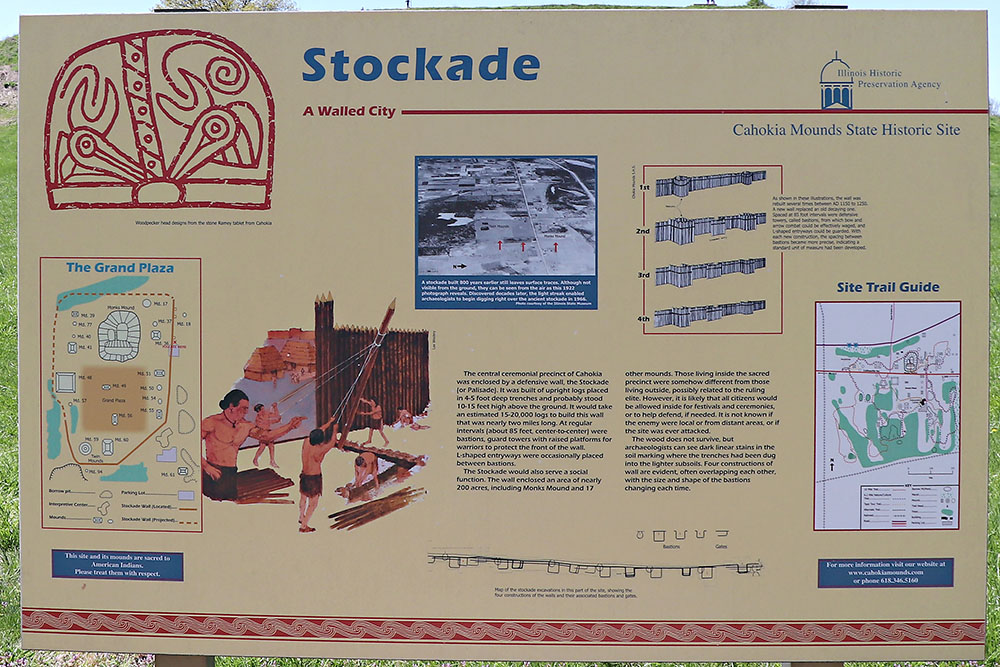
This sign says: The central ceremonial precinct of Cahokia was enclosed by a defensive wall, the Stockade (or Palisade). It was built of upright logs placed in 4-5 foot deep trenches and probably stood 10-15 feet high above the ground. It would take an estimated 15,000 - 20,000 logs to build this wall that was nearly two miles long. At regular intervals (about 85 feet, center-to-center) were bastions, guard towers with raised platforms for warriors to protect the front of the wall. L-shaped entryways were occasionally placed between bastions. The Stockade would also serve a social function. The wall enclosed an area of nearly 200 acres, including Monks Mound and 17 other mounds. Those living inside the sacred precinct were somehow different from those living outside, possibly related to the ruling elite. However, it is likely that all citizens would be allowed inside for festivals and ceremonies, or to help defend, if needed. It is not know if the enemy were local or from distant areas, or if the site was ever attacked. The wood does not survive, but archaeologists can see dark linear stains in the soil marking where the trenches had been dug into the lighter subsoils. Four constructions of wall are evident, often overlapping each other, with the size and shape of the bastions changing each time.
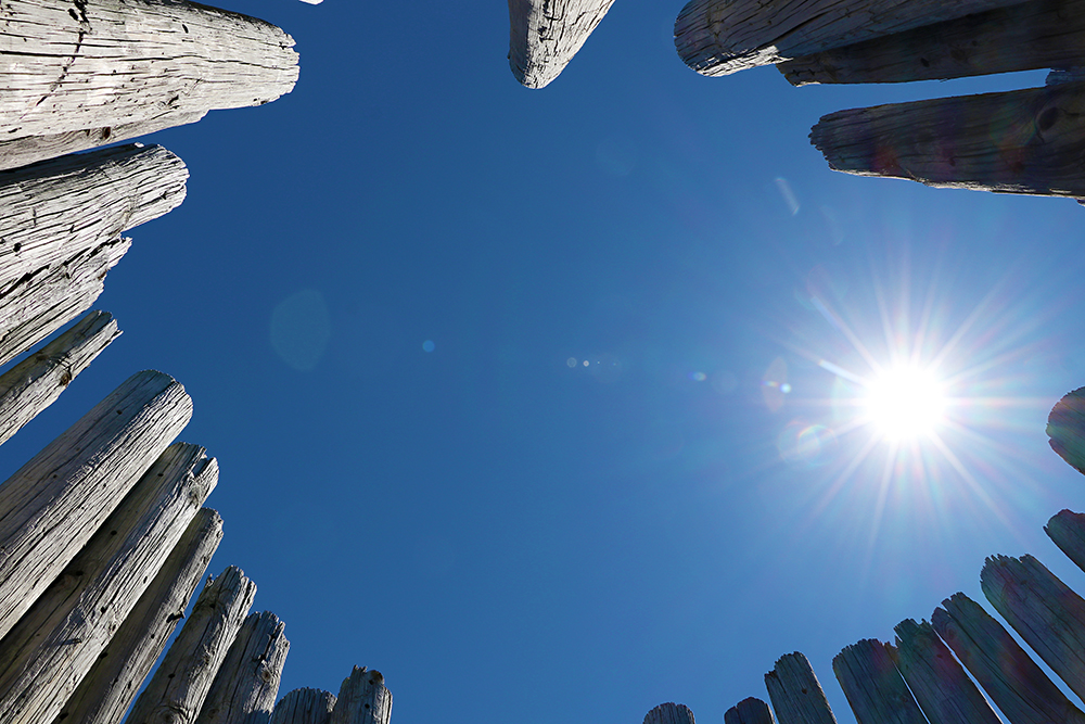
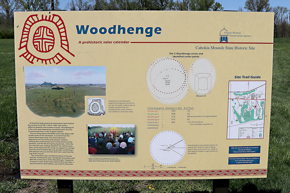
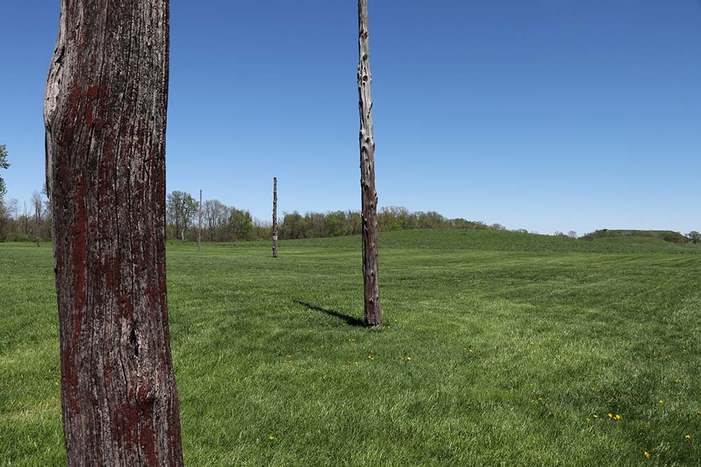
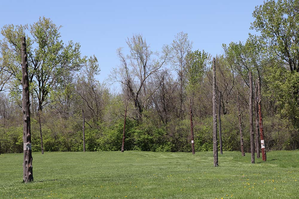
Down the road we visited the Woodhenge.
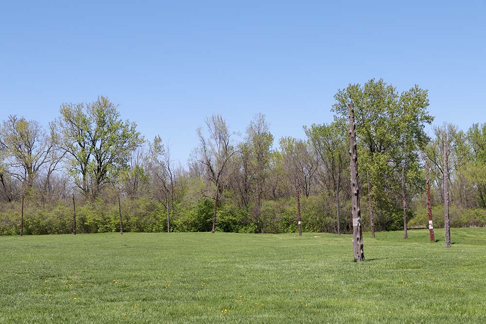
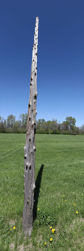
The poles were so tall I had to put two photos together to capture it.
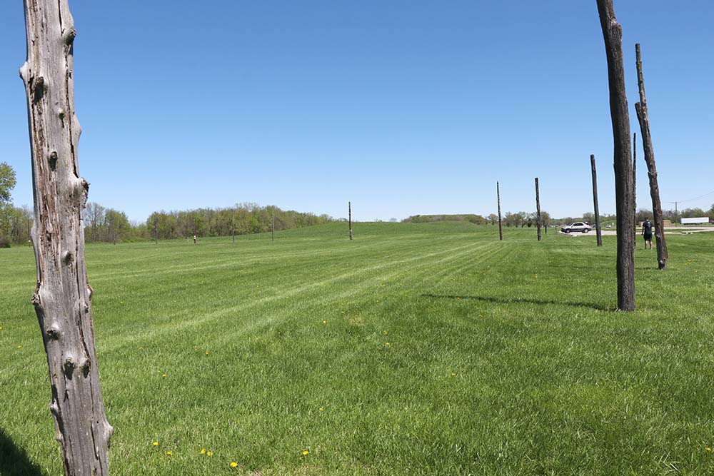
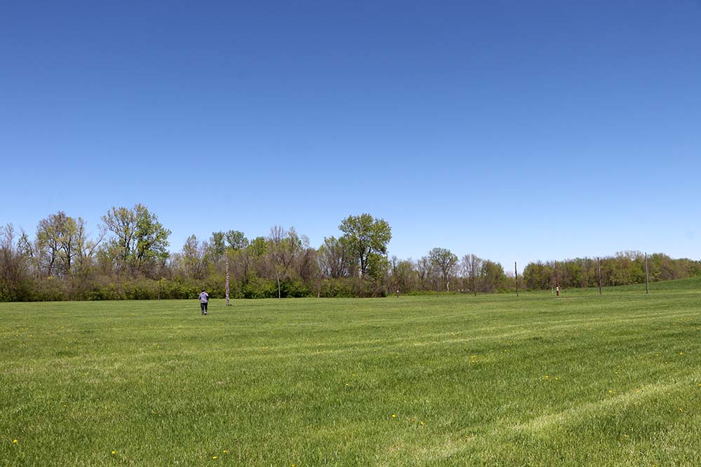
I purposefully captured hubby in the photo for perspective as it was too difficult to capture the size and how far apart the poles. I could to photograph the whole thing in one photo.
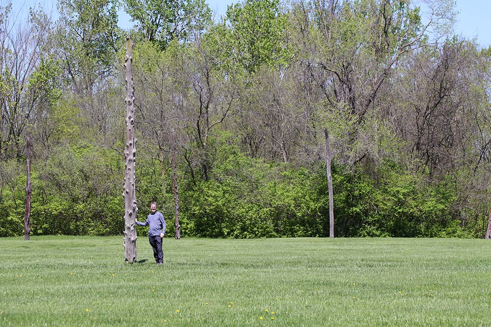
Perspective for height for the poles.